The rocks and troglodyte caves of Orival

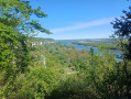
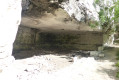
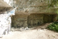
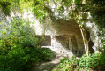
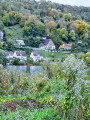
Nestled on the heights of the Seine Valley, the Grand-Couronne walk to the hamlet of Les Essarts, featuring a visit to the fascinating troglodyte caves of Orival, offers an outing combining nature, history and spectacular scenery. Amidst lush forests, limestone cliffs and panoramic views of the river’s meandering course, this route invites you to discover a heritage that is as much natural as it is cultural. The caves of Orival, carved into the rock over centuries, bear witness to a rich and mysterious past, adding a touch of wonder to this accessible and exotic walk.

Details

94544357
Creation:
Last update:
Last review:
  • Walking
    Activity: Walking
  • ↔
    Distance: 5.82 mi
  • ◔
    Average duration: 3h 25 
  • ▲
    Difficulty: Moderate

  • ⚐
    Back to start: Yes
  • ↗
    Ascent: + 817 ft
  • ↘
    Descent: - 804 ft

  • ▲
    Highest point: 423 ft
  • ▼
    Lowest point: 89 ft
  • ⚐ Country: France
  • ⚐ City: Grand-Couronne (76530)
  • ⚑
    Start/End: N 49.337692° / E 1.028183°
  • ❏
    IGN map(s): Ref. 1911ET, 1912SB, 2012OT
  • Hour-by-hour weather

Photos

Description of the walk

Parking and starting point: car park of the Jean Coiffier Leisure Centre, 9000 Rue du Champ du Bois, Grand-Couronne, Les Essarts hamlet.

(S/E) With the leisure centre on your left, walk up the street to the first turning on the left.

(1) Turn left towards the greenhouses, follow the path until you reach a gate. Go through it; a few metres further on, at the tree marked 152, first turn right then left. At the T-junction, turn left and immediately right. At the next T-junction, turn right and continue until you reach an electricity pylon.

(2) Continue along this path until you reach a wider track at approximately 990 m. Head left, following the GR®23, and continue until you reach the signpost for La Roche Fouet. Turn left, passing the Hêtre de la Roche Fouet on your left. Go down the wooden steps to reach the viewpoint. Then retrace your steps back to the signpost.

(3) Turn left, ignore a path branching off to the right and continue down the track. Ignore a path branching off to the left, keep going straight ahead and walk alongside the troglodyte caves – do consider exploring them. Pass two paths branching off to the left and continue to the right to reach the signpost for the caves.

(4) Turn left, ignore a path branching off to the left and continue along the path marked with a GRX signpost. Walk for about 1000 m on a gentle incline until you reach a signpost with yellow markings; ignore the direction indicated.

(5) Turn left onto the small descending path, with a tree on your right bearing a large yellow dot. After the hillock, at the yellow signpost, turn right and descend to the tarmac forest road.

(6) Turn slightly right, follow the hairpin bend to the left and continue along the stony path until you reach an X-junction with a tarmac road.

(7) Cross the road and continue straight ahead, ignoring a turn-off immediately on the left. Keep going along this path to reach the edge of the forest and the road.

(8) Head straight on along Rue du Pavillon, with the IME les Montées on your right, and continue for 800 m to reach the car park (S/E).

Waypoints

  1. S/E : mi 0 - alt. 394 ft - Car park at the Jean Coiffier leisure centre
  2. 1 : mi 0.17 - alt. 407 ft - Rue du Champ du Bois
  3. 2 : mi 1.3 - alt. 387 ft - Electricity pylon
  4. 3 : mi 2.28 - alt. 299 ft - Signpost for La Roche Fouet - Seine [la]
  5. 4 : mi 3.09 - alt. 180 ft - Signpost for Les Grottes Troglodytiques
  6. 5 : mi 3.81 - alt. 308 ft - Post with yellow markings
  7. 6 : mi 3.95 - alt. 207 ft - Forest Road
  8. 7 : mi 4.86 - alt. 413 ft - Forest gate on the left
  9. 8 : mi 5.33 - alt. 420 ft - Rue du Pavillon
  10. S/E : mi 5.82 - alt. 394 ft - Car park at the Jean Coiffier Leisure Centre

Always be cautious and plan ahead when you're outdoors. Visorando and the author of this route cannot be held responsible for any accidents occurring on this route.

The GR® and PR® markings are the intellectual property of the Fédération Française de Randonnée Pédestre.

Reviews and comments

4.3 / 5
Based on 1 review

Reliability of the description
4 / 5
Ease of following the route
5 / 5
Route interest
4 / 5
Daniel76
Daniel76

Overall rating : 4.3 / 5

Date of your route : Apr 27, 2026
Reliability of the description : ★★★★☆ Good
Ease of following the route : ★★★★★ Very good
Route interest : ★★★★☆ Good
Very busy route : No

A hike I completed using only a GPS track. It’s a fairly hilly route with some steep slopes, so it’s best done in dry weather. There’s a lovely stretch along the cliffs, offering some fine views of the bends in the Seine and the unique cave dwellings. Three hours is enough to complete the circular route.

Machine-translated

Other walks in the area

For more walks, use our search engine .

The GPS track and description are the property of this route's author. Please do not copy them without permission.