Country:
 City:
City:


Parking and starting point: Place Poullard, church and cemetery of Hautot-sur-Seine.
(S/E) With your back to the church, turn left and ignore the sharp left-hand bend to continue straight ahead along Rue du Rouage. Climb the slope for 880 m, ignoring three turn-offs on the left.
(1) At the T-junction, continue straight ahead for 530 m and turn right. Pass through the forest gate, and after 290 m turn right and rejoin the tarmac.
(2) Cross the road and continue straight ahead. Ignore the paths branching off to the right and left, and after 2000 m you’ll reach the tarmac road, the Grande Voie.
(3) Cross the road and continue straight ahead. At the T-junction, turn left onto Rue du Puits Fouquet. Continue straight ahead for 2,070 m until you reach a roundabout.
(4) Go round the roundabout and head straight ahead. Turn right onto Chemin du Prestel and rejoin the Chemin de Halage along the banks of the Seine.
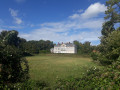
(5) Head left for 3,270 m, following the Chemin de Halage. Note the manor houses and castles on your left as you pass.
(6) You will come out onto the D51 road; follow it along the left-hand pavement to return to the car park. (S/E).

 Visorando Member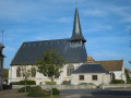


 Easy
Easy 
 Difficult