Country:

 City:
City:


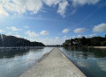
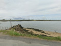
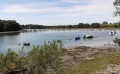
To reach the start point, head towards the Conleau campsite on Avenue du Maréchal Juin in Vannes. Opposite the campsite, there is a large car park where you can park.
Yellow markings for the Rives de Vannes trail and red and white markings forthe GR®34
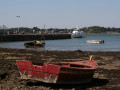
(S/E) At the south-western end of the car park, cross Avenue du Maréchal Juin with care and take the coastal path that runs alongside the Vincin. Follow the river to the Vincin mudflat observatory.
(1) Return to the path and head eastwards to the crossroads. Turn left to continue along the river until the coastal path meets Rue de l’Île d’Arz. Follow this street north-eastwards to the roundabout.
Leave theGR® 34 markings and follow the yellow signposts.
(2) Cross the roundabout, then take the lane below Rue de l’Île d’Arz and continue to the traffic lights.
(3) Turn right (south-east) and then, shortly after the wooded area, continue along Rue de l’Île Bailleron, which runs parallel to Boulevard de la Résistance. Stay on this street until you reach the Les Petits Chaperons Rouges nursery.
(4) Turn right onto the gravel path lined with shrubs, heading south-west. Continue until you reach the crossroads.
(5) First turn left then right to continue along the path heading south-west until you reach Rue de l’Amiral Pierre Ronarc’h, right next to a roundabout.
(6) Cross the road carefully and continue straight ahead along the path until you reach the Cliscouët Stadium. Walk alongside the stadium on your right until you reach a junction.
(7) Turn left (east-southeast), cross Rue Ty Coët and continue along Chemin des Aubépines, in the Cliscouët neighbourhood, following the regular yellow markings. Continue to Rue Jean François de Surville, where you’ll arrive opposite the “Surville” bus shelter.
(8) Turn right, then, after a few dozen metres, turn right onto the path running parallel to Rue Jacques Cassard and continue to the pedestrian crossing.
(9) Cross Rue Jacques Cassard and continue straight ahead along a path that winds between the houses towards the south-west. When you reach Rue Raoul Follereau, carry on straight ahead (south-west) until you reach the 30 sign.
(10) Turn left onto Rue du Docteur Schweitzer, then, at the Stop sign, turn left onto Avenue du Maréchal Juin and follow it for about a hundred metres until you reach the small brick garage.
(11) After passing through a hairpin bend to the right, continue along Allée Maisonneuve (a dead-end road); then, after a right-angled left-hand bend, continue through the green space, keeping to the left to go round the Pollinarium des Salines de Conleau and the Maison de la Nature. You will arrive at a disabled parking area on Rue Rodin, in the Lotissement des Salines.
(12) Turn left, then immediately right to continue northwards along Allée des Paludiers. Carry on almost as far as the roundabout at the exhibition centre. A few metres before this roundabout, take the path on the right, before the stream. At the second footbridge, cross the stream and continue along the path to go round the former marsh and reach the Marle estuary at the Pointe des Émigrés.
(13) Turn right, walk past the Caudard Vannes Nautique shipyard, then follow the Marle along the Promenade Paul Chapel. Continue until you reach the car park.
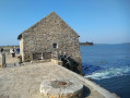
(S/E) Stay on the Promenade Paul Chapel to reach the Conleau Peninsula. Walk along the Conleau Pine Forest and carry on to go round the peninsula. Passing between the beach and Belle Époque villas, you’ll reach the jetty for the Île d’Arz, situated on the other side of the Port-Anna strait. It’s then time to finish the walk by heading back up the peninsula along the west coast. Continue to Conleau Beach.
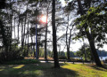
(14) Cross the beach, then pass the Natural Pool on your right before reaching the Conleau Pine Forest. Continue to the Allée Pierre et Paul Cadoret.
(15) Cross carefully and continue to the left, leaving the Conleau Peninsula behind, then walk between the Marle and the Vincin to reach the car park opposite the campsite (S/E).


 Visorando Member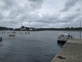
 Moderate