Country:

 City:
City:


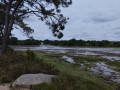
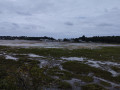
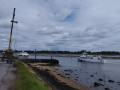
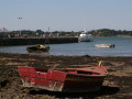
A small car park is available at the start of this walk, next to the roundabout on Rue de l’Île d’Arz. Buses pass nearby on Boulevard de la Résistance.
(S/E) From the car park, cross the roundabout to find the start of the Sentier du Vincin. It is signposted GR®34 in red and white, as is much of the walk, but the route is so straightforward that you can’t go wrong, even without looking for the signs! Follow the path to a small bridge.
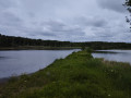
(1) Cross the bridge and turn right to stay on the banks of the Vincin. 100 m further on, you can make your first stop to watch birds at the designated spot. The presence of birds depends on the tide and the season. There is a particularly rich variety of birds to be seen in winter, with many winter visitors present. Continue along the coastal path until it crosses Avenue du Maréchal Juin.
(2) Turn right onto Promenade Paul Charel towards the Conleau Peninsula, then take the coastal path on the right-hand side that runs alongside a pine forest. (Here we chose to continue along the banks of the Vincin, to its confluence with the Marle at the tip of the peninsula.) Cross the embankment between the Conleau swimming pool and the Vincin, then arrive at Conleau Beach, at the end of which there is a jetty.
(3) From the jetty, continue along the coastal path that circles the peninsula. Then head back towards the junction of Avenue du Maréchal Juin and the coastal path.
(2) As you approach this junction, turn right and follow the shore along the Promenade Paul Chapel.
(4) Ignore the path on the left, which is the return route. Stay on this wide promenade.
(5) Ignore another path on the left – which you’ll take on the way back – before reaching Pointe des Émigrés and joining a road, Allée de Caradec. At the junction of this road and Rue Gilles Grahinet, there is a car park.
(6) Cross the car park heading north to reach the bird observatory by the pond.Turn around and head back towards Pointe des Émigrés.
(6) Retrace your steps along the path you took on the way there.
(5) Leave the outward route and turn right to explore the wooded part of this area protected by the Conservatoire du Littoral. This is a chance to observe and listen to the birds of this ecosystem. There are several paths to explore this area. We have chosen the widest one, which runs along the northern edge. Most of the other paths heading south rejoin the Promenade Paul Chapel. Turn left (south) just before reaching a road to rejoin the Promenade Paul Chapel after passing the Pollinarium at the Conleau salt marshes.
(4) Follow the outward route to the right and in the opposite direction until you reach the entrance to the Conleau Peninsula.
(2) Cross Avenue du Maréchal Juin to join the coastal path, then retrace the Vincin riverside path in the opposite direction to the outward journey to reach the car park (S/E).

 Visorando Member

 Moderate