The meadows of Charpenet

The walk took place as part of the Metrorando event. The Grenoble Metro, comprising 49 local authorities around Grenoble, organises two walking days open to all each year, offering three different walks. Each participant chooses the one that suits them best. This was the medium-length walk completed on that Sunday at the end of September.

Details

1521494
Creation:
Last update:
Last review:
  • Walking
    Activity: Walking
  • ↔
    Distance: 8.36 mi
  • ◔
    Average duration: 5h 30 
  • ▲
    Difficulty: Moderate

  • ⚐
    Back to start: Yes
  • ↗
    Ascent: + 1,909 ft
  • ↘
    Descent: - 1,896 ft

  • ▲
    Highest point: 2,267 ft
  • ▼
    Lowest point: 673 ft

Description of the walk

Park in Fiancey, a neighbourhood of Saint-Egrève, and head to Lake Fiancey.

(S/E) Start on the wide path running alongside the sports ground. Pass the stadium and reach a junction just after the gymnasium; a safety net protects this building.

(1) Keep to the right and tackle a short climb followed by a descent ending on the quiet Champy road. Reach the junction with the Route de Quaix.

(2) Turn right onto this road. Cross it and take the steps opposite; this leads onto the Route de Proveysieux. Follow this for a few metres and, as you come out of the bend, head up the tarmac road opposite, passing close to the water tanks, and you’ll soon reach a junction.

(3) Carry on straight ahead until you reach a tarmac road which quickly turns into a wide dirt track. Follow this track to reach the hamlet of Rigaudière. At the first junction, turn left; after a short climb, you’ll reach another junction.

(4) Turn right, passing above the houses of the hamlet of Garcinière; follow an almost level path to come out onto the D105, the road leading to Proveysieux.

(5) Turn left onto this road. Watch out for cars, as they tend to drive fast here. Stay on this road. In the centre of the hamlet of Le Mollard, you’ll come to a right-angled junction.

(6) Turn left onto the uphill road. Pass a spring and continue along the wide dirt track. Walk past a building at a place called Jardon. Carry on, cross the peatland and come out at another crossroads of tracks, where there is another building.

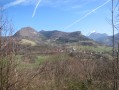
(7) Take the track on the left and, after a final climb, reach the meadows leading up to the Charpenet chalets.

(8) Retrace your steps back to the junction you passed on the way out.

(3) Turn right and head down towards the La Monta neighbourhood. Cross this neighbourhood, following the yellow markings, until you reach the junction in the Champy neighbourhood.

(2) Take the first street on the right (Rue des Brieux) and follow it to the sports hall. Take the left-hand lane to reach the first junction on the outward journey.

(1) Turn right and follow the outbound route to easily return to Lac de Fiancey (S/E).

Waypoints

  1. S/E : mi 0 - alt. 676 ft - Lake Fiancey
  2. 1 : mi 0.8 - alt. 804 ft - Carrefour Gymnasium
  3. 2 : mi 1.54 - alt. 794 ft - Champy
  4. 3 : mi 1.74 - alt. 1,079 ft - Intersection
  5. 4 : mi 2.35 - alt. 1,486 ft - Rigaudière
  6. 5 : mi 2.68 - alt. 1,506 ft - D105
  7. 6 : mi 3.03 - alt. 1,608 ft - Le Mollard
  8. 7 : mi 3.77 - alt. 2,070 ft - Trail Junction
  9. 8 : mi 4.05 - alt. 2,267 ft - Charpenet
  10. S/E : mi 8.36 - alt. 676 ft - Lake Fiancey

Notes

There are two springs along this route: one in Rigaudière and one in Le Mollard.
These hugely popular events allow everyone to find an outing to suit them. Today, 1,250 people took part in these three routes. They also enjoyed a wonderful welcome from the many volunteers on hand, who provided refreshments and encouragement.

Worth a visit

For further information on this great city, click here.

Reviews and comments

4.2 / 5
Based on 3 reviews

Reliability of the description
4 / 5
Ease of following the route
4.3 / 5
Route interest
4.3 / 5
elisacharlotte
elisacharlotte

Overall rating : 5 / 5

Date of your route : Jul 28, 2025
Reliability of the description : ★★★★★ Very good
Ease of following the route : ★★★★★ Very good
Route interest : ★★★★★ Very good
Very busy route : No

I loved this hike.
The different trails, sometimes in the middle of the forest, sometimes in the middle of meadows, were great.
The start of the hike was quite difficult

Machine-translated

lauvisorando
lauvisorando

Overall rating : 3.7 / 5

Date of your route : Aug 02, 2021
Reliability of the description : ★★★☆☆ Average
Ease of following the route : ★★★★☆ Good
Route interest : ★★★★☆ Good
Very busy route : No

Hello, I’m used to hiking in the Alpes-Maritimes, where the routes are extremely well signposted.
I was surprised by the complete lack of signposts along this route...
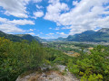
So I’m not entirely sure I followed the right path, but we made it to our destination and enjoyed a magnificent view over the valley. We didn’t come across a single other walker. It was a lovely day.

Machine-translated

Other walks in the area

For more walks, use our search engine .

The GPS track and description are the property of this route's author. Please do not copy them without permission.