Refine your search for walks in Les Mollettes
Les Mollettes walks


 Laissaud Loop
 Visorando Member
 9.20 mi
 +348 ft
 -341 ft
 4h 30
4h 30
 Moderate
 Departure from Les Mollettes (Savoie)
This walk first offers breathtaking views of the Bauges and the Chartreuse mountains, on the Granier side, before reaching the River Isère along its embankment. This takes you to the Lônes de Pontcharra lake, a green haven, ideal for a picnic. The climb up through Laissaud takes you to the Sainte-Anne Chapel and then, after passing close to the vineyards, the route descends towards Les Mollettes, via the hilltop hamlet of La Ville, where a medieval castle once stood.
 Crête de Montraillant from the Chapelle Blanche
 6.13 mi
+1,017 ft
-997 ft
3 hrs
6.13 mi
+1,017 ft
-997 ft
3 hrs
 Easy
Departure from La Chapelle-Blanche (Savoie) (Savoie)
Easy
Departure from La Chapelle-Blanche (Savoie) (Savoie)
A good half-day walk to enjoy panoramic views of the Chartreuse, the Vercors in the distance, Lauzière and the nearby Belledonnes.
Please note: there is an error. This hike is on foot and not by mountain bike as indicated.
Les Hauts de Sainte-Hélène
 2.83 mi
+367 ft
-367 ft
1h 35
Easy
Departure from Sainte-Hélène-du-Lac (Savoie)
2.83 mi
+367 ft
-367 ft
1h 35
Easy
Departure from Sainte-Hélène-du-Lac (Savoie)
A short hike that takes you through a few hamlets and offers unobstructed views of the Belledonnes and Chartreuse mountains.
Tour de Chantemerle
 4.40 mi
+351 ft
-331 ft
2h 20
Easy
Departure from Sainte-Hélène-du-Lac (Savoie)
4.40 mi
+351 ft
-331 ft
2h 20
Easy
Departure from Sainte-Hélène-du-Lac (Savoie)
A route for everyone that will take you to a remote hamlet and its castle steeped in history, then along the shores of Lake Sainte Hélène.
Montmayeur Towers Route
 11.38 mi
+1,814 ft
-1,827 ft
6h 50
11.38 mi
+1,814 ft
-1,827 ft
6h 50
 Difficult
Departure from Détrier (Savoie)
Difficult
Departure from Détrier (Savoie)
A walk on Montraillan Hill between Belledonne and Les Bauges, following in the footsteps of the Lord of Montmayeur, vassal of the Duke of Savoy.
Mont Pezard route
 4.88 mi
+1,115 ft
-1,115 ft
3h 15
Moderate
Departure from Détrier (Savoie)
4.88 mi
+1,115 ft
-1,115 ft
3h 15
Moderate
Departure from Détrier (Savoie)
A family hike with a variety of attractions: flora, slate quarry, chapel and other points of interest. Beautiful view of the Val Gelon on the way down. Directional signs on the ground complement this description. In addition, Lac Saint-Clair is a pleasant place to relax before or after the hike.
Tour de Planaise
 7.17 mi
+499 ft
-522 ft
3h 45
Moderate
Departure from La Chavanne (Savoie)
7.17 mi
+499 ft
-522 ft
3h 45
Moderate
Departure from La Chavanne (Savoie)
A long, easy walk taking in fountains, bridges and castles...
Brame-Farine ridges
 7.42 mi
+2,762 ft
-2,762 ft
5h 50
Difficult
Departure from Saint-Maximin (Isère) (Isère)
7.42 mi
+2,762 ft
-2,762 ft
5h 50
Difficult
Departure from Saint-Maximin (Isère) (Isère)
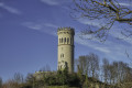
Hike starting from a small village in Isère (on the border with Savoie) to reach the summit that separates it from its neighbour Allevard-les-Bains. From the ridge, a superb panorama allows you to discover the latter at the foot of the massif of the same name.This hike is more athletic than recreational, with a long and fairly steep climb, mainly through sometimes damp undergrowth, which can make the descent quite slippery.
Circular route starting from the Tour d'Avalon
5.57 mi
+1,119 ft
-1,138 ft
3h 30
Moderate
Departure from Saint-Maximin (Isère) (Isère)
A lovely start from the beautiful Tour d'Avalon, followed by a fairly varied circular route through forests and villages.This route is difficult to describe due to the numerous roads and paths in this area, so a GPS and an online map (for example, downloaded via the Visorando app) are recommended. The Tour d’Avalon serves as a good landmark.
Montmélian - Arbin route
4.25 mi
+797 ft
-794 ft
2h 40
Easy
Departure from Montmélian (Savoie)
This hike describes a circular route that takes you to the historical heritage of Montmélian before discovering the Arbin vineyards.
Numerous views of Les Bauges, La Chartreuse, La Lauzière and Belledonne.
Montmélian to Cruet circular loop
 4.54 mi
+1,214 ft
-1,184 ft
3h 10
Moderate
Departure from Montmélian (Savoie)
4.54 mi
+1,214 ft
-1,184 ft
3h 10
Moderate
Departure from Montmélian (Savoie)
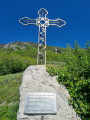
This circular route through the vineyards guarantees a sunny route. It also offers a panoramic view of the Belledonne Massif.
Depending on the time of year, you may see work being done in the vineyards.
The route is signposted.
From Montmélian to La Roche du Guet, returning via the Col du Mont
5.92 mi
+3,084 ft
-3,091 ft
5h 25
Moderate
Departure from Montmélian (Savoie)
A good, challenging hike to reach La Roche du Guet and its two information boards.
The Savoyard circular from Montmélian
 8.43 mi
+3,481 ft
-3,455 ft
6h 55
Difficult
Departure from Montmélian (Savoie)
8.43 mi
+3,481 ft
-3,455 ft
6h 55
Difficult
Departure from Montmélian (Savoie)
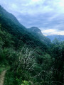
It is a very interesting and varied hike, offering a multitude of beautiful views of the Chambéry valley, the peaks of the Bauges, some of the peaks of the Chartreuse and Belledonne mountains, and the Tarentaise valley. This hike should be avoided in wet weather or just after a wet period.
From Chapelle-du-Bard to Pont du Diable via Beauvoir
6.13 mi
+1,601 ft
-1,591 ft
4h 15
Moderate
Departure from La Chapelle-du-Bard (Isère)
A lovely hike with beautiful views and scenery, quite varied, a little bit of tarmac but not much, with good signposting. Doable almost all year round, except in muddy conditions after rain, of course. At the Pont du Diable, you will cross the Dauphiné-Savoie border, with its pretty, colourful boundary stone. By whom?