Country:

 City:
City:


Park in the car park to the left of the town hall in Les Mollettes.
(S/E) Cross the road that runs behind the school (Route des Granges) and take the dirt track opposite leading to the village hall. Walk past the village hall on the right and take the path on the right for about a hundred metres. Turn left off this path to cross the Coisetan via a small wooden bridge. Go round the field to the left and join the grassy path leading to the D923.
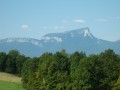
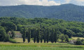
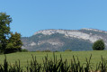
(1) Cross the road carefully, then continue straight on to the electricity pylons after passing alongside rows of vine plants. Lovely views of the Bauges and the Chartreuse. At the pylons, turn right and continue to a track suitable for vehicles.
(2) Turn left. After passing under the power lines of the Grande Île substation and going round a transformer, you’ll rejoin the tarmac road. Follow the path alongside the railway line until you reach the level crossing.
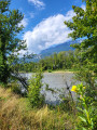
(3) Turn right to cross the level crossing and continue straight on along the tarmac road, which first turns right then left. Carry on to the entrance of a former flooded quarry. To the left of the entrance, climb up the hillock, then walk along the fence surrounding the pond. At the end, climb up onto the embankment to reach the banks of the Isère.
(4) Turn left onto this straight, shaded embankment and continue for approximately 1.8 km.
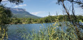
(5) Come down from the embankment and continue along the path that runs below it for about 350 m. Then turn left to reach the Plan d’Eau des Lônes.
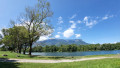
(6) Turn right to walk alongside it, then head up the road that skirts it to the left: there’s a shaded picnic area. Carry on until you’re almost back to the north of the lake and reach the tarmac access road.
(7) Follow this road, turning right. Cross the Coisetan, which flows into the Breda, then cross the railway line.
At the next junction, turn left, then right shortly afterwards. After passing a field of walnut trees and going under a power line, turn left at the junction. At the next junction, carry on straight ahead and, after a row of trees, look out for the football pitch on the right.
(8) Take the grassy path that leads to it. Once you’ve passed it, you’ll come out onto the car park of a former supermarket. Turn left, then right at the end of the street to reach the RD523 in Laissaud, which runs from Montmélian to Pontcharra. Turn left onto the pavement and continue to the first junction.
(9) Turn right onto Rue du Bourg. The street begins to climb and passes through an old residential area. Continue straight on along Rue de l’Église. As you leave the houses behind, at the bend where you can see the church, leave the tarmac and take the path opposite, which climbs quite steeply through woods and meadows.
(10) At the top of the climb, cross the path leading to a beautiful property, then, after a few metres, turn right onto the tarmac road. Turn left. At the junction (with a bus shelter in the centre), keep left and begin a gentle descent to reach the junction at the Chapelle Sainte-Anne.
(11) Take the road leading uphill to the right: be careful, as there is quite a lot of traffic. At the top, as you come out of the wide bend, take the small road leading down to the left towards Les Mollettes.
(12) At the junction, turn left, before heading back up towards the hamlet of La Ville, which you can see opposite. At the foot of this hamlet, head up to the right and then, at the crossroads, turn right onto the street which descends quite steeply.
(13) At the junction at the bottom of the descent (former fire station), take the street on the left which runs alongside a small stream and leads to the school and then to Les Mollettes town hall (S/E).


 Visorando Member
 Easy
Easy 
 Difficult