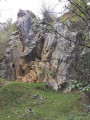
The ponds at Cap de la Serre

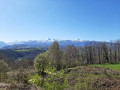
This easy walk takes you through the Bois de Lassègues, home to two remarkable springs and the Cap de la Serre ponds. You can also enjoy a beautiful panoramic view of the Pyrenees.

Details

28752969
Creation:
Last update:
Last review:
  • Walking
    Activity: Walking
  • ↔
    Distance: 1.72 mi
  • ◔
    Average duration: 1h 05 
  • ▲
    Difficulty: Easy

  • ⚐
    Back to start: Yes
  • ↗
    Ascent: + 338 ft
  • ↘
    Descent: - 361 ft

  • ▲
    Highest point: 1,824 ft
  • ▼
    Lowest point: 1,453 ft

Description of the walk

The starting point is situated about 3 km from the village of Montgaillard, on the D28 road leading towards Orignac. You can park at the four-way junction, at a place called Cap de la Serre, near the motocross route.

(S/E) You might want to pop over and take a look at the ponds near the crossroads beforehand; you might be lucky enough to spot a few frogs or newts there. From the crossroads, take the dirt track that climbs southwards into the woods.

(1) Shortly after leaving the woods, take the path on the left at the junction: you can first take a short detour of about twenty metres to enjoy a wider view of the Pyrenees mountain range. Head back into the forest and pass close to a cluster of old chestnut trees, then a conifer plantation. Then head down to the right through the scrubby undergrowth and arrive above the Prégnalède spring, which has been converted into a watercress bed. Continue along the path and then the track through the woods until you rejoin the D120 road.

(2) Walk up the road to the left for a few dozen metres, then turn right onto the path that leads into the woods.

(3) At the first fork, leave the path and take a narrow track on the left. This leads you a little further on to the Fontaine de Lassègues (or ‘Houn de la Sègues’ in Gascon), which is actually two adjoining pools resembling ponds that give off a smell of sulphur. This is a sulphurous spring once reputed to heal wounds.
After the spring, continue along the path until you reach a wide track. Follow this track uphill to the left to rejoin the road and the crossroads (S/E).

Waypoints

  1. S/E : mi 0 - alt. 1,627 ft - Four-way crossroads
  2. 1 : mi 0.35 - alt. 1,821 ft - Panorama junction, turn left
  3. 2 : mi 1.03 - alt. 1,529 ft - D120, path on the right
  4. 3 : mi 1.2 - alt. 1,483 ft - Path on the left
  5. S/E : mi 1.72 - alt. 1,627 ft - Four-way crossroads

Notes

As the route runs mainly through the undergrowth, it can often be muddy.
There are no water points along the route.
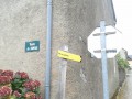
The walk is nevertheless easy and was refurbished in 2014 by various partners, with yellow markings and information boards. The accompanying booklet produced for this occasion, which details the site’s flora, fauna and history, can be viewed and downloaded here: http://lieux.loucrup65.fr/livret_montgai...

Reviews and comments

3.5 / 5
Based on 4 reviews

Reliability of the description
4 / 5
Ease of following the route
3.5 / 5
Route interest
3 / 5
vovon
vovon

Overall rating : 4.3 / 5

Date of your route : Feb 15, 2025
Reliability of the description : ★★★★★ Very good
Ease of following the route : ★★★★☆ Good
Route interest : ★★★★☆ Good
Very busy route : No

A route that must be quite enjoyable in good conditions. The first section is very muddy and therefore slippery up to the field where the view is magnificent;
however, the second part is very hilly with steep slopes. So choose the right season

Machine-translated

Gwenaëlle.F.A
Gwenaëlle.F.A

Overall rating : 3 / 5

Date of your route : Jul 16, 2024
Reliability of the description : ★★★★☆ Good
Ease of following the route : ★★★☆☆ Average
Route interest : ★★☆☆☆ Disappointing
Very busy route : No

The paths were overgrown with thick bushes and brambles, as mentioned in the previous review, so this has clearly been the case for quite some time… Weeds and brambles as tall as a person.
Horsefly attack

Machine-translated

Lilidada
Lilidada

Overall rating : 3 / 5

Date of your route : Aug 07, 2023
Reliability of the description : ★★★☆☆ Average
Ease of following the route : ★★★☆☆ Average
Route interest : ★★★☆☆ Average
Very busy route : No

It’s not your fault, but the paths had been overgrown with thick bushes and brambles for some time now, and the signposting hadn’t been updated
Just one viewpoint on the Pic du Midi
Attacked by horseflies, followed by an allergic reaction...
So no, we wouldn’t recommend it

Machine-translated

PATRICE31800
PATRICE31800

Overall rating : 3.7 / 5

Date of your route : Mar 25, 2023
Reliability of the description : ★★★★☆ Good
Ease of following the route : ★★★★☆ Good
Route interest : ★★★☆☆ Average
Very busy route : No

Hello everyone.
We went on this walk in fine weather; it could have been a lovely outing if quad bikes and motocross bikes hadn’t ruined the first part of the path. What’s more, the foresters are currently felling trees: I won’t even tell you what state the path is in! Otherwise, there are lovely views of the mountain range; this route will be more accessible in summer and in dry weather.

Machine-translated

Other walks in the area

For more walks, use our search engine .

The GPS track and description are the property of this route's author. Please do not copy them without permission.