G65

 Visorando Member
 Premium user
 Sign up:
Published route(s)
 Route des Puyolles
 3.06 mi
 +535 ft
 -531 ft
 1h 50
1h 50
 Easy
Easy
 Departure from Montgaillard (Hautes-Pyrénées) (Hautes-Pyrénées)
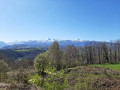
This is a beautiful family circular on the heights of the village of Montgaillard. It will allow you to discover beautiful views of the Tarbes plain and the Haut-Adour valley, with the Pic du Midi de Bigorre and Montaigu as a backdrop!
As you climb up to an ancient Roman oppidum, follow historic paths or stroll through the village streets, you will also get a glimpse of the region's past.
The ponds at Cap de la Serre
1.72 mi
+338 ft
-361 ft
1h 05
Easy
Departure from Montgaillard (Hautes-Pyrénées) (Hautes-Pyrénées)
This easy walk takes you through the Bois de Lassègues, home to two remarkable springs and the Cap de la Serre ponds. You can also enjoy a beautiful panoramic view of the Pyrenees.
Aubuchous circular loop
 1.96 mi
+427 ft
-417 ft
1h 15
Easy
Departure from Gez-ez-Angles (Hautes-Pyrénées)
1.96 mi
+427 ft
-417 ft
1h 15
Easy
Departure from Gez-ez-Angles (Hautes-Pyrénées)
A beautiful, easy circular path near the small village of Gez-ez-Angles, located a few kilometres from Lourdes. You will walk along an open ridge to the small summit of Aubuchous, where you can enjoy a wide panorama of the foothills and the Pyrenees mountain range, before returning to the village via a more wooded path.
The Courbet and Conques huts
4.39 mi
+2,228 ft
-2,211 ft
3h 55
 Moderate
Departure from Beaudéan (Hautes-Pyrénées)
Moderate
Departure from Beaudéan (Hautes-Pyrénées)
A pleasant yet moderately challenging hike in a quiet area, exploring a beautiful pastoral mountain landscape. You’ll come across the Cabanes du Courbet, followed by the magnificent Cabane de Conques nestled in a secluded valley. The return journey follows a path that is initially high up but safe, then an old forest track where a GPS may be useful.