Les Longues Avoines

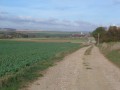
To the silvery chime of the noble 350-year-old Jehanne bell, you will walk through woods and fields.

Details

26215
Creation:
Last update:
Last review:
  • Walking
    Activity: Walking
  • ↔
    Distance: 4.76 mi
  • ◔
    Average duration: 2h 20 
  • ▲
    Difficulty: Easy

  • ⚐
    Back to start: Yes
  • ↗
    Ascent: + 210 ft
  • ↘
    Descent: - 213 ft

  • ▲
    Highest point: 525 ft
  • ▼
    Lowest point: 364 ft

Description of the walk

(S/E) From the church square in Lawarde-Mauger-l’Hortoy, leave the village via the north-east (Rue d’en Haut) and take Rue du Puits as far as the cemetery.

(1) Turn left onto a dirt track, then turn right and walk down the embankment. Take the RD109 to enter Hallivillers. Continue straight on along Rue de la Place.

(2) Turn right onto Rue aux Poulets and you’ll come to a crossroads.

(3) Turn left and head towards the Bois d’Hallivillers near a road.

(4) Turn right, then 200 metres further on, turn right onto a path to go round the woods. Enter the coppice and, further on, join the dirt track.

(5) Turn left, then immediately right, and follow the path to L’Hortoy.

(6) Cross the hamlet on the right-hand side.

(7) When you reach the pond, turn left onto a path (panoramic view) leading to Lawarde-Mauger-l’Hortoy and the church square (S/E).


Waypoints

  1. S/E : mi 0 - alt. 499 ft - Church square in Lawarde-Mauger-l’Hortoy
  2. 1 : mi 0.44 - alt. 476 ft - Cemetery
  3. 2 : mi 0.97 - alt. 364 ft - Rue aux Poulets
  4. 3 : mi 1.22 - alt. 417 ft - Crossroads
  5. 4 : mi 1.65 - alt. 430 ft - Hallivillers Wood
  6. 5 : mi 2.81 - alt. 476 ft - Dirt track
  7. 6 : mi 3.38 - alt. 525 ft - The hamlet of L’Hortoy
  8. 7 : mi 3.5 - alt. 522 ft - Pond
  9. S/E : mi 4.76 - alt. 499 ft - Church square in Lawarde-Mauger-l’Hortoy

Notes

Do not try to follow any signposts as there are none. Follow the route description and map carefully.

Reviews and comments

4.1 / 5
Based on 4 reviews

Reliability of the description
4 / 5
Ease of following the route
4 / 5
Route interest
4.3 / 5
Sylvie Petitpois
Sylvie Petitpois

Overall rating : 4.3 / 5

Date of your route : Nov 25, 2023
Reliability of the description : ★★★★☆ Good
Ease of following the route : ★★★★☆ Good
Route interest : ★★★★★ Very good
Very busy route : No

A lovely walk.
Point 1: Take the dirt track on the left and, after 300 metres, take a path on the right through the vegetation to go down the embankment (then, opposite, the RD109 leading into Hallivillers)
Between points 4 and 5: The path along the Hallivillers woodland disappears completely at one point; you’ll be walking between the field and the woodland, but it’s passable.
Occasional signposting.

Machine-translated

mariedolly
mariedolly

Overall rating : 4.7 / 5

Date of your route : Jun 30, 2019
Reliability of the description : ★★★★★ Very good
Ease of following the route : ★★★★★ Very good
Route interest : ★★★★☆ Good

some lovely views of the Picardy countryside
There’s just one path along the Hallivillers woods that’s not very well maintained, but it’s still passable

Machine-translated

gazok54
gazok54 ★

Hello
This route has been updated. Waypoints have been added to the description and the map to help you find your way around more easily.

Machine-translated

gazok54
gazok54 ★

Thank you, ALAINOIS
This old walking route would be worth updating.
In any case, signposting is not within our remit; we have no control over it.

Machine-translated

ALAINOIS
ALAINOIS

Overall rating : 3 / 5

Date of your route : Mar 30, 2017
Reliability of the description : ★★★☆☆ Average
Ease of following the route : ★★★☆☆ Average
Route interest : ★★★☆☆ Average

With virtually no signposting, we got lost once despite having the guide and the map.
It’s impossible to do this walk without them!
Please note: Rue du Fort does not exist, or no longer does; it should be replaced with Rue de la Place.
Only of moderate interest unless you enjoy walking through fields.

Machine-translated

GOURLET
GOURLET
• Edited:

This route is impossible to complete because the paths have not been maintained for a VERY long time and there are no signposts.

Machine-translated

essertaux4754@orange.fr

Overall rating : 4.3 / 5

Date of your route : Sep 23, 2015
Reliability of the description : ★★★★☆ Good
Ease of following the route : ★★★★☆ Good
Route interest : ★★★★★ Very good

We should point out, however, that the signposting is lacking. Everything else is perfect. Thank you.

Machine-translated

Other walks in the area

For more walks, use our search engine .

The GPS track and description are the property of this route's author. Please do not copy them without permission.