Le Visigneux

The Saint Vincent de Paul Chair and a statue of Saint James in the church, a UNESCO World Heritage Site, tell the story of Picardy’s spiritual journeys.

Details

26187
Creation:
Last update:
Last review:
  • Walking
    Activity: Walking
  • ↔
    Distance: 3.86 mi
  • ◔
    Average duration: 2h 00 
  • ▲
    Difficulty: Easy

  • ⚐
    Back to start: Yes
  • ↗
    Ascent: + 299 ft
  • ↘
    Descent: - 322 ft

  • ▲
    Highest point: 495 ft
  • ▼
    Lowest point: 226 ft

Photos

Description of the walk

Town Hall car park.

(S/E) From the car park near Folleville Town Hall, follow the red-and-white markings ofthe GR®124, which runs along the Grande Rue towards Quiry-le-Sec, up to No. 19. Turn right.

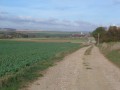
(1) At the junction, turn left towards Blanc Mont, where you turn right onto a path (yellow markings) that runs alongside the sheep pastures.

(2) Join a path running parallel to the railway line, cross the level crossing with care (unguarded) and head down to the road.

(3) Follow the road to the left and pass through the hamlet of Visigneux.

(4) Head up the opposite slope to the left. Pass two path junctions on your right and cross the railway bridge.

(5) At the junction, turn left and follow the red-and-white markings ofthe GR®124towards Folleville.

(1) Turn right, walk through the village on the left-hand side along the Grande Rue and head for the Town Hall car park (S/E).

Waypoints

  1. S/E : mi 0 - alt. 495 ft - Town Hall car park
  2. 1 : mi 0.54 - alt. 338 ft - Turn left towards Blanc Mont
  3. 2 : mi 1.23 - alt. 262 ft - Path running parallel to the railway line
  4. 3 : mi 1.73 - alt. 233 ft - Route to Visigneux
  5. 4 : mi 2.17 - alt. 233 ft - On the left, opposite side
  6. 5 : mi 2.89 - alt. 361 ft - Junction with the GR124
  7. S/E : mi 3.86 - alt. 495 ft - Town Hall car park

Worth a visit

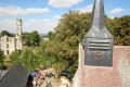
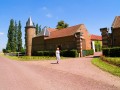
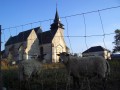
In the late Middle Ages, Folleville was home to an exceptional architectural complex comprising the castle and the church. From the castle’s ruins, the elegant silhouette of the stair tower still rises today, topped by a watchtower reaching a height of 25 metres (listed in the Supplementary Inventory of Historic Monuments in 1992). http://www.folleville-chateau-medieval.f...

The centrepiece of the church is the tomb of Raoul de Lannoy and Jeanne de Poix, a work which introduced Italian Renaissance styles to Picardy.
It was from the pulpit of this church that Vincent de Paul delivered, on 25 January 1617, the sermon that gave rise to the “Œuvre de la Mission” for the relief of the poor and the sick (the church has been a listed historic monument since 1862 and is inscribed on the UNESCO World Heritage List as part of the Routes of Santiago de Compostela). http://www.tourisme-valdenoye.fr/patrimo...
Open from 2 May to 29 September, Wednesday to Saturday, from 10.00 to 12.00 and from 14.00 to 17.30. (Folleville site: 03 22 41 49 52)

Always be cautious and plan ahead when you're outdoors. Visorando and the author of this route cannot be held responsible for any accidents occurring on this route.

The GR® and PR® markings are the intellectual property of the Fédération Française de Randonnée Pédestre.

Reviews and comments

4.3 / 5
Based on 3 reviews

Reliability of the description
4 / 5
Ease of following the route
4.3 / 5
Route interest
4.7 / 5
Sylvie Petitpois
Sylvie Petitpois

Overall rating : 4.3 / 5

Date of your route : Jan 15, 2024
Reliability of the description : ★★★★☆ Good
Ease of following the route : ★★★★☆ Good
Route interest : ★★★★★ Very good
Very busy route : No

Best avoided during the hunting season. Hunters are present between points 4 and 5. It is sometimes impossible to cross the Vallée du Blanc Mont woodland, as it may be a hunting ground.
Otherwise, we did the walk at a different time of year, and it’s very pleasant.

Machine-translated

Celtubert
Celtubert

Overall rating : 4.3 / 5

Date of your route : Jun 05, 2020
Reliability of the description : ★★★★☆ Good
Ease of following the route : ★★★★★ Very good
Route interest : ★★★★☆ Good
Very busy route : No

A pleasant and easy walk.

The trickiest bit, after point 1, is finding the entrance to the path, to the right of the track in the Blanc Mont valley, where I didn’t spot the yellow markings.
The section along the wooded sheep pasture (750 m) is a bit ‘rough’. If you’re worried about brambles and thorns, carry on straight on at point 1 until you reach the path running parallel to the railway line.

The rest of the route is very easy.

Please note that the Tourist Office is working with the French Hiking Federation to check the routes of local trails, their accessibility and the markings, but the Vésigneux trail has not yet been checked.

Machine-translated

MC80250
MC80250

Overall rating : 4.3 / 5

Date of your route : Apr 02, 2017
Reliability of the description : ★★★★☆ Good
Ease of following the route : ★★★★☆ Good
Route interest : ★★★★★ Very good

A lovely walk in glorious sunshine. We couldn’t find the path to point 2, so we walked the route in the opposite direction. On the way back, after the pumping station, the path wasn’t very clear. What’s more, there was a sign warning of ‘traps’, so we turned back to take a path a little further down, which also brought us back to the starting point.

Machine-translated

Other walks in the area

For more walks, use our search engine .

The GPS track and description are the property of this route's author. Please do not copy them without permission.