The Saint-Nicolas Farm and the Bois de Berny

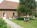
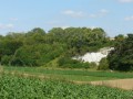
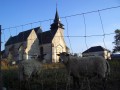
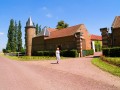
The Saint-Nicolas farm in the rural Petit Val protects well-behaved children, young girls and… walkers.

Details

26158
Creation:
Last update:
Last review:
  • Walking
    Activity: Walking
  • ↔
    Distance: 8.40 mi
  • ◔
    Average duration: 4h 10 
  • ▲
    Difficulty: Moderate

  • ⚐
    Back to start: Yes
  • ↗
    Ascent: + 397 ft
  • ↘
    Descent: - 387 ft

  • ▲
    Highest point: 433 ft
  • ▼
    Lowest point: 164 ft

Photos

Description of the walk

Set off from the motorhome park opposite the lake, Rue de Berny, D193, in Berny-sur-Noye.

(S/E) Follow the road and the yellow signposts towards the village centre. Cross the river and continue straight on until you reach the bend.

(1) Turn right onto Rue du Biais, following the red-and-white markings ofthe GR®124, and continue to Jumel along a dirt track that runs past pastures, poplar groves and ponds. Further on, turn right onto a small road, then cross a bridge.

(2) At the fork in the road at the entrance to the village, turn left onto Rue du Général de Gaulle (yellow markings). Cross the D920, turn left and then, immediately, right onto Rue Jules Verne. This turns into a dirt track and leads onto a small road (an ancient Roman road that linked Lutetia-Paris to Samarobriva-Amiens).

(3) Follow the old Roman road to the right, then immediately turn left onto a dirt track leading to the D162. Take this to the left and, a little further on, turn right to reach a four-way junction.

(4) Turn left towards the Bois du Boquet and walk along its entire eastern edge.

(5) At the crossroads, follow the white-and-red markings ofthe GR®123straight ahead along a path lined with conifers.

(6) At the bottom of the descent, follow the yellow markings to the left, walk alongside the Bois des Ramées, pass close to the Saint-Nicolas farm, cross the D162 and continue to the D920.

(7) Turn right onto the D920 and immediately turn left towards the Ferme d’Éreuse. Continue straight on until you reach the Bois de Berny. Turn left and walk alongside the woodland.

(8) At the fork, follow the white-and-red markings ofthe GR®124to reach the village of Barny-sur-Noye. At the D193, turn left and rejoin the route you have already taken.

(1) Turn right onto Rue de Berny and head back to the motorhome site (S/E).

Waypoints

  1. S/E : mi 0 - alt. 171 ft - Motorhome site. Cross the - Noye (rivière) - Affluent de l'Arve
  2. 1 : mi 0.24 - alt. 177 ft - Rue du Biais
  3. 2 : mi 0.99 - alt. 180 ft - Rue du Général de Gaulle
  4. 3 : mi 1.99 - alt. 256 ft - Ancient Roman road
  5. 4 : mi 2.52 - alt. 377 ft - Four-way crossroads
  6. 5 : mi 3.48 - alt. 390 ft - Junction
  7. 6 : mi 3.82 - alt. 299 ft - Bottom of the descent
  8. 7 : mi 5.27 - alt. 371 ft - D920
  9. 8 : mi 6.18 - alt. 308 ft - Junction
  10. S/E : mi 8.4 - alt. 171 ft - Motorhome site

Worth a visit

From mid-August to mid-September, on Fridays and Saturdays at 9.30 pm, 700 volunteers bring 2,000 years of Picardy’s history to life with 3,000 costumed characters, 35 horsemen, water and light shows, fireworks…

Always be cautious and plan ahead when you're outdoors. Visorando and the author of this route cannot be held responsible for any accidents occurring on this route.

The GR® and PR® markings are the intellectual property of the Fédération Française de Randonnée Pédestre.

Reviews and comments

4 / 5
Based on 3 reviews

Reliability of the description
3.7 / 5
Ease of following the route
3.7 / 5
Route interest
4.7 / 5
micvan80
micvan80

Overall rating : 4.3 / 5

Date of your route : Jul 25, 2022
Reliability of the description : ★★★★☆ Good
Ease of following the route : ★★★★☆ Good
Route interest : ★★★★★ Very good
Very busy route : No

A very pleasant walk with lovely scenery. The only tricky bit is getting started. You need to start the walk by parking in the designated car park by the pond; after that, it’s easy to follow.

Machine-translated

bibi
bibi ★

Thank you for sharing your experience
I hope that these waypoints will be enough to help others find their way around
Kind regards

Machine-translated

jean80
jean80

Hello,

In response to your enquiry, this isn’t a mistake on the map – I was the one who went the wrong way, relying on my common sense!!!

I’ll try to explain it to you using the map.

At the top left of the map (facing north).

At that altitude (point 125 on the contour line), I headed west towards “Le Puchelard” – a thin black line – thinking I’d reached a higher point! I therefore arrived at the contour line marked 119 in front of the “Bois de Ramées”, right on the path!

Finding the woodland lovely, I turned right until I reached altitude 92, “Fond de l’Absous”, where I did indeed find the signpost.

I turned round and headed back in the “normal” direction to complete the circular route.

Please note that I don’t carry a GPS when I go for walks, just a map, just in case!

I hope I’ve answered your question; have a lovely day.

Machine-translated

bibi
bibi ★

Thank you for your feedback; I’ve just added the waypoints to the map.
You’ve mentioned a small error but haven’t specified what it is; could you please let me know what it is? Thank you

Machine-translated

jean80
jean80

Overall rating : 3.3 / 5

Date of your route : Nov 11, 2015
Reliability of the description : ★★★☆☆ Average
Ease of following the route : ★★★☆☆ Average
Route interest : ★★★★☆ Good

Hello,

I did indeed go on that lovely walk

The GPS coordinates took me straight to the spot, but I had to select the format first.

Once I got there, there were no signs indicating which way to go. I had a bit of a look around and eventually found it!

It was a bit tricky to rely on the map for guidance. The instructions, moreover, didn’t seem very clear to me.

In short, using the position of the sun, the north direction marked on the map and a bit of common sense, I managed to follow the route, albeit with one mistake.

I think markers on the map would be useful.

A very pleasant day nonetheless.

Kind regards.

Machine-translated

veronique1964
veronique1964

Overall rating : 4.3 / 5

Date of your route : Mar 29, 2015
Reliability of the description : ★★★★☆ Good
Ease of following the route : ★★★★☆ Good
Route interest : ★★★★★ Very good

a lovely walk – very varied – beautiful views –
a walk I’d recommend to anyone who hasn’t done it yet

Machine-translated

Other walks in the area

For more walks, use our search engine .

The GPS track and description are the property of this route's author. Please do not copy them without permission.