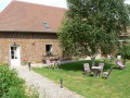
Roman roads from Paillart

Connected to two famous Roman roads, explore the Chaussée Brunehaut and the Via Agrippa,

Details

n°370960
Creation:
Last update:
Last review:
  • Walking
    Activity: Walking
  • ↔
    Distance: 5.31 mi
  • ◔
    Average duration: 2h 40 
  • ▲
    Difficulty: Easy

  • ⚐
    Back to start: Yes
  • ↗
    Ascent: + 220 ft
  • ↘
    Descent: - 226 ft

  • ▲
    Highest point: 361 ft
  • ▼
    Lowest point: 226 ft
  • ⚐ Country: France
  • ⚐ City: Paillart (60120)
  • ⚑
    Start/End: N 49.667965° / E 2.323713°
  • ❏
    IGN map(s): Ref. 2310O
  • Hour-by-hour weather

Photos

Description of the walk

Park in front of the cemetery entrance (one parking space is available; the school car park is unavailable due to heightened anti-terrorism security measures – situation as of autumn 2016).

(S/E) From the car park, take the zigzagging path on the right which joins the main road (D63) and follow it to the right.

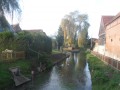
(1) Take in the view of the River Noye as it flows over this small bridge. Pass the first junction and continue through the village towards the south.

(2) At the three-way junction, leave the D63 and take the Chemin de Beauvais on your right, continuing to the next junction (2.8 km). You are now on the Roman road between Amiens and Senlis.

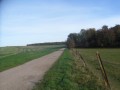
(3) At the junction, turn left onto a track called Chemin à Truie, so named because of its former use. Ride alongside a pasture.

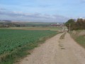
(4) At the junction, turn left onto the Chaussée Brunehaut leading to Paillart.

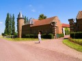
(5) Walk past the farm on your right and head towards the D63.

(6) At the road, turn left and follow it back to Paillart (watch out for vehicles). Shortly after crossing the bridge, take the zigzagging path on the left to climb back up to the cemetery car park (S/E).


Waypoints

  1. S/E : mi 0 - alt. 272 ft - Cemetery car park
  2. 1 : mi 0.08 - alt. 226 ft - Bridge of the - Noye (rivière) - Affluent de l'Arve
  3. 2 : mi 0.6 - alt. 295 ft - Amiens–Senlis Roman Road
  4. 3 : mi 2.31 - alt. 259 ft - At the junction, take the “chemin à truie”
  5. 4 : mi 3.34 - alt. 338 ft - Chaussée Brunehaut
  6. 5 : mi 4.26 - alt. 351 ft - Walk past the farm
  7. 6 : mi 4.51 - alt. 325 ft - Departmental road to the finish
  8. S/E : mi 5.31 - alt. 272 ft - Cemetery car park

Worth a visit

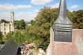
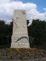
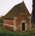
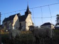
Paillart, a small village in the heart of the Val de Noye, still bears traces of Roman occupation today.

Reviews and comments

3.3 / 5
Based on 4 reviews

Reliability of the description
3.3 / 5
Ease of following the route
3.5 / 5
Route interest
3.3 / 5
Le Fèvre61
Le Fèvre61

Overall rating : 4 / 5

Date of your route : Mar 16, 2026
Reliability of the description : ★★★★☆ Good
Ease of following the route : ★★★★★ Very good
Route interest : ★★★☆☆ Average
Very busy route : No

A lovely walk that gives you a chance to explore the local countryside. Otherwise, it’s a flat route with fields stretching as far as the eye can see.

Machine-translated

curutchet
curutchet

Overall rating : 3.3 / 5

Date of your route : Jun 04, 2022
Reliability of the description : ★★★☆☆ Average
Ease of following the route : ★★★☆☆ Average
Route interest : ★★★★☆ Good
Very busy route : No

A walk not to be undertaken in very hot weather (there is little shade along the route)
You must have a map – there are no signposts
On the way back, you can visit the magnificent garden at the Ventin Mill

Machine-translated

gazok54
gazok54 ★

Thank you, TORTUE95.
I hope the author will read your suggestions.
If you have any nice photos, you could add a few to the hike in question.

Machine-translated

TORTUE95
TORTUE95

Right from the church, on the right, there is indeed a small, winding path that leads onto a narrow street.
Once you reach the little village, I think the street names should be signposted to help you find the famous “Chemin de Beauvais”.
Also, there are several small bridges in the village that you can cross – which one should you take?
As an added bonus, I took some lovely photos of the little village that I’m happy to share.

Machine-translated

gazok54
gazok54 ★

Right, well, sorry about that – perhaps the description isn’t quite clear enough.
If you have any suggestions on how to improve it, we’d love to hear them.

Machine-translated

TORTUE95
TORTUE95

Hello Moderator,
Yes, we have read through the description several times and looked at the map in detail. We even asked two locals who didn’t even know the ‘Chemin de Beauvais’.
I stand by my comments.
Kind regards

Machine-translated

gazok54
gazok54 ★

Thanks, TORTUE95
I don’t think your ratings are justified. Did you even use the description and map provided by Visorando? I get the impression you just looked for the signposts.
If that’s the case, we’re not responsible for your problems, as as far as we’re concerned, only the route description and the map should be taken into account.

Machine-translated

TORTUE95
TORTUE95

Overall rating : 1 / 5

Date of your route : Mar 26, 2017
Reliability of the description : ★☆☆☆☆ Very disappointing
Ease of following the route : ★☆☆☆☆ Very disappointing
Route interest : ★☆☆☆☆ Very disappointing

The walk was very disappointing; right at the start, we wasted 30 minutes trying to find the first path, which isn’t signposted at all.
The signposting for this walk needs a complete overhaul.
The village, with its little stream, is a good spot for photos.

Machine-translated

polo541
polo541

Overall rating : 5 / 5

Date of your route : Nov 03, 2016
Reliability of the description : ★★★★★ Very good
Ease of following the route : ★★★★★ Very good
Route interest : ★★★★★ Very good

A lovely walk in the sunshine, completely flat: 9 km in 2 hours

Machine-translated

Other walks in the area

For more walks, use our search engine .

The GPS track and description are the property of this route's author. Please do not copy them without permission.