Country:
 City:
City:


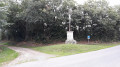
Park in the square by the church in Saint-Christophe-sur-Roc.
(S/E) Head towards the war memorial and follow Rue de la Croix, then continue along its extension, Chemin de la Gelousière. Further on, ignore the dead-end road and stay on Chemin de la Gelousière until you reach the Y-junction, where you turn left onto the path.
(1) Turn right, then, after a few metres, at the ‘give way’ sign, turn left onto the Route du Plan d’Eau. Take the first exit on the right to enter the car park at the Étang de Cherveux-Saint-Christophe. Immediately after passing through the car park gate, head down to the left, then turn right onto the path that runs alongside the lake. Follow this path to go all the way round the lake.
Leave the car park and, to retrace your steps, head left up the Route du Plan d’Eau, then turn right onto the road that takes you back to the junction you passed on the way there.
(1) Continue along this small road. When you reach the hamlet of La Truite, carry on straight ahead, crossing the bridge over the Ruisseau de Brangeard. Stay on the road, ignoring a road on the right and a path further on. When you reach the hamlet of Lussais, continue straight ahead, heading down the Chemin Porte Pierre Lussay.
(2) At the junction, turn left down onto the Route de Lussay and take the first road on the right just before the house (the Moulin de Lussais). Continue along this small road.
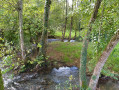
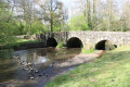
(3) Just before the wash house, take the path on the left between the field and the row of trees. Cross the Ruisseau de Brangeard via the small stone bridge and head up the path opposite.
(4) At the crossroads, take the path on the right and, further on, at another crossroads, head down the path on the right to rejoin the road.
(5) Turn left onto this road and continue until you reach the right-hand bend in the road.
(6) Follow the path opposite, which winds its way through the bushes, and carry on until you reach the road; cross it to continue along the path opposite. Carry on along this path until you reach a road, ignoring a path branching off to the left.
(7) Turn left onto the road and go up the hill; once at the top, take the path opposite. Continue along this path. When you reach the Y-junction, take the path on the left and continue until you reach a road. Turn right onto the road near Maillé.
(8) Carry on, staying on the left-hand road, i.e. keeping to the buildings. Continue along this small road, ignoring the turnings to the right at the hamlet of Le Peu.
(9) At the junction, turn left onto a path and continue along it, ignoring all the side paths.
(10) At the crossroads, head up to the right onto the Chemin de la Roche.
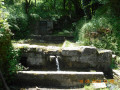
(11) As you turn left, there’s a short detour option: just past the low stone wall and just before the first buildings (the old dairy) you’ll find the wash house and the porch leading to the underground river at Saint-Christophe-sur-Roc.
(12) Continue along the left-hand-most road (with the church on your right) to reach the car park (S/E).

 and the ‘lantern of the dead’ at the Francis Gonnord site are also worth a mention....
 Visorando Member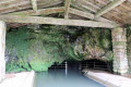

 Association / Club / Walk leader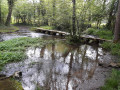
 Easy
Easy