The Bacivèr Lakes in the Val d’Aran

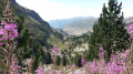
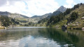
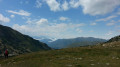
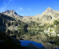
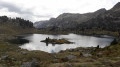
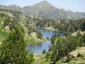
It is a beautiful route in the Val d’Aran, in the Vaqueira mountains, leading to the Naut and Baish de Bacivèr lakes.
Although it is a short circular route, it requires a good level of fitness to tackle the first half of the route.
Your efforts will be rewarded upon reaching Lake Naut de Bacivèr, the highest point of the walk.

Details

709772
Creation:
Last update:
Last review:
  • Walking
    Activity: Walking
  • ↔
    Distance: 4.84 mi
  • ◔
    Average duration: 3h 30 
  • ▲
    Difficulty: Difficult

  • ⚐
    Back to start: Yes
  • ↗
    Ascent: + 1,506 ft
  • ↘
    Descent: - 1,499 ft

  • ▲
    Highest point: 7,615 ft
  • ▼
    Lowest point: 6,086 ft

Photos

Description of the walk

To reach the Orri car park and park there, you need to leave the village of Baqueira heading north, towards Beret and Orri.
To do this, take Calle Placita Beret (C-142B), which passes in front of the Hotel-Chalet Val de Ruda.
The road winds uphill for about 6.5 km before you come to the sign for Orri car park on the right. This car park belongs to the Baqueira-Beret ski area.

(S/E) From the car park, head towards the cable car station. Go round it, passing under the cable car cables. Approach the Moët Winter Lounge and walk past it. Begin the ascent via the wide track of earth and stones, HRP Variant 25.1. You’ll reach a sort of Fork in the road with a narrow path branching off to the right; ignore this.

(1) Continue straight ahead along the wide track. After a wide bend to the right, you’ll come to a small path branching off to the left, at an elevation of 2014.

(2) Leave the wide white track, HRP Variant 25.1, and take this path. The path rejoins the HRP track only to leave it again on two further occasions. On its final stretch off the HRP, Lac Baish de Bacivèr comes into view.

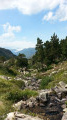
(3) Junction with the HRP, above Lac Baish de Bacivèr. The track is stony and runs alongside a torrent. A small waterfall cascades halfway along. Further on, you’ll come to a Y-junction.

(4) Continue to follow the water’s edge, veering to the left. Stones stand upright, like menhirs, to guide the path towards Lac Naut de Bacivèr at an altitude of 2,330 metres.

(5) Walk alongside the lake for about 300 m. Leave the HRP and follow the bend to the right to go round the hill and return to the Y-junction.

(4) Retrace your steps along the route you took on the way there to return to the junction with the HRP.

(3) Stay on the HRP, which joins the shore of Lac Baish de Bacivèr at its north-western corner.

(6) Stay on HRP Variant 25.1, heading generally north-west.

(7) Stay on the right bank of Malo Brook at all times and follow the track on the right which descends towards the junction you passed on the way out.

(2) Retrace your steps along the outward route to return to the Orri car park (S/E).

Waypoints

  1. S/E : mi 0 - alt. 6,109 ft - Orri car park - Domaine skiable de Baqueira-Beret
  2. 1 : mi 0.66 - alt. 6,325 ft - Common junction (out and back)
  3. 2 : mi 0.89 - alt. 6,512 ft - Common junction (out and back)
  4. 3 : mi 1.7 - alt. 7,044 ft - Common junction (out and back) - Lac Baish de Bacivèr
  5. 4 : mi 1.96 - alt. 7,329 ft - Y-junction
  6. 5 : mi 2.29 - alt. 7,595 ft - Lake Naut de Bacivèr, 2,330 metres above sea level.
  7. 6 : mi 3.34 - alt. 7,005 ft - Lake Baish de Bacivèr, 2,160 metres above sea level.
  8. 7 : mi 3.81 - alt. 6,562 ft - Keep to the right
  9. S/E : mi 4.84 - alt. 6,115 ft - Orri car park - Parking Orri

Notes

No water sources.
Baqueira-Beret ski area
The Moët Winter Lounge is closed in summer.

The route will follow almost the entire HRP Variant 25.1, except for a short section halfway up the mountain and another, even shorter, section to set off again from Lac Dalt de Bacivèr.

However, please note

The Haute Randonnée Pyrénéenne is not signposted as such. In fact, it is not a marked trail to follow but rather a route that each person creates and follows as they wish.
Consequently, you should follow the GPS track or the printed map.

To take part in the Pujada and make a shorter ascent starting from Spain, there are numerous mountain huts in Alós d’Isil.
Accommodation is available at the Refugi del Fornet to start the climb from a higher altitude.
The language spoken is Spanish, apart from Catalan and Occitan.

Route completed by the author on 5 August 2017.

Worth a visit

Reviews and comments

4.4 / 5
Based on 12 reviews

Reliability of the description
4.3 / 5
Ease of following the route
4.2 / 5
Route interest
4.8 / 5
JLOURMEL
JLOURMEL

Overall rating : 5 / 5

Date of your route : Jul 21, 2026
Reliability of the description : ★★★★★ Very good
Ease of following the route : ★★★★★ Very good
Route interest : ★★★★★ Very good
Very busy route : No

Two beautiful lakes situated between two areas of the Baqueira resort. A moderate hike, ideal for a morning out during this very hot summer.

Machine-translated

jptiger
jptiger

Overall rating : 4.7 / 5

Date of your route : Jul 06, 2026
Reliability of the description : ★★★★★ Very good
Ease of following the route : ★★★★★ Very good
Route interest : ★★★★☆ Good
Very busy route : No

A really lovely route up to the second lake.
Be careful at the start. The track isn’t very well signposted.
Head past the “Moët & Chandon” bar and carry on straight across the fields to find the track.

Machine-translated

User 2378579

Overall rating : 4.3 / 5

Date of your route : Jun 09, 2026
Reliability of the description : ★★★★☆ Good
Ease of following the route : ★★★★☆ Good
Route interest : ★★★★★ Very good
Very busy route : No

Do make sure you stay to the left of the stream at the start; the path is hard to see and starts behind the bar.
In June there are lots of flowers and hardly anyone around.
A very beautiful walk

Machine-translated

Girlpower
Girlpower

Overall rating : 4.7 / 5

Date of your route : Sep 24, 2024
Reliability of the description : ★★★★★ Very good
Ease of following the route : ★★★★☆ Good
Route interest : ★★★★★ Very good
Very busy route : No

A very fine walk in fine weather.
It's best to have a GPS track as the markings sometimes get lost.
No problem though, as the paths are well marked.
Lake Baciver and the upper lakes are very beautiful.
The descent is a bit rocky, but that doesn't detract from the appeal of this hike.
I highly recommend it.

Machine-translated

madydou
madydou ★

Hello,
Thank you for your feedback.
I will modify the description as soon as possible.
Best regards.

Machine-translated

estellej
estellej

Overall rating : 4.3 / 5

Date of your route : Aug 07, 2024
Reliability of the description : ★★★☆☆ Average
Ease of following the route : ★★★★★ Very good
Route interest : ★★★★★ Very good
Very busy route : No

Very nice walk, beautiful views. However, the description of the start of the hike is not easy to understand. You simply have to walk past the Moet bar and take the visible path that starts directly in front of you, which corresponds to the GPS route.

Machine-translated

or69
or69

Overall rating : 3.7 / 5

Date of your route : Aug 08, 2023
Reliability of the description : ★★★☆☆ Average
Ease of following the route : ★★★★☆ Good
Route interest : ★★★★☆ Good
Very busy route : No

A lovely hike to see several glacial lakes where it is possible to swim.
The explanations given at the start are inadequate, so you have to position yourself to the left of the torrent (which is sometimes dry) after passing the bar/altitude restaurant and follow the path up to the first of the lakes.
It's a steep climb over rough terrain, but you'll be well rewarded with a fine view of the Aneto peak.

Machine-translated

J-A
J-A

Overall rating : 4.7 / 5

Date of your route : Aug 02, 2023
Reliability of the description : ★★★★★ Very good
Ease of following the route : ★★★★☆ Good
Route interest : ★★★★★ Very good
Very busy route : No

A very nice walk in fine weather. No orientation difficulties in these conditions. A few rocky outcrops with cairns marking the route, which includes two loops to make the most of the splendour of the site.

Machine-translated

Philippe ROY
Philippe ROY

Overall rating : 4.3 / 5

Date of your route : Aug 14, 2023
Reliability of the description : ★★★★☆ Good
Ease of following the route : ★★★★☆ Good
Route interest : ★★★★★ Very good
Very busy route : Yes

Very nice walk.
Be sure to follow the hiking trail and not the uninteresting ski slopes.
The ascent is along a charming little path full of flowers. Don't hesitate to climb higher than the first lake, and for the most courageous, climb the path leading to the summit of Pic Rosari. It's an extra 1 hour uphill and 15 minutes downhill, but the view is well worth it. Be careful, however, to follow the track on the last section, as you climb over a scree of large stones.

Machine-translated

madydou
madydou ★

Hello talidorist,
Thanks for the positive feedback.
I'm going to make it more difficult so that it's more realistic with the terrain.
Happy hiking.

Machine-translated

talidorist
talidorist

Overall rating : 5 / 5

Date of your route : Jul 09, 2023
Reliability of the description : ★★★★★ Very good
Ease of following the route : ★★★★★ Very good
Route interest : ★★★★★ Very good
Very busy route : No

Hello everyone,
Very nice hike punctuated by magnificent waterfalls and a majestic finish on the lake.
I recommend continuing to the 2nd lake, below the refuge, an extra 20-30 minutes of steady climbing.
I did find that "average" was not the right classification.

Machine-translated

PATRICE31800
PATRICE31800
• Edited:

Overall rating : 4 / 5

Date of your route : Sep 22, 2022
Reliability of the description : ★★★★☆ Good
Ease of following the route : ★★★☆☆ Average
Route interest : ★★★★★ Very good
Very busy route : No

Hello everyone.
I did this walk in very good weather. Magnificent hike reminiscent of the Néouvielle lakes, but I think a GPS is essential in view of the many paths if you want to follow the route on the map. We took the walk as far as the third lake, which is also very pretty. What's more, we saw some marmots and found some mushrooms. Thanks for sharing.

Machine-translated

madydou
madydou ★

The "average" rating may discourage other hikers.
In fact, it's well known that GPS is required for mountain tours.
In this environment, there are no routes, strictly speaking, as everyone follows what comes their way and what inspires them.
I'm glad you enjoyed the tour.

Machine-translated

TISSOTY
TISSOTY

Overall rating : 4.3 / 5

Date of your route : Jun 23, 2022
Reliability of the description : ★★★★★ Very good
Ease of following the route : ★★★☆☆ Average
Route interest : ★★★★★ Very good
Very busy route : No

This is a lovely, pleasant hike that takes in the BACQUEIRA - BERET highlands and the BACIVER lakes.
This trail requires special attention because the route is sometimes random, which is no problem with a GPS.
I'm very satisfied and have excellent memories of this hike.

Machine-translated

saxodu31
saxodu31

Overall rating : 4 / 5

Date of your route : Nov 06, 2021
Reliability of the description : ★★★☆☆ Average
Ease of following the route : ★★★★☆ Good
Route interest : ★★★★★ Very good
Very busy route : No

It was a special day because we did this walk with 10cm of snow at the bottom and 20cm at the top, but in fine weather. So it wasn't easy to find the track, but we had to rely on the map. Otherwise, follow the trail, especially on the descent. Magnificent snow-covered scenery among the fir trees, particularly on arrival at the first lake. We didn't make the ascent to the second lake because of the rocks, snow and lack of visibility of the track. A wonderful day in conclusion

Machine-translated

Other walks in the area

For more walks, use our search engine .

The GPS track and description are the property of this route's author. Please do not copy them without permission.