Les hauts de Triel

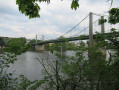
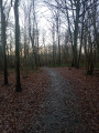
Sur les hauteurs de Triel-sur-Seine, avec une première partie dans les bois de l'Hautil et un retour par les coteaux.
Trace gpx nécessaire en forêt.

Details

n°63341277
Creation:
Last update:
  • Walking
    Activity: Walking
  • ↔
    Distance: 5.89 mi
  • ◔
    Average duration: 3h 00 
  • ▲
    Difficulty: Moderate

  • ⚐
    Back to start: Yes
  • ↗
    Ascent: + 331 ft
  • ↘
    Descent: - 338 ft

  • ▲
    Highest point: 591 ft
  • ▼
    Lowest point: 266 ft
  • ⚐ Country: France
  • ⚐ City: Triel-sur-Seine (78510)
  • ⚑
    Start/End: N 48.979302° / E 2.019939°
  • ❏
    IGN map(s): Ref. 2113ET, 2214ET, 2313OT
  • Hour-by-hour weather

Description of the walk

Start from the car park near the Jean de la Fontaine school.

(S/E) Turn left onto Rue des Saussaies until you reach the roundabout.

(1) Turn right onto Avenue de la Forêt. Continue along the street until you reach the intersection with Allée Georges Bizet. There, take the stairs on the right at the top and take the path called "sente du battoir". At the end, take the path on the right that goes up into the forest. Continue along this path until you reach Carrefour des Picardes (2). Just after the crossroads, turn quickly left towards the north-west until you reach the Carrefour Corneille (3) star junction.

Leave the path on your left. There are two paths ahead; take the one opposite, which continues on from the one you arrived on (the one on the left, which is more winding, leads to the same place). Continue to the observatory.

(4) Cross the D2 with caution, turn left, go through the barrier. After 20 m, turn right, leaving one road in front of you and one on your right, and continue straight ahead on the road until you reach the Carrefour des Deux Amants.

(5) Take thethird path clockwise, almost opposite. Continue, leaving several paths on your left and right. The path turns north-west and arrives at another crossroads.

(6) Fork left after 150 m, down the slope.
(7) Turn left at the edge of the forest and join theGR®®2.
Alternative: descend to the next intersection and follow theGR®®2to the left.

(8) Follow it straight ahead, then take Chemin des Mareilles, then Chemin des Beauregards until you reach the junction with Rue des Bois.

(9) Cross it and follow Rue des Beauregards opposite until you reach the D2.

(10) Cross it and continue along Rue du Général Leclerc until you reach the junction with Rue d'Octave Mirbeau.

(11) Turn right onto this street, then left onto Rue des Biaunes.

(12) Turn left onto Rue des Temporets and follow it to the end.

(13) Go up Rue Saint-Marc on the left, towards the square, then turn right onto Rue du Puits. Take thefirst left (Sente des Perruches) and, at the top, turn right onto Rue des Saussaies.

(1) At the roundabout, continue straight ahead to return to the car park (S/E).

Waypoints

  1. S/E : mi 0 - alt. 318 ft - Parking at 23 Rue des Saussaies, opposite Espace Fradet.
  2. 1 : mi 0.11 - alt. 312 ft - Place des Saussaies - Roundabout
  3. 2 : mi 0.87 - alt. 535 ft - Carrefour des Picardes
  4. 3 : mi 1.24 - alt. 574 ft - Corneille crossroads
  5. 4 : mi 1.76 - alt. 561 ft - D2 - Observatoire de Triel - Parc aux Etoiles
  6. 5 : mi 2.14 - alt. 571 ft - Crossroads of the Two Lovers
  7. 6 : mi 2.91 - alt. 469 ft - Crossroads
  8. 7 : mi 3.03 - alt. 407 ft - Crossroads
  9. 8 : mi 3.54 - alt. 335 ft - GR2 junction
  10. 9 : mi 4.4 - alt. 348 ft - Road junctions
  11. 10 : mi 4.5 - alt. 318 ft - Rue du Général Leclerc
  12. 11 : mi 4.95 - alt. 354 ft - Rue Octave Mirbeau
  13. 12 : mi 5.15 - alt. 279 ft - Rue des Temporets
  14. 13 : mi 5.46 - alt. 266 ft - Rue Saint-Marc
  15. S/E : mi 5.89 - alt. 318 ft - Parking at 23 Rue des Saussaies, opposite Espace Fradet.

Notes

Certains passages en forêt peuvent être boueux. Pas de difficulté après la montée initiale (D+ 60 m environ) (noté moyen à cause de la longueur de près de 10 km).

Comme souvent en forêt, l'application Visorando peut être utile.

Worth a visit

Always be cautious and plan ahead when you're outdoors. Visorando and the author of this route cannot be held responsible for any accidents occurring on this route.

The GR® and PR® markings are the intellectual property of the Fédération Française de Randonnée Pédestre.

Reviews and comments

2 / 5
Based on 1 review

Reliability of the description
1 / 5
Ease of following the route
2 / 5
Route interest
3 / 5
Gilles490
Gilles490
• Edited:

Overall rating : 2 / 5

Date of your route : Feb 04, 2025
Reliability of the description : ★☆☆☆☆ Very disappointing
Ease of following the route : ★★☆☆☆ Disappointing
Route interest : ★★★☆☆ Average
Very busy route : No

On this unmarked route, we relied on the map, compass and signposts.
Unfortunately, there were far too many approximations and inaccuracies in the text.
It starts right at point 1, where the words "PEU APRES" (shortly after) are really imprecise... We didn't find anything "PEU APRES" (except an exhausted man with a three-day beard who asked us, "Are you looking for the path too?").
So we walked a little further and a few dozen metres after house No. 53, we took a staircase on the right that led to a path which we followed parallel to the road. We turned right onto the first path going up into the forest, marked on signs as "chemin des picardes", which led to a crossroads that we assumed was the Picardes crossroads on the map.
The next challenge will be to find the right path to the observatory.
Once you have crossed the D2, YOU MUST PASS THE BARRIER before turning right at the fork about 20 metres after the barrier. Do not take the first path on the right before the barrier: it leads to the main road to Triel - l'Hautil.
At the Carrefour des Deux Amants (don't expect a large intersection), the road "almost opposite" is not the third one clockwise. It is the last one you need to take (a compass was very useful here).
I would add that this route should be avoided after rain, as the forest before the D2 has a number of flooded sections, forcing you to make detours far from the planned route. We live in the area, so we know our way around, but it's not necessarily obvious to everyone. Then, the section in the forest after the D2 winds around a restricted area due to the risk of landslides (there are quarries below us) and you sometimes have to pass between two large holes, which isn't particularly pleasant.

Machine-translated

Other walks in the area

For more walks, use our search engine .

The GPS track and description are the property of this route's author. Please do not copy them without permission.