Country:

 City:


Park in the small car park at the entrance to the hamlet of Les Fonts, at an altitude of 700 m.
(S/E) Head north towards the RN106. Shortly after crossing the bridge over the Bramont, take the dirt track on the right, which runs below the road.
(1) Turn left to join the road. Cross safely (there is sufficient visibility to both the left and right) and, opposite, slightly to the left, take the forest track which will lead you up onto the Causse de Mende. After passing four hairpin bends, you’ll reach the plateau at an altitude of around 940 m.
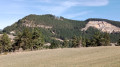
(2) Enjoy the west-north-west view towards the Lot valley and the hamlets of Villaret and Balsièges. Stay on the widest track, which, after about 100 metres, emerges from the forest onto a large cleared area (usually a meadow). Cross this area, heading north-east uphill, until you reach another access point (with a sheep fence that is either open or easy to climb over) to this agricultural plot at the edge of the forest.
(3) This access path descends to the left for about 150 m to a fork on the northern slope. Take the right-hand grassy path, which runs flat through the undergrowth and then gradually climbs up to the junction with a wide, unpaved forest track coming from Balsièges.
(4) At this bend in the track, carry on straight ahead, climbing eastwards to the highest point of the walk (1,038 m).
(5) There, a small grassy path leads downhill to the right of the dirt track, initially heading south-east and then west after taking a sharp right turn. After about 500 m of fairly steep descent, it joins another path (which is level and comes from the left).
(6) Continue straight ahead, heading west; the path no longer descends but is narrow. It then emerges from the forest and reaches a sheep fence which is easy to cross. Once on this grassy southern slope overlooking the valley, walk across for about fifty metres to find a steep, barely marked track. Take it to the left (heading downwards). The path turns south-east towards Rouffiac and becomes clearly marked.
(7) Continue down a gentler slope towards the east until you reach the village of Rouffiac. Back on the tarmac, turn right and, at each junction, head straight on down this narrow lane which takes you back to the RN106. Cross it at the pedestrian crossing and take the pedestrian access opposite (a few steps) leading to the path that heads towards the campsite and allows you to cross the Bramont again. The path begins to climb and reaches a fork.
(8) Continue uphill, ignoring the path on the right. At the top of the hill, join the forest track that links Les Fonts and Montialoux.
(9) Carry on straight ahead, heading west-south-west to approach Les Fonts. The track is initially flat for 700 or 800 metres, then begins to descend as you approach the houses. After two hairpin bends, head down into the hamlet and return to the car park at the exit (S/E) to complete this circular route.



 Visorando Member

 Easy