The circular Antennes Loop starting from Molines

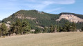
This is a circular trail, mainly through woodland, situated at the eastern end of the Causse de Sauveterre. In an area where there are still few walking routes, it offers beautiful views of the Truc de Balduc, Varazoux, Saint-Étienne-du-Valdonnez, the Bramont State Forest, and, further afield, the Plateau du Roi, dominated by the Truc de Fortunio (Margeride).

Details

n°110494415
Creation:
Last update:
Last review:
–
  • Walking
    Activity: Walking
  • ↔
    Distance: 7.38 mi
  • ◔
    Average duration: 4h 20 
  • ▲
    Difficulty: Moderate

  • ⚐
    Back to start: Yes
  • ↗
    Ascent: + 1,119 ft
  • ↘
    Descent: - 1,115 ft

  • ▲
    Highest point: 3,783 ft
  • ▼
    Lowest point: 2,933 ft

Description of the walk

Turn right off the N106 when coming from Molines at the sign for a DFCI reservoir. After about 300 m, park in the clearing at the junction of two tracks, just past the small bridge over the Lançon stream. Please note: from this junction onwards, vehicles are not permitted.

(S/E) Set off along the main track, heading north, until you reach the next junction.

(1) Take the track leading uphill. Then pass one track on your left, followed much further on by a second track – both narrower and less frequently used – until you reach the next fork.

(2) Leave the main dirt track and turn right onto a slightly downhill grassy track. First head downhill along this wide grassy path, then uphill to the south of the area known as Chou de Mouton until you reach a junction in the Chaillac area.

(3) Take the busier track on the left coming from La Bazalgette, and continue to a multi-way junction.

(4) Carry on straight ahead, uphill, along the main track, until you reach a flatter area, then, about 500 m further on, the junction leading to the DFCI reservoir.

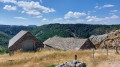
(5) Turn left, heading slightly downhill, towards the DFCI reservoir. Leave it on your left – it is situated beneath a large sheepfold – and carry on until you reach the crossroads beneath the aerial masts.

(6) Take the path on the left to reach them.

(7) Turn back to the previous junction.

(6) Turn left onto the path leading uphill. Continue to a clearing and the fork in the path beneath a power line.

(8) Turn left onto the grassy, downhill path; continue along the track that follows it, keeping to the left until you reach a steeper, less grassy section. You’ll reach a junction with a balcony path below the edge of the Causse.

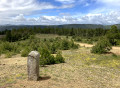
(9) From this junction, below a cairn, veer right onto the path (sometimes just a narrow track due to overgrown vegetation), which generally descends, until you reach a fork at a hairpin bend.

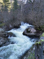
(10) Turn sharply left onto a faintly marked path (covered in vegetation) which leads to a much wider track. Follow this down to the right towards the bottom of the valley to reach the junction leading back into the Lançon valley. Continue to the left to reach the car park in the clearing near the Lançon (S/E).

Waypoints

  1. S/E : mi 0 - alt. 2,933 ft - Car park in a clearing on the banks of the Lançon
  2. 1 : mi 0.55 - alt. 2,969 ft - 1st fork
  3. 2 : mi 2.12 - alt. 3,376 ft - 2nd fork
  4. 3 : mi 3.22 - alt. 3,297 ft - Junction in the Chaillac area
  5. 4 : mi 4.17 - alt. 3,520 ft - Crossroads with several directions
  6. 5 : mi 4.92 - alt. 3,757 ft - Junction towards DFCI
  7. 6 : mi 5.19 - alt. 3,707 ft - Junction towards the antennas
  8. 7 : mi 5.31 - alt. 3,711 ft - The antennas
  9. 8 : mi 5.81 - alt. 3,753 ft - Junction beneath a power line
  10. 9 : mi 6.07 - alt. 3,543 ft - Junction with a balcony path
  11. 10 : mi 6.65 - alt. 3,258 ft - Junction
  12. S/E : mi 7.38 - alt. 2,933 ft - Car park in a clearing on the banks of the Lançon

Notes

Please note: this route is not signposted! You must therefore have at least downloaded the route description and the Visorando topographic map and/or the app to complete this walk.
However, using the .gpx track file via the app or on a hiking GPS with IGN base maps will make the walk even more convenient.
(5) Sheepfold: make use of the wooden table for a break if you wish.

Worth a visit

(7) The antennas, by the site’s protective fence: go round it to the left to reach (20 to 30 metres further on) the promontory offering an unobstructed view:
- in the foreground, a view of the Bramont valley and the Petit Causse de Balduc,
- further afield, the southern part of La Margeride with its highest point: the Truc de Fortunio radio relay station (1,554 m)
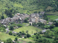
- closer by, on the right: the village of Saint-Étienne-du-Valdonnez, overlooked by the western edge of Mont Lozère (Serre des Countrats).

Other walks in the area

For more walks, use our search engine .

The GPS track and description are the property of this route's author. Please do not copy them without permission.