The Gué Charet and Étunel ponds

A circular route passing by the communal lake at Treffendel, continuing to Gué Charet, then following the River Serein to the Étang de l’Étunel.

Details

n°64316724
Creation:
Last update:
Last review:
  • Walking
    Activity: Walking
  • ↔
    Distance: 2.79 mi
  • ◔
    Average duration: 1h 30 
  • ▲
    Difficulty: Moderate

  • ⚐
    Back to start: Yes
  • ↗
    Ascent: + 213 ft
  • ↘
    Descent: - 213 ft

  • ▲
    Highest point: 400 ft
  • ▼
    Lowest point: 187 ft
  • ⚐ Country: France
  • ⚐ City: Treffendel (35380)
  • ⚑
    Start/End: N 48.040129° / W 2.0056°
  • ❏
    IGN map(s): Ref. 1118SB, 1119SB
  • Hour-by-hour weather

Description of the walk

Coming from the south via the D63, after passing the town hall, park at the cemetery near Saint-Malo Church, on the bend in the D63.

(S/E) Head north and walk along the right-hand side of the cemetery, following the Chemin de la Fontaine Saint-Méen. Join the Rue des Deux Fontaines and follow it to the left for 50 metres.

(1) Turn right and walk alongside the small Étang du Presbytère on your left, then turn right onto the street and you’ll come to a junction.

(3) Turn left onto Route de l’Étunel and follow it for 600 metres towards the leisure park.

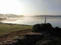
(3) Turn left at the bike park, just after the field on your left. Follow the path, then head downhill until you’re walking alongside the fence of the Cirque-Parc site. Carry on straight ahead until you reach the Gué Charet and its pond.

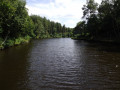
(4) Turn right to join the path running alongside the Serein. Follow the path all the way (keeping the stream on your left) until you reach the Étang de l’Étunel and a fork in the path.

(5) Turn right to rejoin the main path. Carry on straight ahead until you reach the bike park.

(3) Carry on straight ahead and, following the route in reverse to the one taken on the way out, return to the starting point (S/E).

Waypoints

  1. S/E : mi 0 - alt. 400 ft - Cemetery car park - Église Saint-Malo (Treffendel)
  2. 1 : mi 0.19 - alt. 331 ft - Étang du Presbytère (Treffendel)
  3. 2 : mi 0.36 - alt. 341 ft - Crossroads
  4. 3 : mi 0.7 - alt. 285 ft - Bike park – Junction of the circular loop
  5. 4 : mi 1.12 - alt. 230 ft - Étang du Gué Charet
  6. 5 : mi 1.81 - alt. 190 ft - Étang de l'Étunel
  7. S/E : mi 2.79 - alt. 400 ft - Cemetery car park

Reviews and comments

4.3 / 5
Based on 2 reviews

Reliability of the description
4 / 5
Ease of following the route
4.5 / 5
Route interest
4.5 / 5
olive 37
olive 37

Overall rating : 4 / 5

Date of your route : Jun 09, 2025
Reliability of the description : ★★★★☆ Good
Ease of following the route : ★★★★☆ Good
Route interest : ★★★★☆ Good
Very busy route : Yes

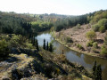
very nice hike, pretty landscape, but it's true that at the end, you have to climb on the rocks and be careful not to slip because the river is below .... it might be necessary to classify it, with a little difficulty

Machine-translated

Ourozz
Ourozz

Overall rating : 4.7 / 5

Date of your route : Mar 30, 2025
Reliability of the description : ★★★★☆ Good
Ease of following the route : ★★★★★ Very good
Route interest : ★★★★★ Very good
Very busy route : No

A really lovely walk with some beautiful scenery. But I wouldn’t have classed it as easy. You have to climb over rocks, descend from quite a height, and walk along narrow paths by the river…

Machine-translated

Other walks in the area

For more walks, use our search engine .

The GPS track and description are the property of this route's author. Please do not copy them without permission.