The Dran Circular Route

Discover Guer and its surroundings. Explore the Voie Verte, a former railway line that has been converted into a cycle path, the Couëdor Manor House, the former seat of the lords of Guer, and Saint-Étienne Chapel, the oldest in the Morbihan department!

Details

n°21892221
Creation:
Last update:
Last review:
  • Walking
    Activity: Walking
  • ↔
    Distance: 7.08 mi
  • ◔
    Average duration: 3h 30 
  • ▲
    Difficulty: Moderate

  • ⚐
    Back to start: Yes
  • ↗
    Ascent: + 318 ft
  • ↘
    Descent: - 348 ft

  • ▲
    Highest point: 335 ft
  • ▼
    Lowest point: 85 ft
  • ⚐ Country: France
  • ⚐ City: Guer (56380)
  • ⚑
    Start/End: N 47.906056° / W 2.123873°
  • ❏
    IGN map(s): Ref. 1019SB, 1020SB, 1119SB, 1120SB
  • Hour-by-hour weather

Description of the walk

Park near the Guer Tourist Office.

Yellow signposting along the entire route

(S/E) Follow the Voie Verte towards Ploërmel for 3.5 km until you reach the hamlet of Couëdor at a crossroads.

(1) Leave the Voie Verte and turn left onto the road until the next junction.

(2) Turn right towards the Chapelle Saint-Étienne.

(3) Turn round.

(2) Turn right and continue straight on along the dirt track. After a left-hand bend (towards the east), you’ll reach another fork in the road.

(4) Turn slightly to the right and, at the junction with the road, carry on straight ahead to the hamlet of La Ville Boscher.

(5) Turn left for 350 m, then right and follow the track to the D776.

(6) Turn left onto this road with care, then cross over to take the next road on the right. Very soon after, turn right between the houses and follow the path to the crossroad at Tertre Béchepy.

(7) Follow this road to the right for 80 m, then turn left onto the farm track and head into the wooded area.

(8) Continue along the path on the right. At the next junction, turn left onto the footpath and carry on until you reach the road.

(9) Continue along this road until you reach the hamlet of Les Moûtiers. Turn left at the junction and continue to Avenue de l’Hippodrome (D773).

(10) Turn right onto this road until you reach the roundabout, then follow Rue du Four to the left towards the town centre and the church.

(11) Turn left onto Rue Saint-Gurval and continue along Rue Saint-Thomas until you reach the starting point (S/E).

Waypoints

  1. S/E : mi 0 - alt. 148 ft - Guer Tourist Office
  2. 1 : mi 2.16 - alt. 112 ft - Couëdor
  3. 2 : mi 2.4 - alt. 154 ft - The chapel junction
  4. 3 : mi 2.6 - alt. 177 ft - Chapelle Saint-Étienne (Guer)
  5. 4 : mi 3.43 - alt. 217 ft - Crossroads
  6. 5 : mi 3.73 - alt. 295 ft - La Ville Boscher
  7. 6 : mi 4.16 - alt. 253 ft - D776 road
  8. 7 : mi 4.41 - alt. 302 ft - Le Tertre Béchepy
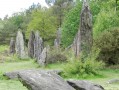
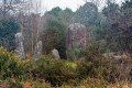
  9. 8 : mi 4.9 - alt. 328 ft - Butte du Dran - Top
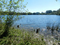
  10. 9 : mi 5.7 - alt. 112 ft - Butte du Dran - Lower - Oyon (rivère) - Affluent de l'Aff
  11. 10 : mi 6.54 - alt. 138 ft - D773 Road – Avenue de l’Hippodrome
  12. 11 : mi 6.84 - alt. 138 ft - Église Saint-Gurval (Guer)
  13. S/E : mi 7.08 - alt. 148 ft - Guer Tourist Office

Notes

Toilets and all amenities and shops are available in the town centre.

Worth a visit

Places to see along the way:
- Couedor Manor
- Saint-Étienne Chapel
- The hamlet of Ville Boscher
- The thousand-year-old yew tree.

Reviews and comments

5 / 5
Based on 1 review

Reliability of the description
5 / 5
Ease of following the route
5 / 5
Route interest
5 / 5
lou17lou17
lou17lou17

Overall rating : 5 / 5

Date of your route : Sep 28, 2026
Reliability of the description : ★★★★★ Very good
Ease of following the route : ★★★★★ Very good
Route interest : ★★★★★ Very good
Very busy route : No

It’s a shame that the ‘trembling stone’ isn’t mentioned on this route, especially as it’s steeped in history and legend; it’s only a few metres off the route.

Machine-translated

Other walks in the area

For more walks, use our search engine .

The GPS track and description are the property of this route's author. Please do not copy them without permission.