The Chaluet ponds

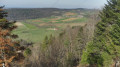
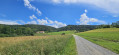
A countryside walk through meadows, woods and ponds, passing through two villages. Views of the foothills of the Jura.

Details

43609170
Creation:
Last update:
Last review:
  • Walking
    Activity: Walking
  • ↔
    Distance: 6.43 mi
  • ◔
    Average duration: 3h 15 
  • ▲
    Difficulty: Moderate

  • ⚐
    Back to start: Yes
  • ↗
    Ascent: + 371 ft
  • ↘
    Descent: - 344 ft

  • ▲
    Highest point: 1,677 ft
  • ▼
    Lowest point: 1,463 ft

Description of the walk

Park in the car park at Levoncourt church.

(S/E) Walk down Rue de l’Église, cross the D411 and the River Largue, then walk up Rue de Charmoille until you reach a fork in the road.

(1) Turn right and walk past the little Saint-Laurent Chapel on your left; continue until you reach a crossroads at the end of the tarmac road.

(2) Take the path on the right, then turn left at the next junction. Pass under a power line, go round a copse and join a stony track.

(3) Turn right onto this track, walk through the woodland, then turn left at the next junction. You’ll reach a multi-way junction by a pond.

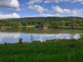
(4) Turn left and walk along the left-hand side of the pond, then veer right. Cross the D473 with great care. Continue straight ahead into the Chaluet Forest and reach the southern shore of the Étang du Chaluet.

(5) Take the dirt track opposite to walk along the left-hand side of the Étang du Chaluet. You’ll come to a forest track; follow it, turning right, walking past some fishermen’s huts until you reach a crossroads at the foot of some trees.

(6) Take the path on the left, pass between the fields, ignoring the turnings to the left, and arrive at another crossroads on the edge of the woods.

(7) Turn left at a 90° angle, walk alongside the woodland and then enter it. Shortly after leaving the woodland, you’ll reach a road (D41).

(8) Take this road to the right with care to reach the entrance to the village of Courtavon, the Pont de la Largue and the junction with the D473.

(9) Turn left onto the D473, towards Ferrette, until you reach the edge of the village. Turn right onto the Chemin de la Claverie, at the last houses. Continue to thefirst path on the left.

(10) Follow this straight track to walk once again through meadows and fields, continuing along it until you reach the path marked with a Yellow Ring, a few metres after passing under the power line. Carry on straight ahead, enter the forest and you’ll soon reach a crossroads with several directions.

(11) Turn right here and carry on straight through the forest, following the Yellow Ring and Red Diamond markings. Keep following these markings until you reach a track.

(12) Cross it and continue straight ahead, still following the same markings. You’ll easily reach the car park at Levoncourt Church (S/E) via a very gentle descent.


Waypoints

  1. S/E : mi 0 - alt. 1,575 ft - Car park at the - Église Saint-Maurice (Levoncourt)
  2. 1 : mi 0.28 - alt. 1,568 ft - Junction.
  3. 2 : mi 0.58 - alt. 1,667 ft - End of the tarmac path
  4. 3 : mi 1.12 - alt. 1,617 ft - Bois des Fourches Forest
  5. 4 : mi 1.52 - alt. 1,558 ft - Levoncourt Pond
  6. 5 : mi 2.26 - alt. 1,506 ft - Étang du Chaluet
  7. 6 : mi 2.7 - alt. 1,526 ft - Courtavon Meadows
  8. 7 : mi 3.23 - alt. 1,545 ft - Edge of the woodland
  9. 8 : mi 3.71 - alt. 1,604 ft - D41 road
  10. 9 : mi 4.16 - alt. 1,467 ft - Bridge of the - Largue (rivière) - Affluent de l'Ill
  11. 10 : mi 4.46 - alt. 1,493 ft - Courtavon Meadow
  12. 11 : mi 5.26 - alt. 1,614 ft - Courtavon Forest
  13. 12 : mi 6 - alt. 1,634 ft - Levoncourt Forest
  14. S/E : mi 6.43 - alt. 1,575 ft - Car park at the - Église Saint-Maurice (Levoncourt)

Notes

No special equipment required, but do take the weather into account.

Worth a visit

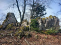
(S/E) Nearby, you can visit the ruins of Morimont Castle.

(3) At a place known as Bois des Fourches, condemned prisoners from Morimont Castle were taken to be executed by being pinned to the ground with wooden stakes driven into the earth (is this a legend or not?).

Reviews and comments

3.8 / 5
Based on 4 reviews

Reliability of the description
4 / 5
Ease of following the route
3.3 / 5
Route interest
4.3 / 5
User 23968508

Overall rating : 3 / 5

Date of your route : Jul 23, 2026
Reliability of the description : ★★☆☆☆ Disappointing
Ease of following the route : ★★★☆☆ Average
Route interest : ★★★★☆ Good
Very busy route : No

The access route shown to the Chaluet pond does not exist at all, and there is no parallel path.
Nor does the path shown on the IGN map exist.
It is a long walk (a good 10 minutes for 300 metres) through dense undergrowth overgrown with scrub.
Ultimately, because of this gap, the route no longer exists.

Machine-translated

Bapou
Bapou
• Edited:

Overall rating : 3.3 / 5

Date of your route : Jun 20, 2025
Reliability of the description : ★★★★☆ Good
Ease of following the route : ★★★☆☆ Average
Route interest : ★★★☆☆ Average
Very busy route : No

Hello, the trail was quite pleasant until point 5. After that, we couldn't find the supposed path that runs along the Chaluet ponds. We ended up in a pine forest, and at 1.90 metres tall, I can't tell you how difficult it was. What's more, my wife had an anxiety attack because it was so oppressive. So, despite the rest of the hike, I wouldn't recommend this one until the problem with the missing path is resolved.

Machine-translated

MP68
MP68

Thank you for your feedback. I’m afraid that dirt track no longer exists. We looked for it; we even retraced our steps.
If by any chance you happen to pass by there again! In any case, it’s a lovely walk, and thank you for describing it.

Machine-translated

gerhub
gerhub

You missed the dirt track at the end of the bend. My description was edited by a moderator. The track isn’t the main road but a forest track. I’ve updated it again.
Gerhub

Machine-translated

MP68
MP68

Overall rating : 4 / 5

Date of your route : Mar 24, 2025
Reliability of the description : ★★★★★ Very good
Ease of following the route : ★★☆☆☆ Disappointing
Route interest : ★★★★★ Very good
Very busy route : No

There is no path between points 5 and 6. You have to make your way through woodland with brambles, and you end up on private property; you don’t get to enjoy the Chaluet pond on this stretch, which runs alongside it. It’s a shame, as the walk is very beautiful,

Machine-translated

dbaegser
dbaegser

Overall rating : 5 / 5

Date of your route : Feb 17, 2025
Reliability of the description : ★★★★★ Very good
Ease of following the route : ★★★★★ Very good
Route interest : ★★★★★ Very good
Very busy route : No

A lovely, easy route

Machine-translated

Other walks in the area

For more walks, use our search engine .

The GPS track and description are the property of this route's author. Please do not copy them without permission.