Courtavon Circular

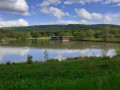
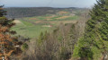
A short circular walk starting from the Courtavon lake, alternating between fields and woodland at La Montagne.

Details

12859642
Creation:
Last update:
Last review:
  • Walking
    Activity: Walking
  • ↔
    Distance: 3.84 mi
  • ◔
    Average duration: 2h 20 
  • ▲
    Difficulty: Easy

  • ⚐
    Back to start: Yes
  • ↗
    Ascent: + 623 ft
  • ↘
    Descent: - 623 ft

  • ▲
    Highest point: 2,060 ft
  • ▼
    Lowest point: 1,437 ft

Photos

Description of the walk

Park in the lake car park.

(S/E) Follow the southern shore of the lake and cross the small wooden bridge over the Largue on the left. Stay on this path, cross another bridge over the Largue, then turn right onto the D473, taking care to watch out for traffic. You will then reach the entrance to the village of Courtavon.

(1) Leave the road and take the path on the left which leads into the meadow until you reach a T-junction. Take the path on the left, passing under a power line before reaching a four-way junction at the edge of the forest.

(2) Enter the forest straight ahead via an uphill path. Carry on straight ahead at every fork you come to until you reach a flatter area, the highest point of the walk.

(3) Continue straight on and begin the descent to reach the junction with a wider track.

(4) Turn left onto this track, marked with a Red Diamond. You’ll soon reach a path junction at the edge of the woodland.

(5) Here, leave the Red Diamond markings and continue to the right along the track. You’ll come out directly beneath the power line running down into the valley.

(6) Turn right onto the dirt track, which is initially straight before curving to the left, to reach the junction with the D473 road.

(7) Turn right onto it, taking great care to watch out for vehicles. Leave the road and turn left about 200 metres further on, to reach the car park by the lake (S/E).

Waypoints

  1. S/E : mi 0 - alt. 1,437 ft - Lake car park
  2. 1 : mi 0.71 - alt. 1,463 ft - Courtavon - Largue (rivière) - Affluent de l'Ill
  3. 2 : mi 1.43 - alt. 1,644 ft - Tonalliate crossroads
  4. 3 : mi 2.12 - alt. 2,041 ft - High point
  5. 4 : mi 2.47 - alt. 1,909 ft - Crossroads marked with a Red Diamond
  6. 5 : mi 3.01 - alt. 1,640 ft - Crossroads at the edge of the forest
  7. 6 : mi 3.29 - alt. 1,516 ft - Dirt track
  8. 7 : mi 3.66 - alt. 1,463 ft - D473 road
  9. S/E : mi 3.84 - alt. 1,437 ft - Lake car park

Notes

Proceed with caution on the road.

Worth a visit

(S/E) Food and drink available, but closed on Mondays and Tuesdays. You can also walk around the lake, a distance of approximately 2.7 km.

Reviews and comments

4.2 / 5
Based on 3 reviews

Reliability of the description
4 / 5
Ease of following the route
4.7 / 5
Route interest
4 / 5
Patrick 68
Patrick 68

Overall rating : 4.7 / 5

Date of your route : Jun 01, 2024
Reliability of the description : ★★★★★ Very good
Ease of following the route : ★★★★★ Very good
Route interest : ★★★★☆ Good
Very busy route : Yes

A lovely, peaceful walk, perfect for the whole family. Especially in summer, as you’re in the shade of the trees

Machine-translated

koukinet
koukinet

Overall rating : 4.3 / 5

Date of your route : Feb 19, 2022
Reliability of the description : ★★★★☆ Good
Ease of following the route : ★★★★★ Very good
Route interest : ★★★★☆ Good
Very busy route : No

The walk around Courtavon Lake is absolutely lovely. It’s best done in dry weather.

Machine-translated

gerhub
gerhub

Hello, I’m the route designer. Could you please point out the relevant details to me?
Thank you
Gérard Hubler

Machine-translated

mouk
mouk

Overall rating : 3.7 / 5

Date of your route : Oct 17, 2021
Reliability of the description : ★★★☆☆ Average
Ease of following the route : ★★★★☆ Good
Route interest : ★★★★☆ Good
Very busy route : No

a few details that can’t be found, otherwise nothing much

Machine-translated

Other walks in the area

For more walks, use our search engine .

The GPS track and description are the property of this route's author. Please do not copy them without permission.