Country:

 City:
City:


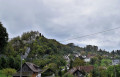
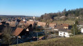
Parking is available in the lower car park by the church in Levoncourt, where you’ll find the information board for the Chemin de Mariastein route.
(S) Walk down the street, cross the road and the bridge, then turn left (the small village museum is on the left). At the large lime tree and fountain, turn right onto the street that climbs up and leads into the orchards. At the top of the steps, turn right, then left (signpost). Follow the fence of the fallow deer park along the right-hand bank; the path leads into the forest until you reach a T-junction, where you turn right (vehicle barrier). Follow this path to the Ferme-Hôtel du Morimont.
(1) Pass it on the right and follow the stony track (you can see La Vacherie farm on the right in the meadow). Ignore the two tracks on the left and continue straight on (farm building on the right) until you reach the D41 road, which you follow to the right. Enter Oberlarg via Rue Principale.
(2) Walk through the village of Oberlarg. At the school, head straight up Rue de l’Église, then take the path to the left of the fountain, which joins the road you should follow for a few hundred metres, until you reach La Chapelle du Haut.
(3) In the shade of the lime trees, take the path on the right which climbs through the forest to the Route de Lucelle.
(4) Follow this road to the right. A few hundred metres further on, you’ll reach a crossroads.
(5) Take the path on the left, called Chemin des Marocains and marked with a Red Ring, which leads into the forest. Leave the forest and, at the junction, turn right towards Place de la Charrière (shelter and car park).
(6) Cross the road and take the path on the right, the Allée des Hêtres, marked with a Yellow Ring. Continue along this path until you reach a junction at the edge of the forest.
(7) The Allée des Hêtres continues, running high above the meadows of the Grand Kohlberg, to reach the hamlet of Les Neufs Chênes (a hut) at the Col du Neuneich.
(8) Take the path leading uphill to the right (Red Saltire) to the Hornihof farm. Walk past the farm on your left (where alpacas and Asian dogs are bred).
(9) Go past the farm on the left and join the access path to the farm. Take this path on your left, following the Red Saltire markings, until you reach the Route de Kiffis (a few dozen metres to the right is the path leading to the ruins of Blochmont Castle).
(10) Cross the road – take care – and take thesecond path on the left which climbs into the forest, marked with a Red Diamond. This path along the edge of the forest passes through the Kiffis hills. To the right of the path is St Nicholas’ Chapel. Join the road by heading down to the right.
(11) Follow the road to the left until you reach the bend, then take the stony track, marked with a Yellow Saltire signpost, which climbs to the right. Follow this track until you come to a path on the right (marked with a Yellow Saltire signpost); be careful not to walk past it.
(12) Leave the track and climb about a hundred metres towards the ridge. Then, turn left and follow the ridge to the Tour du Remel.
(13) Continue along this ridge path, which forms the French-Swiss border (views over the Lauffon and Klein-Lucelle valleys and, in good weather, of the Swiss Alps), then take a steep descent to the left towards the road to Burg.
(14) Continue northwards towards the bottom of the village. Reach it via a path to the right of the houses, then take the road on the left, signposted for Biederthal. On leaving Burg, take the road on the right (marked with a Yellow Diamond, part of the Swiss signposting system). When you reach the right-hand bend, continue along the path opposite, which runs alongside the border, until you reach the Route de Metzerlen-Biederthal.
(15) Cross it and take the path opposite, still following the Yellow Diamond markings, to the hamlet of Rebberg.
(16) Walk through the hamlet to the end, then follow the road on your right to reach Mariastein (E).
 Visorando Member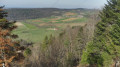
 Moderate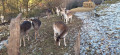
 Easy
Easy