Liebenstein Castle and the Oberlarg pastures

A lovely walk mainly along forest paths, around the Montagne

Details

31389287
Creation:
Last update:
Last review:
  • Walking
    Activity: Walking
  • ↔
    Distance: 5.20 mi
  • ◔
    Average duration: 3h 00 
  • ▲
    Difficulty: Easy

  • ⚐
    Back to start: Yes
  • ↗
    Ascent: + 712 ft
  • ↘
    Descent: - 725 ft

  • ▲
    Highest point: 2,044 ft
  • ▼
    Lowest point: 1,545 ft

Description of the walk

Park in the upper car park at Levoncourt church.

(S/E) Take the path leading into the forest on the right and continue straight on, ignoring the paths on the right. You’ll come to a crossroads.

(1) Carry on straight ahead towards Liebsdorf until you reach a T-junction.

(2) Take the path that climbs to the right and go through the vehicle barrier.

(3) Leave the main track and take a dirt track on the left that leads into the forest.

(4) Opposite Liebenstein, take the path on the right which joins the upper stone path; follow this to the right, slightly uphill, until you reach a junction. Take the path on the right which runs alongside the forest on your right-hand side until you reach the five-way junction at the Oberlarg pasture.

(5) Take thesecond path on the right which leads into the forest. Continue straight on for 2.5 km, ignoring all turnings to the left and right. Continue until you reach the RD411.

(6) Follow it carefully to the right until you reach the village of Levoncourt. Turn right at the second street to reach the church car park (S/E).


Waypoints

  1. S/E : mi 0 - alt. 1,558 ft - Car park at the - Église Saint-Maurice (Levoncourt)
  2. 1 : mi 0.46 - alt. 1,644 ft - Crossroads (2 paths)
  3. 2 : mi 1.17 - alt. 1,640 ft - T-junction
  4. 3 : mi 1.72 - alt. 1,906 ft - Exit the main path
  5. 4 : mi 2.39 - alt. 1,699 ft - Path on the right
  6. 5 : mi 3.03 - alt. 2,044 ft - Crossroads at the Oberlarg pasture
  7. 6 : mi 4.61 - alt. 1,614 ft - Junction with the RD411
  8. S/E : mi 5.2 - alt. 1,555 ft - Car park - Église Saint-Maurice (Levoncourt)

Notes

Light footwear, weather-appropriate clothing, drinks, snacks.

Worth a visit

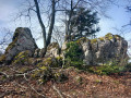
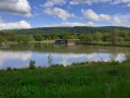
View of Liebenstein Castle and farm.
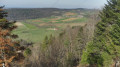
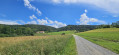
View of the village of Oberlarg and Morimont Farm.
At the car park, look out for the signs for the Mariastein Trail.

Reviews and comments

4.2 / 5
Based on 3 reviews

Reliability of the description
4.3 / 5
Ease of following the route
4.3 / 5
Route interest
4 / 5
EMMANU
EMMANU

Overall rating : 5 / 5

Date of your route : Jul 20, 2025
Reliability of the description : ★★★★★ Very good
Ease of following the route : ★★★★★ Very good
Route interest : ★★★★★ Very good
Very busy route : No

A magnificent walk in the forest with some elevation changes and beautiful views of the hills through the trees. The path was easy to walk on. 👍

Machine-translated

gerhub
gerhub
• Edited:

Unfortunately, this is just the nature of the forest after a gale has passed through, as well as the impact of forestry machinery. The Sundgau is a region that receives a great deal of rainfall, and the soil is also clayey.
You really mustn’t miss the path that branches off to the right at point 4, opposite the Liebenstein.

Machine-translated

TAurélien
TAurélien

Overall rating : 4.3 / 5

Date of your route : Mar 25, 2024
Reliability of the description : ★★★★★ Very good
Ease of following the route : ★★★★☆ Good
Route interest : ★★★★☆ Good
Very busy route : No

A lovely walk; the first section along the private path is brilliant, as it’s very shady, but some people might find it a bit claustrophobic.

Please note: when I walked this route on 25 March 2024

Between point 3 (exit from the main track) and point 4 (Liebenstein Castle), the route is in a right mess for about 750 metres; lots of large, felled larch trees litter the ground, making it impossible to cycle through, and walking turns into an obstacle course – it’s better to walk further into the forest on the right
Point 4 is confusing, as it is located (according to the app, 50 metres further on) beyond the path on the right that allows you to continue the walk; if you complete a circular route, this will extend the distance to over 9 km.
After point 5, over a distance of 350 m on the heights of Oberlarg, a number of small, freshly cut trees are strewn across the ground.

Machine-translated

francois.gutz
francois.gutz

Overall rating : 3.3 / 5

Date of your route : May 01, 2023
Reliability of the description : ★★★☆☆ Average
Ease of following the route : ★★★★☆ Good
Route interest : ★★★☆☆ Average
Very busy route : No

The first part is through a pine forest, so it’s a very dark walk, especially as you can’t see the sky – it’s a bit gloomy. The return journey is more pleasant, through beech woods and meadows.

Machine-translated

Other walks in the area

For more walks, use our search engine .

The GPS track and description are the property of this route's author. Please do not copy them without permission.