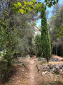
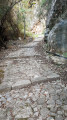
The two Monts Chauves from La Banquière

Starting from the Levens road, this route allows you to discover and climb the two mountains via the little-known wooded eastern trails overlooking Tourrette-Levens and its castle.

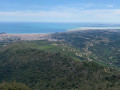
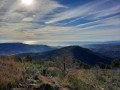
The very pleasant return trail, which is completely deserted, offers a unique panorama of Nice, Cannes and Théoule.

Only the pass and the area around the Mont Chauve d'Aspremont fort are frequented by the public.

Details

8528849
Creation:
Last update:
Last review:
  • Walking
    Activity: Walking
  • ↔
    Distance: 7.29 mi
  • ◔
    Average duration: 5h 25 
  • ▲
    Difficulty: Moderate

  • ⚐
    Back to start: Yes
  • ↗
    Ascent: + 2,346 ft
  • ↘
    Descent: - 2,349 ft

  • ▲
    Highest point: 2,762 ft
  • ▼
    Lowest point: 673 ft

Photos

Description of the walk

In order to make the M19 (Route Métropole 19) safer for heavy traffic, the road has been modified here, removing this bend, which will serve as the starting point and parking area for your vehicle.

By bus:
Take Line 19, route: Vauban-Levens.
Bus company: Lignes d'Azur. Stop at: La Clua.

(S/E) At the start, follow the curve of the old bend for about a hundred metres to see the pools of the La Banquière river below and join the M19. Please note that there is heavy traffic. Cross the road and continue along Chemin de la Condamine, also known as D.F.C.I. No. LD 86, until you reach a crossroads of carriageways.

(1) Turn left and then immediately right onto the path that starts on the right at 180°. The path joins a track suitable for vehicles.

(2) Turn left and continue on the track until you reach a fork.

(3) Turn right just before the chalet onto the paved slanting street (yellow markings).

(4) Turn right just after the cross.

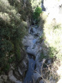
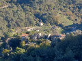
(5) At the crossroads, take the path on the right, which offers views of the Château de Tourrette-Levens.

(6) At the crossroads of paths on a small flat area, turn right. The path climbs steeply and the wooded area gradually disappears, revealing Mont Chauve de Tourrette and its telecommunications pylon.

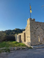
(7) The Fort du Mont Chauve de Tourrette is above you. Be careful, the path has almost disappeared, with thorny heath shrubs. Leave the track and head right, due west, through the heath for about a hundred metres to reach the fenced perimeter of the fort. Go around the fence on the left (south side of the fort) to reach the site's entrance gate.

This is a private area managed by the local shooting club, under the 1901 law. When the gate is open, enter and stay strictly on the track that leads to the shooting club members' car park, about 50 metres away.
This will give you a view of the main gate of the fort. This area leading to the car park is not dangerous. A friendly greeting or wave is always appreciated in this type of place. Leave the site by the same route.

Walk down the track to reach the valley. Be careful on the way down and look around the valley to find the tunnel entrance.

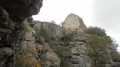
(8) If one of the two tunnel entrances is open, feel free to go inside and take a look at the military architecture. Pass to the left of the tunnel and cross the small hill above it. You are now in sight of and at the foot of Mont Chauve d'Aspremont. A path visible from afar shows you the way to the fort. You will come to a crossroads and a cairn.

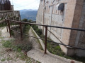
(9) Turn right to go around the entire Fort du Mont Chauve d'Aspremont (on the north side). Enjoy the views of the Var and the Pre-Alps. This is a popular spot. Complete the full tour of Mont Chauve, then enter the fort through the entrance gate. Don't hesitate to visit the moat. The site is open to all visitors. Leave the site. The view from outside is exceptional.

From the entrance gate, at thefirst bend to the right, turn left onto a mound and follow the path that runs along the fort's surrounding walls to return to the crossroads you passed on the way there.

(9) Turn right and head towards the valley. Pass on the right well before the tunnel and join the tarmac road of Mont Chauve below. Continue left on the access road to the shooting range/departmental kennel and pound. Pass through the swing gate.

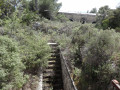
(10) Turn right after the bend onto the path that is slightly below. Continue on the south-facing track that passes through an area of buildings dating from the years when the forts were built. Turn left, just after the steps leading down a staircase, walk along the ruins and continue on the path, still facing south. Go down the slope and cross thefirst tarmac road.
(11) Turn left at thesecond tarmac road and continue along this road.

(12) At the three-way junction in the tarmac roads, turn left onto the road that climbs slightly, then turn left again onto Chemin de Gheirart, also known as DFCI n° LD 86. Continue along this track and you will come to a fork that you passed on the way out.

(3) At the chalet, continue straight ahead and follow the path in the opposite direction to the outward journey. Continue along the track to return to the starting point (S/E).


Waypoints

  1. S/E : mi 0 - alt. 686 ft - Parking in the straightened bend. - Banquière (rivière)
  2. 1 : mi 1.19 - alt. 1,276 ft - Crossroads of carriageways
  3. 2 : mi 1.29 - alt. 1,378 ft - Trail x Vehicle track
  4. 3 : mi 1.37 - alt. 1,388 ft - Trail x Vehicle track
  5. 4 : mi 1.42 - alt. 1,467 ft - Trail junction
  6. 5 : mi 1.5 - alt. 1,499 ft - Trail junction
  7. 6 : mi 2.09 - alt. 2,064 ft - Trail junction
  8. 7 : mi 2.3 - alt. 2,346 ft - Turn right towards the - Mont Chauve de Tourette (784m)
  9. 8 : mi 2.85 - alt. 2,339 ft - Tunnel - Baisse de Guigo (747m)
  10. 9 : mi 3.26 - alt. 2,657 ft - Trail junction - Cairn around the - Mont Chauve d'Aspremont
  11. 10 : mi 4.3 - alt. 2,336 ft - Path on the right
  12. 11 : mi 5.13 - alt. 1,631 ft - Tarmac road.
  13. 12 : mi 5.43 - alt. 1,637 ft - Tarmac road - DFCI
  14. S/E : mi 7.29 - alt. 686 ft - Parking in the straightened bend.

Notes

Moderately difficult hike.

No water sources along the route.

Remain vigilant: some tyre tracks indicate the presence of mountain bikes.
DFCI = Forest Fire Defence Routes.

Worth a visit

Reviews and comments

4 / 5
Based on 5 reviews

Reliability of the description
4 / 5
Ease of following the route
3.8 / 5
Route interest
4.2 / 5
User 19555185
• Edited:

Overall rating : 3.3 / 5

Date of your route : May 16, 2026
Reliability of the description : ★★★★☆ Good
Ease of following the route : ★★★☆☆ Average
Route interest : ★★★☆☆ Average
Very busy route : No

There’s no longer a small car park to park in. You have to take the bus. The section along the M19 is particularly dangerous.
This is followed by a dull climb on tarmac for nearly 2km. It’s a long way. The return journey is the same. The path at point 1 is easily accessible, but then the vegetation stopped me from going any further – there were lots of brambles. I went back onto the road for a short detour to carry on.
At point 7, you do indeed have to climb through the heath; there are no major difficulties (less so than my attempt to brave the brambles at point 2), but you do end up on private land belonging to the shooting range. I came across some members who made it clear to me that it was dangerous to come here. There are numerous signs stating that this area is reserved for authorised persons and members of the shooting range, and other signs warning of danger due to live ammunition being fired – shots that can be heard very, very frequently.
The friendly welcome mentioned in the walk guide was sorely missed. I was simply told off and given a dirty look, and I can understand why, as you arrive from behind the shooting range and it can be dangerous. Hearing bullets so close by isn’t exactly reassuring either.
I came across a Patou at point 8, as well as some horses further up the trail.
The view along the route is very beautiful.
You then pass through paths bordering numerous private houses of little interest, with dogs barking at the slightest movement.
This isn’t a hike to do in the height of summer as it gets hot. I came across very few people.
It’s the perfect time to pick some thyme along this path! The return journey took us along a long, uninteresting 2km road and across the M19, which is just as dangerous.
To be honest, I didn’t find this hike exceptional; there were a few nice views, yes, but I remain ambivalent about the access, the kilometres on tarmac roads and the welcome at the shooting range.

Machine-translated

bernard bb
bernard bb

Thank you, Violette C2, for this review.
Have a good week, best wishes, Rando B.

Machine-translated

Violette C2.
Violette C2.

Overall rating : 5 / 5

Date of your route : Feb 21, 2026
Reliability of the description : ★★★★★ Very good
Ease of following the route : ★★★★★ Very good
Route interest : ★★★★★ Very good
Very busy route : No

Very beautiful route with stunning views, best done in winter as it is very warm.

Machine-translated

bernard bb
bernard bb

Thank you Niçois for this very clear opinion
best regards, B.

Machine-translated

Niçois
Niçois

Overall rating : 4 / 5

Date of your route : Sep 16, 2025
Reliability of the description : ★★★★☆ Good
Ease of following the route : ★★★★☆ Good
Route interest : ★★★★☆ Good
Very busy route : No

A pleasant hike on trails that are not too busy (at least when I was there).
Alternates between some fairly steep sections and others that are more gentle.
The route description aims to be relatively precise and concise, but in practice, on several sections, it is easy to stray from the suggested route without noticing. But don't panic, it's easy to find your way back.
Point (7): as mentioned above, there is clearly no path, so you have to make your own way through the thorns, which isn't very pleasant, to reach a gate surrounding a closed area. I would recommend skipping this section
Point (9): the fort itself appears to be closed and not open to visitors. However, you can walk around part of the moat, which allows you to appreciate some of the fort's architecture

Machine-translated

bernard bb
bernard bb

Thank you Nathjm for your opinion
Best regards, Rando B.

Machine-translated

Nathjm
Nathjm
• Edited:

Overall rating : 4.7 / 5

Date of your route : Apr 08, 2024
Reliability of the description : ★★★★★ Very good
Ease of following the route : ★★★★★ Very good
Route interest : ★★★★☆ Good
Very busy route : No

Moderately difficult hike. The view from the summit is very beautiful. To the south, there is a panoramic view of the sea from Villefranche to Cannes. To the north are the snow-capped mountains of Mercantour, and to the west is the Var valley. Completed in 5.5 hours, including a lunch break. We had to go around point 8 because there was a herd of goats with patous (shepherd dogs).

Machine-translated

bernard bb
bernard bb

Thank you, Espedaillac, for your constructive feedback.

Indeed, those 100 metres of heath are unpleasant.
Note your "Very good" for "the interest of the route".

Have a great end of the year on the trails of the 06.
Best regards, B.

Machine-translated

Espedaillac
Espedaillac

Overall rating : 3 / 5

Date of your route : Dec 17, 2021
Reliability of the description : ★★☆☆☆ Disappointing
Ease of following the route : ★★☆☆☆ Disappointing
Route interest : ★★★★★ Very good
Very busy route : No

Hello,

I'm not usually critical, but I must admit that yesterday I was surprised by the section between points 6 and 7. Leaving the track to head right through the heath (made up of thorny bushes between boulders for about a hundred metres, there are absolutely no signs of a path).
I would advise against taking children or hikers who are not used to struggling during a leisurely hike.
I know this area well.

Machine-translated

Other walks in the area

For more walks, use our search engine .

The GPS track and description are the property of this route's author. Please do not copy them without permission.