Country:

 City:
City:


At the hamlet of Faliconnet, park near marker 799, the starting point of the walk.
(S/E) From marker 799, head due north along the main road (very little traffic).
(1) At the gate, take the footpath on the right (freely accessible) and continue uphill along the road until you reach a sharp bend to the left.
(2) Take the small path branching off to the right, between the villas.
(3) At thefirst junction, take the path on the right; this will very quickly lead you to a crossroads on a road.
(4) Cross the road and head up the track opposite, past a gate.
(5) Take the DFCI LD 86 track to the left, pass through a hamlet whilst staying on the path that heads off to the left
(6) At marker 803, continue straight on along the track, towards La Condamine / Aspremont / Tourrette, until you reach marker 802 (elevation 380).
(7) Pass marker 802 and carry on straight ahead along the main track. Reach marker 795.
(8) Pass a homemade wooden rubbish bin (hung from a tree) whilst continuing along this lovely wide track.
(9) At the house called “La Peira”, leave the forest track and take a small path to the left. Pass marker 796 and, after a short climb, reach the road linking Aspremont to Tourrette (Caution: busy road).
(10) Take thefirst road branching off to the left, at a fire hydrant, before Aspremont primary school. Follow the road to the left (passing marker 839), which ends in a path leading towards a sheepfold.
(11) At marker 838, take the path on the right, above the sheepfold, towards La Baisse de Guigo. The climb here winds its way up a fairly steep and slippery slope with loose stones. On the level stretch, leave the path towards La Baisse de Guigo on your right. You’ll then walk alongside an enclosure with a meadow below (goats, turkeys and horses, depending on the season). Return to the road (leading to the shooting range) for a short stretch.
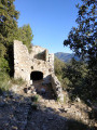
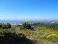
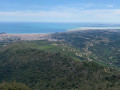
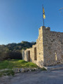
(12) Leave the road and take a narrow track on the left (note: the path is poorly marked) and walk through a mix of pine and deciduous woodland. Pass behind an abandoned building, revealing the remains of a squat toilet. After these remains, go down the steps and take the path on the left, passing several remains of a rampart walk (?). The vegetation becomes more sparse, typical of Mediterranean heath. The path is relatively well marked, but using a GPS track may prove useful. The view here is spectacular. Continue the descent (which is quite steep on a relatively stony path, and therefore more or less slippery) until you reach a road.
(13) Cross the road and continue the descent along the same type of path, surrounded by the same heath. You’ll come out onto a road.
(14) Turn left onto it to rejoin the original path and return to the original junction.
(4) Turn right and, following the route in reverse to the one taken on the way there, return to the car park (S/E).
 Visorando Member


 Easy
Easy