The Val du Drac Noir Postman’s Trail (circular)

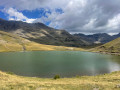
A short, refreshing circular route on the north-facing slope of the Drac Noir and through the forest. Cool and lush with water, this route starting from the Orcières leisure centre is ideal on hot summer’s days. At the edge of the forest, you’ll find wild raspberry and strawberry bushes on one side, and on the other, views of the south-facing slope and the mountain hamlets.

Details

72840476
Creation:
Last update:
Last review:
  • Walking
    Activity: Walking
  • ↔
    Distance: 5.19 mi
  • ◔
    Average duration: 3h 05 
  • ▲
    Difficulty: Easy

  • ⚐
    Back to start: Yes
  • ↗
    Ascent: + 837 ft
  • ↘
    Descent: - 837 ft

  • ▲
    Highest point: 4,839 ft
  • ▼
    Lowest point: 4,098 ft

Photos

Description of the walk

From Pont-du-Fossé, follow the Route d’Orcières (D944) and, shortly after the hamlet of Laye, take the road on the right which leads down to the leisure centre. Situated below the village centre, the car park at the Orcières leisure centre is the starting point for the route. 

(S/E) From the car park, walk past the Auberge de la Gravière. Take the road towards the Drac bridge and cross it.

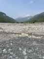
(1) Turn right to follow the track that winds down alongside the River Drac. After a few dozen metres, leave the track that climbs to the left towards Combe Noire and continue straight ahead, heading south-west. This is undoubtedly the least interesting part of the route, which runs alongside the Drac as it flows through its widened riverbed. The only point of interest is the vertiginous waterfall that looms almost vertically above us for over 100 metres. 

(2) Cross the Torrent d’Archinard, then leave the path that climbs to the left – this will be the route back. Continue along the bank of the Drac.

(3) At the Chalet du Cuit, leave the track and take the path opposite, which winds through the woodland.

(4) At the next junction, do not take the path on the left which climbs up to the Chalet Ricou, but carry on towards the banks of the Drac.

(5) Similarly, at the next junction, do not take the path leading up to Chalet Mauduit, but continue towards the banks of the Drac, passing through a few slightly tricky sections, until you reach a junction next to a footbridge crossing the Drac.

(6) At the Pont des Côtes, leave the banks of the Drac and take the path leading uphill to the left (Tour du Parc National des Écrins) towards Serre-Eyraud. The forest grows darker and the stones are covered in moss. The climb takes place on a carpet of dead leaves.

(7) At the junction, continue uphill straight ahead to join the Route des Bois.

(8) When you reach a wide forest track, take it to the left, heading east towards Les Audiberts. The route is almost flat, through woodland and along a ridge. Continue along the track to the hamlet of Le Veyret, then cross the Torrent de la Pisse, ignoring the path that climbs to the right towards Chalet Giraud.

(9) Walk past the Rocher d’Arthouze, which features a via ferrata, ignoring the path leading up to it on the right. About a hundred metres further on, also ignore the return path from Arthouze on the right and continue along the Route des Bois. It crosses numerous streams (known as ‘rious’), some of which may have a strong current and, due to the steep gradient, resemble torrents.

(10) Shortly after a car park on the right, do not take the first path leading down to the left towards Chalet Mauduit, but continue along the road. Similarly, after the bend: do not head down towards Chalet Ricou.

(11) When you reach the dovecote, turn off onto the path that descends to the left towards the leisure centre (Martelle). It passes through a damp forest (which is cool in summer). The vegetation may obscure the ground and the yellow markings that indicate the route. Return to the junction you passed on the way out.

(2) Take the wide path on the right which crosses the Torrent d’Archinard and then leads to the Drac bridge.

(1) Cross the bridge to return to the leisure centre and the car park where you started (S/E).

Waypoints

  1. S/E : mi 0 - alt. 4,268 ft - Car park at the Orcières leisure centre - Drac (rivière) - Drac Noir-Drac
  2. 1 : mi 0.2 - alt. 4,295 ft - Junction with the A/R road. Bridge over the - Drac (rivière) - Drac Noir-Drac
  3. 2 : mi 0.41 - alt. 4,268 ft - Carrefour de la circular
  4. 3 : mi 0.59 - alt. 4,245 ft - Chalet du Cuit
  5. 4 : mi 0.69 - alt. 4,288 ft - Chalet Ricou footpath
  6. 5 : mi 0.87 - alt. 4,219 ft - Chalet Mauduit footpath
  7. 6 : mi 1.99 - alt. 4,098 ft - The Pont des Côtes - Drac (rivière) - Drac Noir-Drac
  8. 7 : mi 2.43 - alt. 4,593 ft - Croisement des Côtes du Ranc
  9. 8 : mi 2.5 - alt. 4,678 ft - Route des Bois
  10. 9 : mi 3.6 - alt. 4,692 ft - Arthouse Rock Trail
  11. 10 : mi 4 - alt. 4,649 ft - Walk down from Chalet Mauduit
  12. 11 : mi 4.44 - alt. 4,728 ft - Le Pigeonnier (at the foot of the Archinard torrent)
  13. S/E : mi 5.19 - alt. 4,268 ft - Car park at the Orcières leisure centre - Drac (rivière) - Drac Noir-Drac

Notes

Please note! Part of the path along the banks of the Drac is prone to bad weather and crossing the stream bed can be tricky. Mountain bikes are not permitted on this section.

There are no drinking fountains along the route, but plenty of facilities are available at the leisure centre.
 - Picnic tables with barbecue areas
 - Petanque court
 - Swimming area and water play area
 - Fishing
 - Synthetic multi-sports pitch
 - Beach volleyball.

Worth a visit

Situated at an altitude of 1,280 metres on the banks of the River Drac, the Orcières leisure centre offers a wide range of recreational and sporting activities in a wooded setting.

The Rocher d’Arthouze features a via ferrata.

Serre-Eyraud is both a mountain village and a winter sports resort overlooking the confluence of the Drac Noir and Drac Blanc rivers, at an altitude of 1,450 metres, facing the Champoléon Valley. Founded in 1962 by a handful of locals, the smallest of the ski resorts in the Champsaur Valley faces north, and its slopes wind through a larch forest.

Reviews and comments

4.4 / 5
Based on 4 reviews

Reliability of the description
4.5 / 5
Ease of following the route
4 / 5
Route interest
4.8 / 5
User 14196573

Overall rating : 5 / 5

Date of your route : Jul 16, 2026
Reliability of the description : ★★★★★ Very good
Ease of following the route : ★★★★★ Very good
Route interest : ★★★★★ Very good
Very busy route : No

An easy and enjoyable walk in the forest

Machine-translated

giron thierry
giron thierry

Overall rating : 4.7 / 5

Date of your route : Aug 12, 2025
Reliability of the description : ★★★★★ Very good
Ease of following the route : ★★★★★ Very good
Route interest : ★★★★☆ Good
Very busy route : No

A lovely walk through the forest and along the banks of the Drac. No particular difficulty, suitable for children.

Machine-translated

doudou05+
doudou05+

Overall rating : 3.7 / 5

Date of your route : Aug 08, 2025
Reliability of the description : ★★★★☆ Good
Ease of following the route : ★★☆☆☆ Disappointing
Route interest : ★★★★★ Very good
Very busy route : Yes

The signposting on the trails is imperfect

Machine-translated

llcm83
llcm83

Overall rating : 4.3 / 5

Date of your route : Jun 11, 2025
Reliability of the description : ★★★★☆ Good
Ease of following the route : ★★★★☆ Good
Route interest : ★★★★★ Very good
Very busy route : No

Great hike in the forest, no particular difficulties, but please note that the bridges have been washed away by bad weather, although it is still possible to cross.

Machine-translated

Other walks in the area

For more walks, use our search engine .

The GPS track and description are the property of this route's author. Please do not copy them without permission.