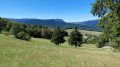
Les Clôts – Refuge de la Soldanelle

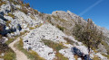
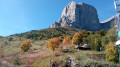
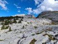
First stage of the hike. Set off from the Clôts car park towards the Refuge de la Soldanelle for an overnight stay.

This walk is part of a multi-day hike: The eastern ridges of the Vercors over two days

Details

n°27441387
Creation:
Last update:
Last review:
  • Walking
    Activity: Walking
  • ↔
    Distance: 8.21 mi
  • ◔
    Average duration: 5h 40 
  • ▲
    Difficulty: Moderate

  • ⚐
    Back to start: No
  • ↗
    Ascent: + 2,139 ft
  • ↘
    Descent: - 1,283 ft

  • ▲
    Highest point: 5,764 ft
  • ▼
    Lowest point: 4,035 ft

Photos

Description of the walk

(S) From the large car park at Les Clôts (a hamlet south-east of Villars-de-Lans), take the path that climbs to the left towards the Col Vert. Do not take the one on the right.

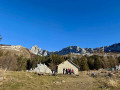
(1) Continue along the wide path towards the Fauge sheepfold on your right.

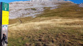
(2) Leave the sheepfold on your left and cross the meadow, following the signposts. A sign points towards Col Vert. Follow this path across the meadows and cross the small streams, then enter the forest by taking the path leading up towards Roybon.

(3) At the Roybon refuge, continue the climb eastwards. The Col Vert is directly ahead. Stay on this path as it climbs beneath the fir trees.

(4) Just below the pass, continue climbing towards Col Vert. Do take a moment to look back! The climb up to the pass really gets going here.

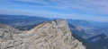
(5) The Col Vert is the highest point of this first day. Cross the pass and descend, following the path on the right. You’ll enter the ‘eastern balconies’. Continue along this path, which drops steeply for 300 m before levelling out almost completely.

(6) At the Baraque du Col Vert (1,609 m), carry on straight ahead, heading due south.

(7) Below the Ranc des Agnelons (1,530 m), take the path on the right and continue southwards.

(8) At La Pierre des Deux Heures (elevation 1,587 m), keep to the right and stay on this path.

(9) At the scree slope, stay on the path which continues to the right.

(10) At the Ruines de Clos, several paths cross here; stay on the one directly ahead – neither left nor right – towards Pré Achard.

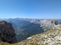
(11) Pré Achard offers a magnificent view. The refuge is visible below on the left (10 mins’ walk).

(E) Refuge de la Soldanelle. It’s best to book in advance to secure accommodation and meals.

Waypoints

  1. S : mi 0 - alt. 4,035 ft - Les Clôts car park
  2. 1 : mi 0.46 - alt. 4,085 ft - Elevation 1245 - Pont de l'Amour
  3. 2 : mi 1.44 - alt. 4,409 ft - Abri de la Fauge
  4. 3 : mi 2.53 - alt. 4,754 ft - Abri de Roybon
  5. 4 : mi 3.01 - alt. 5,443 ft - Below the pass
  6. 5 : mi 3.21 - alt. 5,764 ft - Col Vert
  7. 6 : mi 3.85 - alt. 5,253 ft - Col Vert Hut
  8. 7 : mi 4.29 - alt. 5,092 ft - Below the Ranc des Agnelons
  9. 8 : mi 5.23 - alt. 5,213 ft - La Pierre des Deux Heures
  10. 9 : mi 6.54 - alt. 5,197 ft - The scree slope
  11. 10 : mi 6.69 - alt. 5,157 ft - Ruins of the Clos
  12. 11 : mi 7.86 - alt. 5,272 ft - Pré Achard
  13. E : mi 8.21 - alt. 4,865 ft - Refuge de la Soldanelle

Notes

This walk is not recommended in winter when there is snow. Check the weather forecast before setting off to make the most of the spectacular scenery. Walking poles are strongly recommended.

Reviews and comments

3.3 / 5
Based on 1 review

Reliability of the description
4 / 5
Ease of following the route
3 / 5
Route interest
3 / 5
Claude R3.
Claude R3.

Overall rating : 3.3 / 5

Date of your route : Aug 21, 2022
Reliability of the description : ★★★★☆ Good
Ease of following the route : ★★★☆☆ Average
Route interest : ★★★☆☆ Average
Very busy route : No

A long route with a significant elevation gain; it is much easier to reach the Soldanelle refuge directly from the east balcony

Machine-translated

Other walks in the area

For more walks, use our search engine .

The GPS track and description are the property of this route's author. Please do not copy them without permission.