Les Baraques la Bresse – Trois Fours mountain refuge

First stage of a two-day hike.
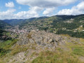
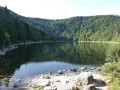
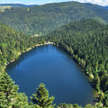
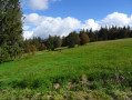
There are plenty of lovely views on this route, which takes you past the Altenberg, the Rainkhoft, the Kastelberg and the Honechkt, not to mention Lac des Corbeaux and the chamois at the finish.

Details

n°78627
Creation:
Last update:
Last review:
  • Walking
    Activity: Walking
  • ↔
    Distance: 12.56 mi
  • ◔
    Average duration: 9h 15 
  • ▲
    Difficulty: Difficult

  • ⚐
    Back to start: No
  • ↗
    Ascent: + 4,009 ft
  • ↘
    Descent: - 2,247 ft

  • ▲
    Highest point: 4,288 ft
  • ▼
    Lowest point: 2,231 ft
  • ⚐ Country: France
  • ⚐
  • ⚐ City: La Bresse (88250)
  • ⚑
    Start: N 48.002191° / E 6.9039°
  • ⚑
    End: N 48.053307° / E 7.025951°
  • ❏
    IGN map(s): Ref. 3618OT, 3618OTR, 3619OT, 3619OTR
  • Hour-by-hour weather

Photos

Description of the walk

The start is at the small car park, just on your left after the river.

(S) Follow the road for 200 metres and take the signposted path on your right towards Lac des Corbeaux. You’ll cross the tarmac road several times.

(1) At the lake, go round to the right and, after a few metres, head up to the right towards the Collet Mansuy memorial.

(2) At the memorial, take the path furthest to the left, which goes uphill.

(3) Once on the plateau, head down to your right. This will take you to a path; turn left and you’ll come to a track suitable for vehicles, which will take you to the Col de la Vierge and the Refuge de l’Union (unmanned).

(4) Then take the Chemin Bery straight ahead for a few dozen metres and head up to your right towards the Vieille Montagne.

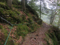
(5) Cross the plateau and head straight on. Follow the signposted path to go round the Altenberg on the right. The path is steep in places. Watch out for rockfalls, which are always a possibility.
After walking along the mountainside of the Altenberg, cross the track leading to the Col du Bramont.

(6) Then head straight ahead; you’ll arrive directly at the Col de Bramont.

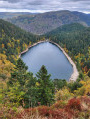
(7) At the pass, cross the road and turn right towards Ronde Tête, where you’ll be treated to a magnificent view of Lake Wildenstein.

(8) At the Col de l’Étang, there is an open shelter.
Then head up to your right towards the Rainkhopft, cross the road twice and take the path straight ahead which leads you to the summit.

(9) From there, there’s a succession of lovely views. Head back down towards the Rainkopf-Louis Hergès mountain hut.

(10) Then continue towards the Route des Crêtes lodge (source) before heading slightly uphill to your right towards the Kastelberg.

You have two options:
- either go round the Kastelberg as shown on the map
- or head straight up to the summit (depending on your fitness level)
If you choose to go round it, take the path along the mountainside rather than the track. Before the refuge (on your right), head left up towards the summit of the Kastelberg, then follow the cliffs to the Hohneck (get your binoculars out to spot the ibex).
If you’re feeling up to it, head up to the summit; otherwise, carry on straight on towards the Falimont Pass and then on to the Refuge des Trois Fours, where, as well as a warm welcome, you’ll be able to spot chamois coming to feed just a few dozen metres from the refuge in the late afternoon.

End of the first stage (E).

Waypoints

  1. S : mi 0 - alt. 2,231 ft - Car park, just on your left after the river
  2. 1 : mi 0.79 - alt. 2,907 ft - Lac des Corbeaux
  3. 2 : mi 1.31 - alt. 3,465 ft - Memorial stone at the small pass of Collet Mansuy
  4. 3 : mi 1.6 - alt. 3,668 ft - On the plateau, head down to your right
  5. 4 : mi 3.06 - alt. 3,497 ft - Refuge de l’Union (unmanned) - Col de la Vierge (1067m)
  6. 5 : mi 3.59 - alt. 3,740 ft - Cross the plateau of the > - La Vieille Montagne
  7. 6 : mi 4.56 - alt. 3,438 ft - Head straight on
  8. 7 : mi 5 - alt. 3,136 ft - Col de Bramont
  9. 8 : mi 6.49 - alt. 3,383 ft - Abri de l’Étang
  10. 9 : mi 7.42 - alt. 4,278 ft - Rainkopf
  11. 10 : mi 7.88 - alt. 3,940 ft - Refuge Louis Hergès
  12. 11 : mi 11.38 - alt. 4,245 ft - Col de Falimont (1295m)
  13. E : mi 12.56 - alt. 3,970 ft - refuge des Trois Fours

Notes

A spring in front of the Refuge de la Route des Crêtes.
An alternative route is possible by not going round the Altenberg and taking the direct path from the Col de la Vierge to the Col de Bramont.
The route round the Altenberg is a bit technical.
A stunning view from Ronde Tête over Lake Wildenstein.
At the Refuge des Trois Fours, you can see large numbers of chamois approaching the refuge.
I completed this two-day route with a hiking club whose oldest member was 72 – and he was always out in front.

This route passes through multiple protected areas, which may be subject to special regulations:

Reviews and comments

4.7 / 5
Based on 1 review

Reliability of the description
4 / 5
Ease of following the route
5 / 5
Route interest
5 / 5
MéméRando
MéméRando

Hello,
I'm interested in the two-day loop with an overnight stay at Les 3 Fours. Do you have the GPX track for the second day?
Thank you in advance.

Machine-translated

RANDONNEUR51700
RANDONNEUR51700

Overall rating : 4.7 / 5

Date of your route : Jan 24, 2016
Reliability of the description : ★★★★☆ Good
Ease of following the route : ★★★★★ Very good
Route interest : ★★★★★ Very good

I modified the route, starting from Haut des Bluches. Then from Lac des Corbeaux, I climbed up to Col de la Vierge and stopped for a snack at the Union refuge. I returned to Croix Louis and Col du Brabant, where a car was waiting for me.
A beautiful forest circuit with the Lac des Corbeaux and, at the end, stunning views of the Cornimont valley.
The weather was milder than on the 23rd, but there were clouds and slush.

Machine-translated

Other walks in the area

For more walks, use our search engine .

The GPS track and description are the property of this route's author. Please do not copy them without permission.