The trails around Auxillac

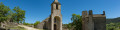
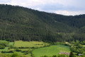
Between Causse Sauveterre and the Lot Valley, set off to explore a hidden valley steeped in history.

Set off on this circular route near La Canourgue, Lozère. Generally considered a moderate walk, it takes an average of 4½ hours to complete. This route is ideal for running and walking; you’re unlikely to come across many people on the trails. It’s accessible all year round and well worth the experience in any season. Dogs are welcome but must be kept on a lead.

Details

n°41548242
Creation:
Last update:
–
Last review:
  • Walking
    Activity: Walking
  • ↔
    Distance: 4.89 mi
  • ◔
    Average duration: 3h 10 
  • ▲
    Difficulty: Moderate

  • ⚐
    Back to start: Yes
  • ↗
    Ascent: + 1,010 ft
  • ↘
    Descent: - 997 ft

  • ▲
    Highest point: 2,762 ft
  • ▼
    Lowest point: 2,034 ft

Description of the walk

Park in the Auberge car park, near the roundabout.

(S/E) Follow the road to the right to reach the hamlet of Le Paven.

(1) When you see the fountain on your left, carry on straight ahead, then take the dirt track on your left. Carry on straight ahead, climbing the track that runs alongside a chicken coop and fields, until you reach a woodland halfway up the Causse.

(2) Turn left again to reach the Causse.

(3) Once on the Causse, take a path marked in yellow on your left, which leads back down into the forest. Follow the path downwards and keep to your left. Cross a small wooden bridge amidst the vegetation, and continue along the path until you cross the Chardonnet to reach the hamlet of Marijoulet.

(4) When you reach the road to Marijoulet, turn right, then left to head up into the hamlet of Marijoulet. Continue uphill, keeping to the left at all times, until you reach Malbosc Farm.

(5) Walk past the farm, keeping to your left, and stay there by taking another wide track on your left. Continue along the2nd Causse, this time in the opposite direction to the first, to reach Auxillac. You’ll come out onto a road.

(6) Once on the road, turn left to head back down until you reach a dirt track on your right.

(7) This track takes you to Rue de Fraternité and into Auxillac.

(8) Once you’ve passed the church, turn right towards the old town hall. Walk down Rue du Lavoir to reach the roundabout by the war memorial and the car park (S/E).

Waypoints

  1. S/E : mi 0 - alt. 2,034 ft - Car park at the Auberge du Moulin
  2. 1 : mi 0.15 - alt. 2,060 ft - The hamlet of Le Paven
  3. 2 : mi 0.74 - alt. 2,500 ft - Forest
  4. 3 : mi 1.1 - alt. 2,762 ft - 1st Causse
  5. 4 : mi 2.5 - alt. 2,198 ft - The hamlet of Marijoulet
  6. 5 : mi 2.86 - alt. 2,421 ft - The Malbosc farm
  7. 6 : mi 3.59 - alt. 2,379 ft - The return route
  8. 7 : mi 4.23 - alt. 2,283 ft - Junction on the path
  9. 8 : mi 4.78 - alt. 2,064 ft - The hamlet of Auxillac
  10. S/E : mi 4.89 - alt. 2,034 ft - Car park at the Auberge du Moulin

Notes

Hiking boots are recommended.
Bring water – it can get hot on the Causse and the climbs can be quite strenuous.
The water from the hamlet’s fountain is safe to drink.

Worth a visit

The Auberge du Parking, with its playground, is none other than the birthplace of Céleste Albaret, who was Marcel Proust’s housekeeper.
Today, the Auberge is a microbrewery, tapas bar and games bar. More information at https://www.ortan.fr
Le Paven is the hamlet where Céleste Albaret lived for a few years.
There are many sheep farms in the surrounding area, so it is not uncommon to see them grazing in the summer. The milk is mainly used by the Rocquefort cheese dairy.

Reviews and comments

5 / 5
Based on 1 review

Reliability of the description
5 / 5
Ease of following the route
5 / 5
Route interest
5 / 5
gervaise rodriguez
gervaise rodriguez

Overall rating : 5 / 5

Date of your route : Mar 02, 2026
Reliability of the description : ★★★★★ Very good
Ease of following the route : ★★★★★ Very good
Route interest : ★★★★★ Very good
Very busy route : Yes

Very beautiful route, a bit steep at the start but very pleasant and with beautiful views of the hills.

Machine-translated

Other walks in the area

For more walks, use our search engine .

The GPS track and description are the property of this route's author. Please do not copy them without permission.