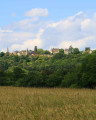
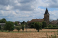
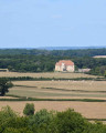
The botanical orchard as seen from Brinon-sur-Beuvron

Explore the diverse landscapes of the Beuvron region on this multifaceted walk. Starting from Brinon-sur-Beuvron, you’ll pass through several charming villages such as Neuilly and Champallement. The Olcy washhouse offers a refreshing break during your walk.

Details

103511513
Creation:
Last update:
Last review:
  • Walking
    Activity: Walking
  • ↔
    Distance: 9.41 mi
  • ◔
    Average duration: 4h 55 
  • ▲
    Difficulty: Moderate

  • ⚐
    Back to start: Yes
  • ↗
    Ascent: + 633 ft
  • ↘
    Descent: - 630 ft

  • ▲
    Highest point: 1,027 ft
  • ▼
    Lowest point: 673 ft

Description of the walk

Starting point: Place Jean-Baptiste Durbise (GPS - 47°16'49.8"N 3°29'31.5"E)

(S/E) Starting from Place Jean-Baptiste Durbise, with the town hall opposite, turn right and then left onto the D34 towards Clamecy. After the last houses, turn right onto the D214 and follow it for about a hundred metres.

(1) Take the path known as the Montroin Trail on the right, which climbs into the woods at the electricity box. At the top of the hill, follow the ridge path straight ahead. When it begins to descend, pass the Montroin orchards on your right and continue straight ahead.

(2) Once you reach the valley, take the path on the right across the fields. After 750 metres, at the fork, take the path on the left, then at the crossroads turn right onto the straight path. Continue straight on until you reach the road, then follow it to the right until you reach the D34.

(3) Cross it and carry on straight ahead along the track that runs alongside the D34. At the fork, carry on straight ahead. When you reach the tarmac road, turn left towards Neuilly, then right before the bridge. The road turns into a grassy track which you’ll follow to the village of Champallement.

(4) At the D146, carry on straight ahead until you reach the crossroads in the village, then take thesecond road on the right (the D140) towards Champlin. Turn right at the first road and continue along this road until you reach Thory.

(5) In the hamlet, turn right at the crossroads. The road continues along a track that enters the woods, runs alongside them and then descends back into the valley.

(6) Cross the stream and turn right at the junction. At the next junction, turn left onto the track that runs alongside the D34 as far as Olcy.

(7) In the hamlet, carry on straight ahead, passing the wash house on your left, then take the grassy path opposite which runs alongside the D34. Follow this path to Brinon-sur-Beuvron. At the junction with the D5, follow it to the right, then turn left onto the D23 to return to Place Jean-Baptiste Durbise (S/E).

Waypoints

  1. S/E : mi 0 - alt. 676 ft - Place Jean-Baptiste Durbise - Beuvron (rivière) - Affluent de l'Yonne
  2. 1 : mi 0.35 - alt. 719 ft - Montroin Trail
  3. 2 : mi 1.73 - alt. 820 ft - Montroin Orchard. Crossroads
  4. 3 : mi 3.64 - alt. 748 ft - Neuilly. D34 - Beuvron (rivière) - Affluent de l'Yonne
  5. 4 : mi 4.86 - alt. 1,010 ft - Champallement. D146
  6. 5 : mi 6.21 - alt. 889 ft - Thory
  7. 6 : mi 7.26 - alt. 755 ft - Stream
  8. 7 : mi 8.3 - alt. 696 ft - Olcy
  9. S/E : mi 9.41 - alt. 676 ft - Place Jean-Baptiste Durbise - Beuvron (rivière) - Affluent de l'Yonne

Notes

Brinon-sur-Beuvron: shops and toilets.

Worth a visit

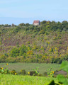
Montroin Orchard: It covers an area of 4 hectares, which lay fallow when the project began in 1999. There are around 400 fruit trees of all varieties (apples, pears, cherries, apricots, peaches, plums, quinces) as well as numerous deciduous trees. This site helps to preserve heritage fruit varieties. The ‘Le Greffon’ association provides invaluable support for the upkeep of the site. Pruning workshops are organised there.

Champallement: the Champallement family is famous in Burgundy for having provided three bishops to Nevers and Auxerre in the11th century. The village is also home to their former fortified castle, which dominates the landscape. The view from the hill offers a beautiful panorama of the valley. The church features a12th-century Romanesque nave and a16th-century Flamboyant Gothic chancel, which was extensively remodelled inthe 19th century.

Neuilly Church: the present choir has retained its original Romanesque form despite successive restorations. The nave, however, dates from the late15th century, and the bell-tower porch was rebuilt in the19th century. The tympanum features a sculpture dating from 1878, depicting the death of Saint Martin and his reunion with the Archangel Gabriel and Jesus.

Olcy washhouse: this is an implivium-style washhouse. A legacy of Roman times, its inverted roof, open at the centre, allows the
basin with rainwater. This opening also provides ventilation and light for the washhouse. It was fully restored in 2018.

Other walks in the area

For more walks, use our search engine .

The GPS track and description are the property of this route's author. Please do not copy them without permission.