The Gallo-Roman site at Compierre

Follow in the footsteps of our Gallo-Roman ancestors, discover a lovely Cluniac site and stroll through the charming villages of the Beuvron. This route will take you to the Church of Saint-Révérien, a Cluniac site, the Gallo-Roman settlement of Compierre and a number of charming villages.

Details

103475891
Creation:
Last update:
Last review:
  • Walking
    Activity: Walking
  • ↔
    Distance: 6.19 mi
  • ◔
    Average duration: 3h 15 
  • ▲
    Difficulty: Moderate

  • ⚐
    Back to start: Yes
  • ↗
    Ascent: + 456 ft
  • ↘
    Descent: - 453 ft

  • ▲
    Highest point: 1,125 ft
  • ▼
    Lowest point: 781 ft

Photos

Description of the walk

Starting point: Town Hall car park (GPS – 47°12'41.1"N 3°30'11.7"E)

(S/E) From the Town Hall square, turn right onto the D977 bis and follow it for a few metres. Turn left onto Rue de la Fontaine and continue until you reach the junction. Turn left onto the D34 for 20 metres. Head up Rue du Crot to the right, to the left of the pond. Cross the D977 bis straight ahead with care and take Chemin des Chaumes opposite, which climbs into the woods and joins a road.

(1) Head towards the house on your right and take the path at the corner of it, to the left of a pond. Continue due north through the woods along the old Aedui track. You’ll reach the ruins of the Gallo-Roman settlement of Compierre on your left. Carry on to the D512.

(2) Turn left onto it. At the first junction, take the right-hand road (D512), then at the second, follow the left-hand road (D140). Cross the Ruisseau de la Jarnosse. At the crossroads, take the road on the right which leads up towards the village. Walk straight through the village and continue along the D146 for 100 m.

(3) When you reach the last houses, turn right onto the track, then take the first track on the left which follows the road. Pass the cemetery on your left, then the bridge on your right. At the junction, cross the D34 carefully and, after a few metres, take the first track on the right.

(4) At the junction of the tracks, take the one on the right. Continue until you reach the D34, which you’ll follow for 50 metres.

(5) Turn left onto Rue Jean Rousseau and continue to Flassy. In the village, take the first street on the right. Pass the pond on your right, then at the junction take the road on the right leading out of the village.

(6) At Les Chaumes de Flassy, take the dirt track on the right which leads to Saint-Révérien. Once in the village, carry on until you reach the D34. Turn left onto this road to reach the Place de la Mairie (S/E).

Waypoints

  1. S/E : mi 0 - alt. 1,004 ft - Town Hall car park - Église Saint-Révérien (Saint-Révérien)
  2. 1 : mi 0.83 - alt. 1,089 ft - Aeduan Way
  3. 2 : mi 1.67 - alt. 971 ft - Étang de la Bouille - Site de Compierre
  4. 3 : mi 3.02 - alt. 1,014 ft - Champallement
  5. 4 : mi 3.97 - alt. 840 ft - Neuilly - Beuvron (rivière) - Affluent de l'Yonne
  6. 5 : mi 4.62 - alt. 863 ft - Rue Jean Rousseau
  7. 6 : mi 5.13 - alt. 843 ft - Les Chaumes de Flassy - Beuvron (rivière) - Affluent de l'Yonne
  8. S/E : mi 6.19 - alt. 1,004 ft - Town hall car park - Église Saint-Révérien (Saint-Révérien)

Worth a visit

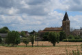
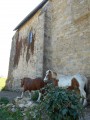
Church of Saint-Révérien: a Cluniac site, this 12th-century Romanesque priory church was built on a grand scale to accommodate pilgrims travelling to Santiago de Compostela. The building is notable for its murals and capitals. Carved by Cluniac monks, they depict themes drawn from the Book of Revelation and other passages of Scripture, rendered with admirable skill.

The Gallo-Roman site at Compierre. Hidden away in a wood dominated by a colossal lime tree, the ruins of an unnamed Gallo-Roman settlement began to be unearthed in the 19th century. The stones bear witness to a town of 1,000 or 2,000 inhabitants that was abandoned in the 4th century. The remains will allow you to imagine this town, described as a ‘large market town’ by Julius Caesar in his *Commentaries on the Gallic War*.

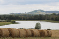
Montenoison Hill and the Bouille Pond: according to legend, Montenoison Hill was fortified by a wall featuring five towers, which
enclosed a temple dedicated to Caesar. In the Middle Ages, a feudal town and a castle belonging to the Counts of Nevers were built, along with a leper colony. The Étang de la Bouille, at its foot, is ideal for fishing and barbecues.

Champallement: the Champallement family is famous in Burgundy for having produced three bishops, in Nevers and Auxerre, during the 10th century.
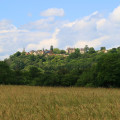
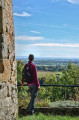
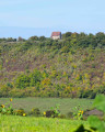
The village is also home to their former fortified castle, which dominates the landscape. The view from the hill offers a beautiful panorama of the valley.

Other walks in the area

For more walks, use our search engine .

The GPS track and description are the property of this route's author. Please do not copy them without permission.