Country:

 City:
City:


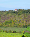
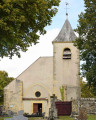
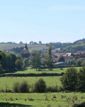
Start at the church in Brinon-sur-Beuvron (GPS – 47°16'50.3"N 3°29'28.4"E)
(S/E) Head north along the D23 towards Taconnay until you reach the edge of the village. At the cross, turn right. Go round the castle on the right and continue along the road for 300 m.
(1) At the bend, take the dirt track on the left which runs alongside the Beuvron valley.
(2) When you reach the D23, turn right and drive through the village of Taconnay.
(3) At the junction with the D180, turn right, then immediately left onto the road running parallel to the D23. Head uphill through the woods for 800 m, then take the ridge path on the right for 1.8 km, ignoring the other tracks.
(4) At the end of the path, head down to the right along the sunken path, then continue along the wide stony track and pass through the village of Grenois, keeping straight ahead.
(5) On leaving the village, head straight ahead, north-east, along the path leading to the Chapelle de la Montagne.
(6) Walk round the building and take the ridge path for 800 m. At the fork, turn left and continue for 300 m.
(7) Take the path on the right and carry on straight ahead, due south, through the forest for about 1 km. Before reaching the statue of the Virgin Mary, turn right to go downhill, then turn right onto the tarmac road and pass the cemetery. When you reach the D135, turn right.
(8) Take the dirt track on the left and continue to the junction. Keep left, then head right until you reach the road. At the junction, turn left, go through Hubans and head up to the right to the chapel.
(9) Retrace your steps. At the first house, take the path on the right until you reach the Fork in the road with the D34.
(10) At the cross, take the path on the right and head straight up through the woods.
(11) On the plateau, at the crossroads, turn left to head down towards Brinon-sur-Beuvron. At the bottom, turn left and return to the original fork in the road.
(1) At the road, turn right and return to the starting point via the same route you took on the way out (S/E).
 Tourist office
 Moderate
 Visorando Member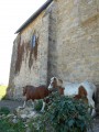
 Easy
Easy