From Grenois to La Roche

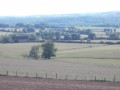
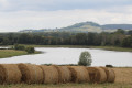
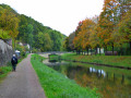
A lovely walk through pleasant woodland in the Haut Nivernais.

Details

201118
Creation:
Last update:
Last review:
  • Walking
    Activity: Walking
  • ↔
    Distance: 6.12 mi
  • ◔
    Average duration: 3h 25 
  • ▲
    Difficulty: Moderate

  • ⚐
    Back to start: Yes
  • ↗
    Ascent: + 663 ft
  • ↘
    Descent: - 666 ft

  • ▲
    Highest point: 1,027 ft
  • ▼
    Lowest point: 610 ft
  • ⚐ Country: France
  • ⚐ City: Grenois (58420)
  • ⚑
    Start/End: N 47.320831° / E 3.527279°
  • ❏
    IGN map(s): Ref. 2622SB, 2623SB
  • Hour-by-hour weather

Description of the walk

Starting and finishing point: Church car park in Grenois.

(S/E) Set off (eastwards) towards Beuvron. At the crossroads, turn left. Immediately after the ‘Grenois’ exit sign, turn left onto the path between two fields.

(1) At the fork in the road, after 100m, turn right (north) and follow the path along the edge of the woodland. At a fork in the road, turn left (north-west) and stay along the edge of the woodland. About 500m further on, enter the woodland as the path climbs. Continue north-west, ignoring all side paths on the left.

(2) Turn sharply left onto the “chemin blanc”, a wide, stony track. For about 1 km, stay on this main track (the only wide, motorable one), ignoring the side tracks.

(3) When you reach a large roundabout, take the first track on the right towards La Roche. Follow this track downhill for about 1.5 km. The gradient becomes steeper as you approach the village.

(4) In La Roche, turn left towards the wash house and continue south-west. Join the D23 road, follow it to the left for about 250 metres, then continue until you reach the D23, which you follow to the left.

(5) At the Mazot farm, take the path on the left that climbs into the Bois du Grand Griffé. Follow this path straight on (south-east) for 2.5 km, ignoring the smaller paths branching off to the sides.

(6) At a junction with a path coming from the right, turn left and begin the descent. At the next junction, continue straight ahead (east-southeast) downhill. The path widens as you approach Grenois. At the entrance to the village, it gives way to a narrow street (Rue de Franchy), which you follow back to the starting point (S/E).

Waypoints

  1. S/E : mi 0 - alt. 787 ft - Car park by the church in Grenois
  2. 1 : mi 0.35 - alt. 860 ft - Fouche
  3. 2 : mi 1.72 - alt. 968 ft - Dirt track
  4. 3 : mi 2.36 - alt. 951 ft - Crossroads
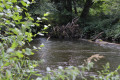
  5. 4 : mi 3.15 - alt. 610 ft - La Roche - Beuvron (rivière) - Affluent de l'Yonne
  6. 5 : mi 3.9 - alt. 630 ft - Le Mazot
  7. 6 : mi 5.42 - alt. 1,004 ft - Junction
  8. S/E : mi 6.12 - alt. 787 ft - Car park by the church in Grenois

Notes

No special equipment required.
Shelter available at La Roche.

Worth a visit

Places to visit in Grenois:
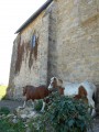
- The wash house in a former chapel in the centre of the village, next to the statue of the washerwoman.
- The Chapelle de la Montagne near the Grenois cemetery, about 1,700 metres from the village centre.

Reviews and comments

3.9 / 5
Based on 4 reviews

Reliability of the description
4.3 / 5
Ease of following the route
3.5 / 5
Route interest
3.8 / 5
Calopterix
Calopterix

Overall rating : 2 / 5

Date of your route : May 15, 2025
Reliability of the description : Not used / Not applicable
Ease of following the route : ★★☆☆☆ Disappointing
Route interest : ★★☆☆☆ Disappointing
Very busy route : No

We walked the route in the opposite direction, and the GPS proved very useful.
The first straight section was passable, but you need to be careful not to stray onto better-maintained paths.
The path between the Mazot farm and La Roche was blocked by a gate, so we turned back and took the road to La Roche. However, the path from La Roche soon turned out to be poorly marked; luckily we had the GPS and walked alongside the ‘path’ in the less overgrown sections. There were no issues with the white path after that, but we preferred to head to Grenois via the road rather than the path, as the section between stages 2 and 1 seemed rather overgrown to us.
The route is therefore no longer passable on the whole. A shame.

Machine-translated

barbin
barbin

Overall rating : 4.3 / 5

Date of your route : Jun 01, 2020
Reliability of the description : ★★★★☆ Good
Ease of following the route : ★★★★☆ Good
Route interest : ★★★★★ Very good
Very busy route : No

We had a bit of trouble finding the path at the start of the walk. Then there were some difficulties after the Mazot farm, past the hunting lodge. Otherwise, a lovely walk.

Machine-translated

bernardc
bernardc

Yes; I realised this summer, when I wanted to do that walk again, that the start of the path was virtually impassable. I actually mentioned it to the Mayor of Grenois … but to no great avail: what a shame!!

Machine-translated

vangal
vangal

Overall rating : 5 / 5

Date of your route : Oct 22, 2016
Reliability of the description : ★★★★★ Very good
Ease of following the route : ★★★★★ Very good
Route interest : ★★★★★ Very good

A lovely walk through the woods; it was a bit tricky at the start as the path had become somewhat overgrown, but thanks to the map and the GPS, we managed just fine.

Machine-translated

Other walks in the area

For more walks, use our search engine .

The GPS track and description are the property of this route's author. Please do not copy them without permission.