The Cumba Valley in Levens

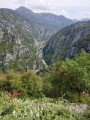
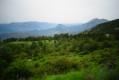
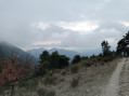
A return walk along this little-known, centuries-old path, which is particularly interesting for its diversity. The trail begins in woodland alongside the stream, then winds its way through the rock. You’ll follow the Vésubie canal for a few metres before reaching a series of winding hairpin bends overlooking the Vésubie. Following Storm Alex, the path ends at the Vésubie.

Details

7888040
Creation:
Last update:
Last review:
  • Walking
    Activity: Walking
  • ↔
    Distance: 2.83 mi
  • ◔
    Average duration: 2h 50 
  • ▲
    Difficulty: Moderate

  • ⚐
    Back to start: Yes
  • ↗
    Ascent: + 1,785 ft
  • ↘
    Descent: - 1,791 ft

  • ▲
    Highest point: 1,598 ft
  • ▼
    Lowest point: 482 ft

Photos

Description of the walk

Free car park on Chemin de la Cumba, 100 m past the fire station.
Park near the sewage treatment plant next to the olive oil cooperative.

(S/E) Head towards the nearby sewage treatment plant. Walk past the left-hand side of the plant and you’ll reach an embankment of earth and stones. The path starts on the left, below the embankment.

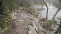
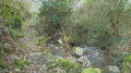
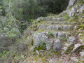
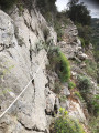
(1) Follow this wooded path as it descends, crossing from one side of the Cumba to the other. As you emerge from the wooded area, the site offers views of rocky outcrops. The edges of this centuries-old path are carved into the rock. Do not look around whilst walking; stop to take in the views. You will reach the cairn marking the end of the path on the parapet.

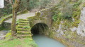
(2) Take the steps on the left to descend from the bridge and continue in line with the steps. Follow the canal to the next bridge.

(3) Shortly after the bridge, turn right onto the descending path. If you’re curious, you can follow the bank as it curves to see, 100 metres further on, where the canal enters the rock. Turn back.

(3) Begin the descent and continue the walk to the end of the path at the remains of the bridge over the Vésubie.

(4) Return along the same route to reach the Chemin de la Cumba car park (S/E).

Waypoints

  1. S/E : mi 0 - alt. 1,598 ft - Chemin de la Cumba.
  2. 1 : mi 0.09 - alt. 1,575 ft - Start of the trail.
  3. 2 : mi 0.78 - alt. 915 ft - Bridge over the canal and cairn. - Canal de la Vésubie
  4. 3 : mi 0.88 - alt. 869 ft - Start of the downhill path.
  5. 4 : mi 1.4 - alt. 482 ft - The trail ends at Vésubie.
  6. S/E : mi 2.83 - alt. 1,598 ft - Chemin de la Cumba. - Vésubie (rivière)

Notes

This walk should be undertaken by at least two people, as mobile phone reception is not always available in the valley.
There are no water sources along the route.

The word “Cumba” is sometimes spelled “Coumba” or even “Goumba”.

Worth a visit

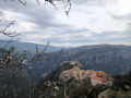
Visit the village of Levens.

Reviews and comments

4.3 / 5
Based on 3 reviews

Reliability of the description
4.3 / 5
Ease of following the route
4.3 / 5
Route interest
4.3 / 5
bernard bb
bernard bb

Thank you, MR06, for this information
Best wishes, B.

Machine-translated

MR06
MR06

Overall rating : 4.3 / 5

Date of your route : Jan 30, 2024
Reliability of the description : ★★★★☆ Good
Ease of following the route : ★★★★☆ Good
Route interest : ★★★★★ Very good
Very busy route : Yes

A trail that’s rarely used but not particularly difficult, running between Levens and Plan du Var. The upper section – i.e. just after Levens – is now ‘marked’ with small pieces of plastic tied to the branches. You just need to keep an eye out.

The lower section – that is, once you reach the Vésubie – is a bit chaotic (Storm Alex cleared the path), but there are clear tracks allowing you to pass safely.

One possible alternative is, once you reach the Vésubie Canal, to follow it. Whenever the canal passes through a tunnel, a path allows you to bypass it. However, some sections are carved into the cliff face and there is a handrail: it is possible to secure yourself as you would on a via ferrata if necessary for those prone to vertigo. You then rejoin the path leading from Mont Arpasse to Plan du Var. From there, you can return to the starting point via Mont Arpasse.

It is also possible to continue along the Vésubie Canal as far as La Roquette-sur-Var. Here too, the path veers away from the canal at each tunnel. Here too, sections that are somewhat vertiginous have been made safer with handrails. Whether to tackle this route depends on your fear of heights and your mountaineering experience… this is no longer a lowland path.

Machine-translated

bernard bb
bernard bb

Thank you, PAACAAL, for your review and this information
Best regards, Rando B.

Machine-translated

PAACAAL
PAACAAL

Overall rating : 5 / 5

Date of your route : Apr 10, 2022
Reliability of the description : ★★★★★ Very good
Ease of following the route : ★★★★★ Very good
Route interest : ★★★★★ Very good
Very busy route : No

Done in lovely, mild weather.
It’s a really, really lovely walk and not very strenuous. You do need a bit of faith at the very start, as it’s overgrown and the path isn’t very clear for the first few tens of metres. On the way back, we actually came across two young lads who were heading down to have a ‘trim’. They knew the trail’s worth and told us they did this regularly. We were the first walkers they’d ever come across… Thanks, lads.
Once you’re right down at La Vésubie, you can carry on to the Durandy Bridge.
On the beach downstream, look out for the two small, perfectly cubic piers of an old footbridge. On the left-hand side, a rope has been fixed to help you climb (+4m) up the old, ruined pier facing its twin on the opposite bank.
Continue with caution and use a new, carefully knotted and bolted rope to help you cross – still with great care – a long stretch that was badly damaged by Storm Alex. From there, the disused path presents no further obstacles all the way to the bridge and, eventually, to nearby Plan du Var, which could serve as a starting point.

Machine-translated

bernard bb
bernard bb

Thanks, Kris, for this very interesting and constructive feedback
Best wishes, Rando B.

Machine-translated

krisdenice06
krisdenice06

Overall rating : 3.7 / 5

Date of your route : Jan 16, 2022
Reliability of the description : ★★★★☆ Good
Ease of following the route : ★★★★☆ Good
Route interest : ★★★☆☆ Average
Very busy route : No

I don’t understand the previous review left for this walk
We didn’t encounter any problems at all.
We even followed the canal all the way to the Vallon de l’Arpasse (near Plan-du-Var) via a path that winds round the rock faces where the canal flows through
I think Priscfil must not have taken the right path from the start to have found this walk impassable and dangerous
Right from the start, you need to head to the left of the valley and follow a path that crosses the stream three times to reach the very passable path that descends to the canal

Machine-translated

bernard bb
bernard bb

Hello Priscfil,

I don’t see where this walk is impassable or dangerous…
our forebears, who created this path to reach the Vésubie from Levens, were not so reckless as to create an ‘impassable and dangerous’ path. I’m happy to go with you to check it out on the ground....

Have you taken the right path?
Best regards, Rando B.

Machine-translated

bernard bb
bernard bb

Hello Priscfil

Thank you very much for your feedback, which we’d love to hear more about

Could you please elaborate on your comment that the “hike is impracticable and dangerous”?

- Is it the return journey that was disappointing but advisable following Storm Alex?
- Is it the wooded area that is impassable?
- Is it the ancient path or the banks of the Vésubie Canal that are dangerous?

I respect your opinion; whilst it’s certainly nothing extraordinary, this walk does have the merit of existing…… it’s August…… the wooded area is pleasant in this heat…… we’re close to Nice…… it’s a quiet area – “Not to be done”, you say??

Priscfil, I’m happy to go and check the area out to understand what you mean.

Thank you for your reply. Best wishes, Rando B.

Machine-translated

Other walks in the area

For more walks, use our search engine .

The GPS track and description are the property of this route's author. Please do not copy them without permission.