Levens – Plan du Var – Mont-Arpasse circular loop

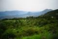
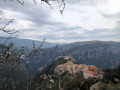
A lovely little walk. Despite its proximity to built-up areas, this route is extremely wild. Superb scenery. Wildlife is abundant: red kites and wild boar were spotted this May.

Details

n°51894358
Creation:
Last update:
Last review:
  • Walking
    Activity: Walking
  • ↔
    Distance: 6.10 mi
  • ◔
    Average duration: 4h 35 
  • ▲
    Difficulty: Moderate

  • ⚐
    Back to start: Yes
  • ↗
    Ascent: + 2,077 ft
  • ↘
    Descent: - 2,080 ft

  • ▲
    Highest point: 2,270 ft
  • ▼
    Lowest point: 466 ft

Description of the walk

Park in the car park on the right, on Chemin de la Cumba, just after the Fire and Rescue Centre.

(S/E) Head towards the sewage treatment works. The path is difficult to find because of a new building under construction next to it.

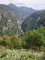
(1) I recommend turning left through the woods to get round this building and then quickly heading down into the valley to easily find the path by the stream. Continue down a good path, with a panoramic view of a splendid valley! You’ll arrive at the Canal de la Vésubie.

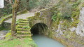
(2) Follow the stream as closely as possible for a few hundred metres.

(3) Leave the canal via the path that descends to the right towards the Vésubie. Walk alongside the river, following the path and then the track to Plan du Var, which you’ll reach at the departmental road. Turn left to enter the village and walk past the town hall.

(4) Just before the Cassini restaurant, take the narrow staircase on the left which leads uphill and follow the signs for “Mont Arpasse”, marked in yellow. Cross the Canal de la Vésubie and continue the steep, steady climb through a series of hairpin bends. You will reach the junction marked by signpost 296.

(5) Turn right, following the sign for “Mont Arpasse”, and reach the summit.

(6) Take the time to walk around the summit to admire the sea on one side and the Mercantour and the Estéron on the other. Then begin the descent towards Levens along a wide track. Further on, ignore a path branching off to the left towards the Ravin de l’Arpasse and continue along the track, which winds down a few bends before reaching a junction at marker 294 and an aerial.

(7) Follow the track to the right until you reach a road (Chemin de la Mole) in a housing estate. Continue in the same direction for about 150 metres.

(8) Turn left onto the path leading downhill past the last villa in the housing estate. Cut across the road to rejoin the path opposite, which serves as a shortcut. Back on the road, turn right to reach the Fire and Rescue Centre.

(9) Turn left to quickly reach the car park (S/E).

Waypoints

  1. S/E : mi 0 - alt. 1,608 ft - Car park
  2. 1 : mi 0.15 - alt. 1,558 ft - Start at the Coumba descent
  3. 2 : mi 0.69 - alt. 922 ft - Canal de la Vésubie
  4. 3 : mi 1.06 - alt. 843 ft - Descend to the right
  5. 4 : mi 1.93 - alt. 466 ft - Plan du Var
  6. 5 : mi 3 - alt. 1,549 ft - Signpost 296, on the right
  7. 6 : mi 3.86 - alt. 2,270 ft - Mont Arpasse - Mont Arpasse
  8. 7 : mi 4.86 - alt. 1,795 ft - Marker 294, aerial, on the right
  9. 8 : mi 5.76 - alt. 1,841 ft - Chemin de la Mole
  10. 9 : mi 6 - alt. 1,627 ft - Fire and Rescue Centre
  11. S/E : mi 6.1 - alt. 1,604 ft - Car park

Notes

You can do the circular route in the opposite direction or start from Plan du Var.

I recommend doing it in the cool of the morning during the summer or in the evening. In the morning, the light is particularly pleasant and the climb is in the shade.

It takes a good two hours to complete the circular route as a brisk walk, or longer if you take breaks and adopt a slower pace.

Reviews and comments

4 / 5
Based on 2 reviews

Reliability of the description
4 / 5
Ease of following the route
3.5 / 5
Route interest
4.5 / 5
LaurentS06
LaurentS06
• Edited:

Overall rating : 4 / 5

Date of your route : May 26, 2025
Reliability of the description : ★★★★☆ Good
Ease of following the route : ★★★☆☆ Average
Route interest : ★★★★★ Very good
Very busy route : No

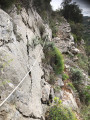
It really is a splendid view of the Vésubie. However, getting there was a bit of a struggle as we couldn’t find a path at point (1). We went round the back of the new building and had to slide down a number of terraces on our bottoms, whilst battling through the brambles… it took us 50 minutes to get out, but what a view! It’s a shame that nothing is properly maintained further up. The path leading down to the Vésubie presents no difficulty. A very pretty spot along the canal. In the end, a rope positioned just right allowed us to descend 2–3 metres without any trouble. Worth noting: a very calm Patou at the top of Mont Arpasse. At point (7), we opted for the path (shown in pink dotted line on the map), paved with stone, which leads back down to the starting point.

Machine-translated

1950bba
1950bba

Overall rating : 4 / 5

Date of your route : Apr 27, 2025
Reliability of the description : ★★★★☆ Good
Ease of following the route : ★★★★☆ Good
Route interest : ★★★★☆ Good
Very busy route : No

A lovely walk, starting from Plan-du-Var, though unfortunately with intermittent rain.
The path is difficult to follow at the start of the descent from Levens: don’t hesitate to cross the stream several times, or even walk along its bed.
On reaching the Vésubie Canal (point 2), the path ends with a steep, paved slope (on which it is very difficult to keep your balance in wet weather) and then abruptly with a drop of a good metre.
Generally speaking, this route should be avoided when the rock is wet (the precautions required for the descent make it a difficult climb).
Note that at point 2, there is a ‘no entry’ sign on the canal bank (but you can quite quickly leave this and take a path that runs alongside the canal further down).

Machine-translated

Other walks in the area

For more walks, use our search engine .

The GPS track and description are the property of this route's author. Please do not copy them without permission.