From Serraval to Le Bouchet-Mont-Charvin via the Bois d’Attrape-qui-peut

An autumn route along lovely forest paths, taking in the villages of Serraval and Le Bouchet-Mont-Charvin.

Details

28462998
Creation:
Last update:
Last review:
  • Walking
    Activity: Walking
  • ↔
    Distance: 6.03 mi
  • ◔
    Average duration: 4h 50 
  • ▲
    Difficulty: Moderate

  • ⚐
    Back to start: Yes
  • ↗
    Ascent: + 2,359 ft
  • ↘
    Descent: - 2,336 ft

  • ▲
    Highest point: 4,311 ft
  • ▼
    Lowest point: 2,493 ft

Photos

Description of the walk

Coming from Thônes, park in the car park on the left at the entrance to the village.

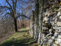
(S/E) From the car park, go up the steps leading to the hiking signpost. The path sets off to the left, running alongside two buildings, enters the woods, then crosses a makeshift footbridge with a gate. You will then come out onto a track; take it to the left for 20 metres to reach the start of a path on the right.

(1) This well-maintained path runs alongside the stream on the right and ends at the Route de la Combe.

(2) Take this road to the right as far as the hamlet of La Combe, pass a small chapel and, at the end of the road, look out for the signpost at the entrance to the forest.

(3) At the junction of two paths, take the one on the left which climbs steeply towards Attrape-qui-peut. Please note: after about 100 metres, leave this path on the left and take a narrow track (the signpost is lying on the ground).
This narrow track heads towards the stream before veering sharply to the right. The track joins a wider path. Continue straight ahead at first, then follow the switchbacks to reach a track at a place called Attrape-qui-peut Ouest.

(4) Leave this track immediately via a path climbing to the left, reach the highest point, then descend to a crossroads.

(5) Ignore the path on the left heading towards the Col de la Botte and Sulens; take the path on the right down towards Le Bouchet.

(6) Leave this path to the left at a sign for the Cernix Circular Path. The path winds through the forest towards Cernix.

(7) As you come within sight of the first house, the path turns at a right angle westwards at the ‘Attrape-qui-peut’ route sign. It then runs along the mountainside, climbing gently, to reach L’Arbelot.

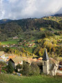
(8) Reach the village of Le Bouchet-Mont-Charvin.

(9) Return to the Arbelot.

(8) Take the path opposite (leaving the path you took on the way there on your right and another path on your left), which climbs slightly at first, then descends towards Serraval. You’ll reach the Route de Bois Berger.

(10) Take the path on the right. There is still a climb of about 50 m before beginning the descent towards La Combe.

(3) At La Combe, follow the reverse route of the outward journey to return to Serraval (S/E).

Waypoints

  1. S/E : mi 0 - alt. 2,493 ft - Car park at the entrance to Serraval
  2. 1 : mi 0.19 - alt. 2,638 ft - Start of the signposted path at La Combe
  3. 2 : mi 0.41 - alt. 2,894 ft - Route de la Combe
  4. 3 : mi 0.58 - alt. 3,005 ft - Signpost pointing towards La Combe
  5. 4 : mi 1.4 - alt. 3,753 ft - West ‘Catch-and-Run’
  6. 5 : mi 1.98 - alt. 4,183 ft - Crossroads
  7. 6 : mi 2.22 - alt. 4,104 ft - Sign for the Cernix circular loop
  8. 7 : mi 2.64 - alt. 3,471 ft - Sign for the ‘Attrape-qui-peut’ route
  9. 8 : mi 3.28 - alt. 3,327 ft - Arbelot – Access to Le Bouchet
  10. 9 : mi 3.66 - alt. 3,045 ft - Le Bouchet
  11. 10 : mi 4.78 - alt. 3,133 ft - Route du Bois Berger
  12. S/E : mi 6.03 - alt. 2,497 ft - Car park at the entrance to Serraval

Notes

Yellow-green marked route.

After point (3), the path is narrow and steep; take care if there is snow.

Between points (7) and (8), tree trunks block the path but this does not present any difficulties.

Worth a visit

In Serraval, there is a small grocery shop and a small museum dedicated to apples and Biscantin.

At Le Bouchet, food is available; please enquire.

Reviews and comments

4.6 / 5
Based on 3 reviews

Reliability of the description
5 / 5
Ease of following the route
4.3 / 5
Route interest
4.3 / 5
Didji 74
Didji 74

Overall rating : 4.3 / 5

Date of your route : Mar 09, 2026
Reliability of the description : ★★★★★ Very good
Ease of following the route : ★★★☆☆ Average
Route interest : ★★★★★ Very good
Very busy route : No

Once you've passed the pass on the blocked side, there isn't really much road for a short while, and you tend to get lost. An interview is suggested.

Machine-translated

ChristineBis
ChristineBis

Overall rating : 4.7 / 5

Date of your route : Nov 10, 2025
Reliability of the description : ★★★★★ Very good
Ease of following the route : ★★★★★ Very good
Route interest : ★★★★☆ Good
Very busy route : No

The Visiorando map is very good for this route, even though we had to do it in reverse because of the hunting season.
We used the map provided and it was very good.

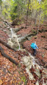
A lovely autumn walk in the forest on a beautiful carpet of fallen leaves (be careful, it can be slippery in places).
Not much of a view, though, and we only met one person!
It's nice to go down to the village of Le Bouchet to see Mont Charvin.

Machine-translated

bouzizi9c
bouzizi9c

Overall rating : 4.7 / 5

Date of your route : Nov 27, 2022
Reliability of the description : ★★★★★ Very good
Ease of following the route : ★★★★★ Very good
Route interest : ★★★★☆ Good
Very busy route : No

The route is mostly through woodland, so it’s best done in autumn or late winter, or in summer when it’s cooler.
To have a go, head down to Le Bouchet

Machine-translated

Other walks in the area

For more walks, use our search engine .

The GPS track and description are the property of this route's author. Please do not copy them without permission.