Country:
 City:
City:


Coming from Allauch, drive through the village of La Fève towards the D908. Pass the canal bridge, then turn left onto the narrow road through the Vallon de la Vache, signposted with a blue sign. Park at the bottom of the valley (designated car park).
(S/E) Go through the barrier on the north-east side, towards the houses, and walk on for about 50 m. Take the small blue-marked path on the right, which climbs steeply into the forest. Pass alongside two high-voltage power lines, then some fire watch posts. Join a DFCI track, which you should follow to the right for about 100 m.
(1) Turn left onto thefirst path that climbs in a straight line. Continue along this path, which crosses the DFCI track (blue markings). Further on, rejoin the DFCI track, walk for about 30 m and turn right onto a new path. Keep to the right to rejoin the DFCI track once more.
(2) Turn right onto the track. Further on, take the path on the right which runs alongside a high-voltage power line (blue markings). Join the track again and, after about 150 m, take the path on the right which leads to a hillock and a cairn. You’ll come to a signpost.
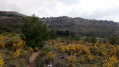
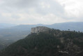
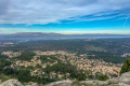
(3) Leave the DFCI track by turning left onto the yellow-marked path, which becomes increasingly steep as you reach the summit of Mont Julien (see the ‘Practical Information’ section). Admire the magnificent 360° panorama.
Head north down the stony descent from Mont Julien, with the Tête du Grand Puech opposite.
(4) Turn right towards the blue and yellow markings for a steep descent. Cross through the undergrowth and arrive at a crossroads of paths with an old, abandoned fire lookout post. Ignore the paths to the left and right and walk past the fire lookout post, heading north. The path climbs steadily (blue markings).
(5) Take the path on the left. The climb becomes steep with rocky sections to negotiate.
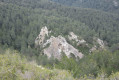
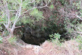
(6) You’ll reach the Grotte des Fées. Explore the cave and note the small figurines placed in the nooks and crannies of the rocks. Walk back a few metres, then continue along the path to the left, passing over the top of the cave (blue markings). You’ll reach a summit and a cairn (elevation 668), then, after a stony descent, arrive at a crossroads of paths.
(7) Keep to the left, heading north-west. After a steep climb, reach a summit (elevation 688): once again, a magnificent 360° panorama. Pass by two old fire lookouts, then keep to the right to join a DFCI track. Turn right onto this track.
(8) Look out for the water tank on the right and the path you’ll take on the way back, then continue along the track. At a Y-junction, keep left.
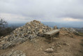
(9) Leave the track and take the path on the left which climbs steeply. Further on, continue along this path which crosses the track. When you reach a lookout point, head towards the pylons to the south. Turn left at the signpost and reach the Tête du Grand Puech, marked by a huge cairn and a bench. Descend south-eastwards and rejoin the DFCI track taken on the way out. Continue to the right.
(8) Pass to the right of underground cistern no. 175 and descend the path which joins the track. Turn right onto the track and pass underground cistern no. 174.
(10) Turn left and keep to the left about fifty metres further on (red markings). Pass by the huge reddish rock at the Aire de la Moure. Join the DFCI track (elevation 443) and follow it to the left.
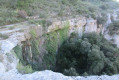
(11) Leave the track and follow the path on the left which passes by two enormous chasms roughly protected by wire fencing. Return to the track and keep to the left at underground cistern no. 248. Pass under two high-voltage power lines and past numerous fire stations and observation posts.
(12) Cut across to the left at the bend in the track. At the bottom, turn left, go through the gate and head for the car park (S/E).

 Visorando Member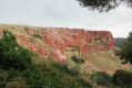

 Difficult