The Tour du Puy from Superdévoluy

This pleasant circular route starting from the Superdévoluy resort is ideal for a family outing. It offers beautiful panoramic views throughout the route. Halfway along, a designated viewing point provides a chance to admire the Gorges des Étroits, the village of Saint-Étienne-en-Dévoluy and the Faraut mountain.

Short, easy and accessible to all-terrain pushchairs, it follows wide paths with no technical difficulties (apart from the optional climb to the summit of Le Puy). The route is also well-suited to those new to mountain biking, thanks to its gentle gradient and smooth terrain. In winter, it also makes for a pleasant snowshoe walk, snow conditions permitting.

Details

50065879
Creation:
Last update:
Last review:
  • Walking
    Activity: Walking
  • ↔
    Distance: 3.54 mi
  • ◔
    Average duration: 2h 05 
  • ▲
    Difficulty: Easy

  • ⚐
    Back to start: Yes
  • ↗
    Ascent: + 571 ft
  • ↘
    Descent: - 548 ft

  • ▲
    Highest point: 5,279 ft
  • ▼
    Lowest point: 4,793 ft

Photos

Description of the walk

To reach the Superdévoluy resort, take the D937 then the D17 (Route des Stations), passing through the village of Saint-Étienne-en-Dévoluy. Park in the sports centre car park, next to the leisure centre.

(S/E) Take the Chemin du Collet du Tat, which passes in front of the hamlet of Le Puy (GRP® alternative route – signposted ‘Saint-Étienne via Les Étroits’). The small road gives way to a track which you follow northwards.

(1) Carry on straight ahead, leaving the track leading to the Collet du Tat on your left.

(2) Carry on straight ahead, heading north, ignoring the track on the right (PR®), until you reach a junction of tracks.

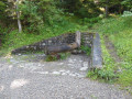
(3) Turn right, heading north-east, to climb to the summit of Le Puy (otherwise carry on straight ahead). The narrow, well-gravelly track winds once before reaching a buried water tower (small structures). This platform offers a fine view of Superdévoluy and the Bure massif.
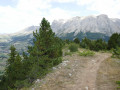
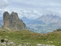
At the end of the viewing platform, take the path that climbs through the forest. Further up, it is best to take the path to the left, which passes through a clearing to reach the summit (a cairn with a wooden post). Enjoy the view of the Pic de Bure massif, the Baumes ridges, and Superdévoluy.

(4) Head back down the same path to the water tower platform, then follow the access track to reach the small pass and the main track.

(3) Turn right, heading north for about 50 m (flat area with a picnic area).

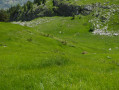
(5) Head down the path on the right, heading north-east, ignoring the track coming from the Crête des Baumes. Follow the “Tour du Puy” through a wide, grassy valley. You’ll reach a junction with a picnic area.

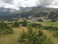
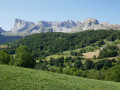
(6) Continue to the right to skirt round the Puy along its slope, heading north-east, then turn east to reach a viewpoint (wooden deck with a railing and a bench). Enjoy the view over the Gorges du Rif, the Étroits, Saint-Étienne-en-Dévoluy, the Col du Noyer and the Dévoluy mountains.

(7) Return to the hillside track, which descends slightly. Take in the views from the eastern slope of Le Puy over the Saint-Étienne-en-Dévoluy valley, Mount Faraut, the Ponsin-Raz de Bec ridges and the Vallon du Rif. The track then climbs again but remains pleasant, until it reaches a flat section and the junction with the Chemin du Collet du Tat.

(2) Turn left to head back towards the resort and the car park (S/E).

Waypoints

  1. S/E : mi 0 - alt. 4,925 ft - Sports centre car park (leisure centre) - Super Devoluy
  2. 1 : mi 0.29 - alt. 4,984 ft - Grand Laus marker post (elevation 1526)
  3. 2 : mi 0.41 - alt. 5,007 ft - Junction with the small pass of the Tat
  4. 3 : mi 0.53 - alt. 5,049 ft - Chemin du Puy junction
  5. 4 : mi 0.94 - alt. 5,279 ft - Le Puy (1609m)
  6. 5 : mi 1.39 - alt. 5,052 ft - Crossroads with a picnic area (signpost)
  7. 6 : mi 1.82 - alt. 4,902 ft - Bois de Boucherac junction (signpost)
  8. 7 : mi 2.07 - alt. 4,833 ft - Puy Viewpoint
  9. S/E : mi 3.54 - alt. 4,925 ft - Sports centre car park (leisure centre) - Super Devoluy

Notes

This PR®-marked circular route is also part of Superdévoluy’s mountain bike route no. 3, as well as a snowshoe trail when there is snow on the ground. The route can be completed in either direction without any particular difficulty.

There are no water sources along the route (no springs, no streams). Make sure you bring enough water, particularly in summer.

Picnic areas are provided near the points (5) and (6).

Public toilets and several places to eat are available in the resort of Superévoluy during the tourist season. The resort also offers a wide range of activities: a sports centre, swimming pool, tennis, mountain biking, tree-top adventure course, via ferrata, horse riding and various seasonal events.

Accommodation, food shops and restaurants are available in Superdévoluy as well as in La Joue du Loup.

Worth a visit

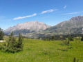
The main attraction of this family walk lies in the many panoramic views it offers. From the summit of Le Puy and the viewpoint, you can admire, in particular:

  • the Pic de Bure massif and its famous summit plateau, home to the former IRAM radio astronomy observatory;
  • the Gorges des Étroits, a narrow natural passage marking the entrance to the Saint-Étienne-en-Dévoluy valley;
  • Mount Faraut and the ridges overlooking the Petit Buëch valley;
  • the Col du Noyer, a historic pass linking the Dévoluy to the Champsaur.

Near the route:

  • the Superdévoluy sports centre;
  • the resorts of Superdévoluy and La Joue du Loup;
  • the church at Saint-Étienne-en-Dévoluy and its rural heritage;
  • the trails leading to the Crêtes de Baumes, offering remarkable views across the entire mountain range;
  • the Mère Église site in Saint-Disdier, one of the most iconic religious buildings in the Dévoluy.

Always be cautious and plan ahead when you're outdoors. Visorando and the author of this route cannot be held responsible for any accidents occurring on this route.

The GR® and PR® markings are the intellectual property of the Fédération Française de Randonnée Pédestre.

Other walks in the area

For more walks, use our search engine .

The GPS track and description are the property of this route's author. Please do not copy them without permission.