The Crête des Baumes and the Combe du Jas

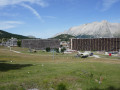
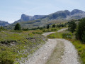
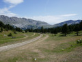
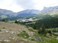
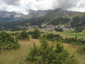
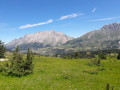
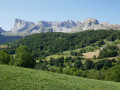
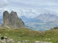
Sometimes you don’t need to climb very high to gain altitude: the Crête des Baumes, which overlooks the resorts of Super-Dévoluy and La Joue du Loup, offers 360° views across the whole of the Dévoluy and its mountainous ramparts. This is a short walk perfect for a rest day, for example, between two longer hikes.

Details

4329833
Creation:
Last update:
Last review:
  • Walking
    Activity: Walking
  • ↔
    Distance: 4.88 mi
  • ◔
    Average duration: 3h 05 
  • ▲
    Difficulty: Moderate

  • ⚐
    Back to start: Yes
  • ↗
    Ascent: + 997 ft
  • ↘
    Descent: - 997 ft

  • ▲
    Highest point: 5,636 ft
  • ▼
    Lowest point: 4,882 ft

Photos

Description of the walk

Drive up to the Super-Dévoluy resort and park in the largest car park at the top and to the west of the resort.

(S/E) Head towards the roundabout at the entrance to this car park and take the road on the left, following the sign for Crête des Baumes 3.0 km (hiking sign).

(1) After about 300 m, take the road on the left which runs alongside a group of chalets, following the signs for Saint-Étienne via Les Étroits. Continue straight on along the road, which turns into a track, until you reach a picnic area.

(2) At the junction where there is a post bearing yellow signposts, head towards Crête des Baumes, which is the main track.

(3) At a hairpin bend, at a place called Boucherac, the track branches off to the left towards La Joue du Loup via the small pass of the Tât. Continue straight on, still following the signs for Crête des Baumes.

(4) 300 metres further on, turn left where the best-maintained track continues, leaving behind a grassy path that runs horizontally opposite and, to the right, a faint path that descends into the woods. After that, simply follow the path – at times earthy, at times root-strewn, at times rocky – which leads right up to the summit plateau. Then, walk along the cliff face to the right, enjoying stunning views of the Joue du Loup, the Col du Festre and the western peaks of the Dévoluy.

The path passes close to two radio masts, then a large cairn, before descending quite steeply towards the small pass of the Collet du Tat, with lovely views of the Super-Dévoluy ski resort.

(5) The Collet du Tat is a vast clearing where you’ll cross the track coming from Super-Dévoluy, which descends gently towards the Joue du Loup.
Take the track heading due south towards the Combe du Jas, and follow this track for about 2 km until you reach the chairlift crossing and the signpost for the Combe du Jas – Altitude 1,686 m.

(6) At this signpost, head towards Super-Dévoluy – 1.5 km. The track first winds downwards, then follows the route of the chairlift before veering off to the right.

(7) Shortly afterwards, turn left onto the path which descends through the clumps of trees and rejoins the track next to the chairlift station.
Go round the largest building on the right.

(8) Once you reach the main road lined with car parks, head up it to the left, skirting the large building, until you reach the roundabout.
From the roundabout, you’ll reach the starting car park (S/E.)

Waypoints

  1. S/E : mi 0 - alt. 4,918 ft - Large car park at the top of the resort - Super Devoluy
  2. 1 : mi 0.24 - alt. 4,928 ft - Towards the Bois de Boucherac
  3. 2 : mi 0.81 - alt. 5,052 ft - Crossroads at the picnic area
  4. 3 : mi 1.06 - alt. 5,131 ft - Straight on at the hairpin bend
  5. 4 : mi 1.27 - alt. 5,180 ft - Turn left at the fork
  6. 5 : mi 2.38 - alt. 5,295 ft - Small pass of Tat
  7. 6 : mi 3.62 - alt. 5,571 ft - Jas chairlift
  8. 7 : mi 4.26 - alt. 5,066 ft - Path on the left
  9. 8 : mi 4.6 - alt. 4,885 ft - Keep left alongside the building
  10. S/E : mi 4.88 - alt. 4,918 ft - Large car park at the top of the resort - Super Devoluy

Notes

Make sure you wear good walking shoes, especially for the descent from the ridge down to the small pass of the Tat, which is quite steep and can be tricky. Walking poles will also be useful.

There are no water sources along the entire route. The terrain is that of a causse, so there are no springs or streams.

Worth a visit

One of the highlights of this walk is the numerous panoramic views – 360° in total – that it offers.
From this viewpoint, you can take stock and identify a large number of possible walks, with much of the route visible right before your eyes.

Reviews and comments

5 / 5
Based on 2 reviews

Reliability of the description
5 / 5
Ease of following the route
5 / 5
Route interest
5 / 5
bural
bural

Overall rating : 5 / 5

Date of your route : Jun 20, 2026
Reliability of the description : ★★★★★ Very good
Ease of following the route : ★★★★★ Very good
Route interest : ★★★★★ Very good
Very busy route : No

A beautiful route, and the scenery leaves us “speechless” – a 360° view of peaks with a rocky texture rarely seen at these altitudes, right within reach.
The intense heat forced us to slow down a bit, but the walk didn’t require us to stick to a different schedule; what better way to make the most of it?

Machine-translated

charpenel
charpenel

Overall rating : 5 / 5

Date of your route : Jul 08, 2025
Reliability of the description : ★★★★★ Very good
Ease of following the route : ★★★★★ Very good
Route interest : ★★★★★ Very good
Very busy route : Yes

we did it the other way around.
the climb up the small pass is tough going, but the view from the ridge is magnificent.
The hike is easy overall.

Machine-translated

Other walks in the area

For more walks, use our search engine .

The GPS track and description are the property of this route's author. Please do not copy them without permission.