


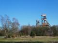
Hikers can enjoy some lovely views both from the top of the spoil heaps (do not underestimate the effort required to climb them, especially the two in the middle of the walk) and from the top of the headframe at the start of the route (please note: there are around 140 steps to climb via an open-tread metal staircase – not recommended for those prone to vertigo).
The lake’s shores are also very pretty and more or less photogenic depending on the time of year and the amount of sunshine.
A few butterflies in season, a few waterbirds in almost all weathers, the occasional trace of wild boar here and there, and birch trees everywhere on this former coal-mining site.
A walk around the Terhills slag heaps


Terhills is, above all, the former site of the Eisden coal mine, with its four slag heaps – three of which are open to the public – its two headframes over the old shafts, and the large management and engineers’ building, which has been magnificently restored and converted into a luxury hotel.
Terhills is also the site of a former gravel quarry. It has now become a vast natural area open to the public, with several signposted walking routes starting from the main entrance to the Haute-Campine National Park, situated next to the hotel.
There is also a holiday village, the Terhills Resort, situated on the north-western shore of the lake, as well as a water sports centre, the Terhills Cablepark, located on the north-eastern shore of the lake.
Details
Creation:
Last update:
–
–
Last review:
–
–
-
 Activity: Walking
 -
 Distance: 7.65 mi
 -
 Average duration: 3h 55
 -
 Difficulty: Moderate
 -
-
 Back to start: Yes
 -
 Ascent: + 472 ft
 -
 Descent: - 469 ft
 -
-
 Highest point: 361 ft
 -
 Lowest point: 118 ft
-
 Country:
Belgium
Country:
Belgium
-
 City:
Dilsen-Stokkem
City:
Dilsen-Stokkem -
 Start/End: N 50.999887° / E 5.705796°
 -


 Hour-by-hour weather
Photos
Description of the walk
Waypoints
- S/E : mi 0 - alt. 131 ft - Maasmechelen Tourist Info car park
- 1 : mi 0.23 - alt. 151 ft - Headframe
- 2 : mi 2.4 - alt. 331 ft - Slag heap – 133 metres
- 3 : mi 2.69 - alt. 351 ft - Slag heap – 126 metres
- 4 : mi 3.59 - alt. 138 ft - A bench for a picnic break
- 5 : mi 4.53 - alt. 164 ft - Old railway line
- 6 : mi 6.54 - alt. 315 ft - Slag heap – 108 metres
- S/E : mi 7.65 - alt. 131 ft - Maasmechelen Tourist Info car park
Notes
There are plenty of benches, particularly at the top of the spoil heaps, as well as a few picnic tables.
Other walks in the area
The sand dunes of the Oudsberg
 Visorando Member
 11.43 mi
+161 ft
-141 ft
5h 25
Moderate
11.43 mi
+161 ft
-141 ft
5h 25
Moderate
 Departure from Opglabbeek (Province de Limbourg)
The Limburg Campine region is home to many gems, including several nature reserves with magnificent sand dunes. This walk crosses the Oudsberg nature reserve on the last authorised paths, offering alternating landscapes of heathland and pine or deciduous forests (beech, birch, etc.). Although the entire route is relatively flat, the nature reserve, at the geographical centre of the route, is quite hilly for the region.Of course, the sand under the snow is only visible in certain places. However, without the snow, the sand is clearly visible in the heart of the Oudsberg nature reserve. Most of the route is wooded, but the landscape is a little more rural at the eastern and northern ends.
Hike without description to be followed with the Visorando app.
Historical and cross-border route from Kanne
 8.64 mi
+860 ft
-866 ft
4h 45
Moderate
Departure from Riemst (Province de Limbourg)
8.64 mi
+860 ft
-866 ft
4h 45
Moderate
Departure from Riemst (Province de Limbourg)
This walk explores some of the region's gems. The route passes successively by a mill on the Geer (Jeker in Dutch) with a wooden paddle wheel that is still fully functional, Neercanne Castle, the Cannerbos, a magnificent tree-lined avenue in the Milleniumbos, a few vineyards, the old Nekum mill (no longer with a wheel), the Maastricht Fort plateau with some beautiful views of the city, Huis de Torentjes, a curious cave/chapel dedicated to Our Lady of Lourdes, the Zonneberg, the Slavantebos, the panoramic site of the former ENCI quarry, the Villa Castrum (admire the tuffeau stone used in its renovation) and, finally, the strange and extremely rare feature of the Geer, which passes under the Albert Canal via a siphon. All in all, this route offers a multitude of historical and educational points of interest for young and old alike.
From the Albert Canal to Montagne Saint-Pierre
8.80 mi
+659 ft
-650 ft
4h 35
Moderate
Departure from Riemst (Province de Limbourg)
A fairly varied walk around the Albert Canal and part of Montagne Saint-Pierre, including a short detour into Dutch territory. The route passes by Neercanne Castle, where the Maastricht Treaty was signed on 9 December 1991.
A challenging visit to Montagne Saint-Pierre
4.84 mi
+348 ft
-364 ft
2h 30
Moderate
Departure from Visé (Province de Liège)
This is on the marked route "Lanaye (I2-4 Blue): Beyond the Banks - Montagne Saint-Pierre", but starting from the Quai de Caster car park instead of the church in Lanaye. Follow the blue diamond markings.
Circular route around Sint Geertruid
 12.54 mi
+512 ft
-512 ft
6h 15
12.54 mi
+512 ft
-512 ft
6h 15
 Difficult
Departure from Belgium
Difficult
Departure from Belgium
The Dutch province of Zuid-Limburg is ideal for hiking, offering an abundance of countryside and forests to explore in a wonderfully bucolic setting, and probably the highest elevation gain in the Netherlands, as the highest point is situated at the BE-DE-NL tripoint south of Vaals.That said, this region bordering Belgian Limburg is also fruit-growing, albeit to a lesser extent, but you can still see a few orchards (cherry, apple and pear trees).And then, from time to time, an old marl quarry (limestone, tuffeau, etc.) appears, or, as is the case near the route of this walk, a prehistoric flint extraction site!
Montagne Saint-Pierre: the essentials!
 4.57 mi
+354 ft
-338 ft
2h 25
4.57 mi
+354 ft
-338 ft
2h 25
 Easy
Departure from Visé (Province de Liège)
Easy
Departure from Visé (Province de Liège)
An unusual walk starting from the small village of Lanaye, traversing the Montagne Saint-Pierre nature reserve from the Albert Canal, before reaching the Geer valley via the Fort d'Eben-Emael. The route also offers stunning views of the Lanaye locks and the Meuse valley across the border.
Route de Lanaye via Montagne Saint-Pierre
 9.45 mi
+512 ft
-522 ft
4h 45
Moderate
Departure from Visé (Province de Liège)
9.45 mi
+512 ft
-522 ft
4h 45
Moderate
Departure from Visé (Province de Liège)
This hike, on the borders of Wallonia, Flanders and the Netherlands, crosses the Montagne Saint-Pierre on either side of the Albert Canal, ending at the Lanaye lock, which allows barges to reach the Meuse in the direction of Maastricht.Before that, the route follows small paths along the Geer. There are several beautiful views of the Meuse valley, the locks and the nearby hills.
Montagne Saint-Pierre from Eben
 6.50 mi
+571 ft
-591 ft
3h 30
Moderate
Departure from Bassenge (Province de Liège)
6.50 mi
+571 ft
-591 ft
3h 30
Moderate
Departure from Bassenge (Province de Liège)
A somewhat challenging hike starting from the Moulin du Broukay and the Tour d’Eben-Ezer in Eben, on the northern slope of the Geer valley, leading to the Montagne Saint-Pierre Nature Reserve, on the other side of the stream. The reserve offers some fine views of the Meuse valley and the Albert Canal.
For more walks, use our search engine .
The GPS track and description are the property of this route's author. Please do not copy them without permission.

