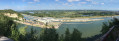
The sand dunes of the Oudsberg

The Limburg Campine region is home to many gems, including several nature reserves with magnificent sand dunes.
This walk crosses the Oudsberg nature reserve on the last authorised paths, offering alternating landscapes of heathland and pine or deciduous forests (beech, birch, etc.).
Although the entire route is relatively flat, the nature reserve, at the geographical centre of the route, is quite hilly for the region.
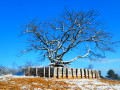
Of course, the sand under the snow is only visible in certain places. However, without the snow, the sand is clearly visible in the heart of the Oudsberg nature reserve.
Most of the route is wooded, but the landscape is a little more rural at the eastern and northern ends.

Hike without description to be followed with the Visorando app.

Details

89973183
Creation:
Last update:
Last review:
  • Walking
    Activity: Walking
  • ↔
    Distance: 11.43 mi
  • ◔
    Average duration: 5h 25 
  • ▲
    Difficulty: Moderate

  • ⚐
    Back to start: Yes
  • ↗
    Ascent: + 161 ft
  • ↘
    Descent: - 141 ft

  • ▲
    Highest point: 299 ft
  • ▼
    Lowest point: 184 ft

Photos

Waypoints

  1. S/E : mi 0 - alt. 276 ft - Sen Tower Park car park
  2. 1 : mi 2.23 - alt. 279 ft - Summit of the Oudsberg
  3. 2 : mi 8.12 - alt. 285 ft - Dunes on the west side
  4. S/E : mi 11.43 - alt. 276 ft - Sen Tower Park car park

Notes

For reasons of conservation, protection and rehabilitation of the natural site, only the main dune at the highest point - on the east side - is still accessible to the public (2025). In 2020, visitors could climb the beautiful dunes in the western part and lose themselves on the countless paths.

The car park at the starting point is very large and free of charge... but it can be full during events at the Sen Tower Park equestrian centre.
Alternative: Opglabbeek cemetery car park (at km 1)

Worth a visit

The benchmark in the region (though quite far away): the Sahara of Lommel

Other walks in the area

For more walks, use our search engine .

The GPS track and description are the property of this route's author. Please do not copy them without permission.