Country:
 City:
City:


Car park: Chemin du Broukay in Eben, 4690 Bassenge.
(S/E) From the car park (or the mill), head back along the road in the opposite direction to the junction.
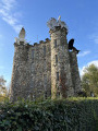
(1) Head up the Haie de Wonck road, taking a sharp left-hand bend towards the Eben-Ezer Tower.
(2) Pass the Eben-Ezer Tower. Ignore the path leading down to the right and keep left at the two forks to arrive in front of a pasture (the gate is usually open).
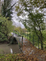
(3) Head diagonally downhill towards the gate at the bottom, which leads onto a concrete path running along the foot of the slope. Take this path to the right. After about a hundred metres, the path turns sharply left and then crosses the stream.
(4) Continue and take the first farm track on the left, between two pastures. Carry straight on at the junction, then turn left at the end to join the Grand-route (N619).
(5) Cross the road (watch out for traffic) to join the farm track opposite and reach the wooded area at the top of the slope.
(6) As soon as you enter the woods, take the forest track on the left. This soon turns right, then runs alongside the woods and a field as it reaches the plateau. Shortly after a second right-hand bend, take the dirt track on the left and cross the plateau towards the upper wooded edge of the Meuse slope.
(7) When you reach the concrete road, turn left and follow it for 800 m until you reach the main road (N671).
(8) Cross it (watch out for traffic), then take the farm track on the right to reach the upper (wooded) edge of the Meuse slope. Follow this for about a hundred metres.
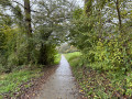
(9) A few metres before the dirt track (on the left), take the path on the right which begins the descent down the slope. The path winds diagonally down the slope, passing through cattle grids, and ends at the foot of the slope. Once at the bottom, take the path on the left and follow it for one kilometre, skirting the bottom of the slope.
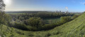
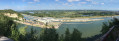
(10) Turn sharply left onto the path climbing diagonally up the slope (halfway up, don’t miss the viewpoint over the canal and the Meuse valley). At the top, a few steps lead up to the cultivated plateau. Continue straight on along the narrow path running alongside the fields. When you reach the dirt track, continue straight on along the farm track. This soon leaves the plateau and begins its descent between two embankments.
(11) At the bottom, you’ll reach a wider track; take the second track on the left, which climbs slightly between two hedges. At the top, take the path on the right. This crosses a grassy area diagonally and then continues its descent through the thickets to reach a gravel road (Rue du Vicinal). Follow this road to the left, down a gentle slope, to reach the bend in the A619 (N619).
(12) Continue straight on along the N619 and, after about fifty metres, cross at the pedestrian crossing to continue along the small lane directly opposite. This lane leads onto Rue du Geer, which you should follow to the end. At the end, turn left into Rue du Village. At the junction, continue straight on into Rue Haie de Wonck and go under the motorway bridge.
(1) Turn left at the fork to reach the car park (S/E).
 Visorando Member

 Easy
Easy