The Commandos M site, starting from Charmont-sous-Barbuise

A walk starting from Charmont-sous-Barbouise that takes you to Longsols and the Commandos M site.

Details

14745724
Creation:
Last update:
Last review:
  • Walking
    Activity: Walking
  • ↔
    Distance: 9.37 mi
  • ◔
    Average duration: 4h 30 
  • ▲
    Difficulty: Moderate

  • ⚐
    Back to start: Yes
  • ↗
    Ascent: + 253 ft
  • ↘
    Descent: - 253 ft

  • ▲
    Highest point: 679 ft
  • ▼
    Lowest point: 413 ft

Photos

Description of the walk

Park in the cemetery car park on Rue du Château in Charmont-sous-Barbuise.

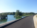
(S/E) Take the footpath through the woodland behind the castle, following the River Barbuise to the small bridge. Cross the river and continue to the left; at the first track, turn right and then reach the edge of the woodland.

(1) Follow the edge of the woodland on the right and carry on straight ahead until you reach the D99. Cross the road carefully, then take Rue du Galmurot opposite and head towards the junction with Rue du Moulin Chaudron.

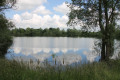
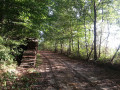
(2) Turn right, then immediately left to take the path through the woodland running alongside a small pond. Continue alongside the Barbuise, go straight on at the junction and join Rue de la Barbuise. Turn right onto it for a few metres, then come to a path junction.

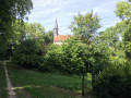
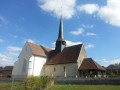
(3) Turn left here. Walk alongside a meadow with a view of Saint-Alban’s Church. You’ll reach another junction not far from the Source de la Barbuise, and take the wide path on the left, which then turns into a footpath.

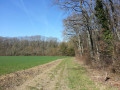
(4) Keep to the left and continue along this path through the fields, heading straight on. You’ll reach a junction by a wood.

(5) Walk alongside it, keeping to the right, to reach the Commandos M site.

(6) Return to the previous crossroads.

(5) Turn right, walk alongside the woodland, and reach the four-way junction at the edge of another woodland.

(7) Take the path on the left and, following an almost straight route, head back to the junction with Rue de la Barbuise that you passed earlier.

(3) Carry on straight ahead along this street, turn left into Rue des Sources and then, shortly afterwards, turn right into Rue des Ouches. You’ll reach a junction just before the railway line; turn right, running parallel to it. Continue in this direction until you reach a level crossing.

(8) Turn right at a 90° angle. At the next junction, turn left into Rue des Champs. Once at the end, turn right onto Rue de la Libération for a few metres to reach the Y-junction at Place Colaverdey.

(9) Turn left onto Rue des Écoles, then turn right onto Voie de Jérusalem (or the D15), finishing with a right-hand bend to reach the cemetery car park (S/E).


Waypoints

  1. S/E : mi 0 - alt. 427 ft - Cemetery car park
  2. 1 : mi 0.48 - alt. 427 ft - Edge of the woods
  3. 2 : mi 1.38 - alt. 440 ft - Moulin Chaudron
  4. 3 : mi 2.03 - alt. 440 ft - Crossroads of the circular loops
  5. 4 : mi 2.92 - alt. 548 ft - Junction, on the left
  6. 5 : mi 4.61 - alt. 600 ft - Edge of the woods
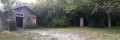
  7. 6 : mi 4.82 - alt. 617 ft - Commandos M site
  8. 7 : mi 5.61 - alt. 679 ft - Edge of the woods
  9. 8 : mi 8.49 - alt. 443 ft - Level crossing
  10. 9 : mi 8.96 - alt. 436 ft - Place Colaverdey
  11. S/E : mi 9.37 - alt. 427 ft - Cemetery car park

Worth a visit

Reviews and comments

4.1 / 5
Based on 4 reviews

Reliability of the description
4.5 / 5
Ease of following the route
4.3 / 5
Route interest
3.5 / 5
jacquito
jacquito

Overall rating : 4.3 / 5

Date of your route : Aug 23, 2026
Reliability of the description : ★★★★★ Very good
Ease of following the route : ★★★★★ Very good
Route interest : ★★★☆☆ Average
Very busy route : No

An easy walk on a lovely, cool, dry and sunny morning. It’s a shame that, during this period of drought, the streams and pools have all but disappeared. The main appeal of an outing like this is to get a good breath of fresh air and, above all, to discover this site of historical significance: the commando hideout. Thank you for sharing this.

Machine-translated

User 10715686

Overall rating : 4 / 5

Date of your route : May 03, 2026
Reliability of the description : ★★★★☆ Good
Ease of following the route : ★★★★☆ Good
Route interest : ★★★★☆ Good
Very busy route : No

A lovely first section along the river. Nice after that.

Machine-translated

spohr
spohr

Overall rating : 4 / 5

Date of your route : Feb 28, 2022
Reliability of the description : ★★★★★ Very good
Ease of following the route : ★★★★☆ Good
Route interest : ★★★☆☆ Average
Very busy route : Yes

A lovely start to the walk, with a view of the rear of the castle. Lots of fields.
The site could be brilliant with a few explanations about the commando. Vigilance is advised during the processionary caterpillar migration season, as there are a few nests near the site.
A lovely walk.

Machine-translated

cococitron
cococitron

Overall rating : 4 / 5

Date of your route : Jan 19, 2038
Reliability of the description : ★★★★☆ Good
Ease of following the route : ★★★★☆ Good
Route interest : ★★★★☆ Good
Very busy route : Yes

A lovely little walk – we didn’t have time to complete the circular route to the M Commandos site as the days are getting shorter at this time of year, but we’ll do it again when the weather’s nicer! We also came across the beautiful Château de Charmont on our way.

Machine-translated

Other walks in the area

For more walks, use our search engine .

The GPS track and description are the property of this route's author. Please do not copy them without permission.