Country:

 City:


From Mulhouse or Colmar, head towards Guebwiller then Soultz. Park by the village church.
(S/E) With your back to the church car park, head straight ahead across the town hall square, then turn right straight away onto a pedestrian lane. Carry on straight ahead at the junction and cross the Rimbach. At the traffic lights, carry on straight ahead until the next junction.
Green Saltire signposting
Carry on to the next set of traffic lights and the restaurant.
(1) Turn right, with the restaurant on your left, and carry on to the roundabout.
(2) Go round it on the left and take the third exit.
Red Ring signposting
At the edge of the forest, turn right onto a track, then immediately left onto the path. Pass close to the first bunker. Cut across a road and pass a second bunker on your right. Carry on to the third bunker.
(3) Continue along the path. First turn right then left at the track to stay on the path. At the end of the path, turn right then left to reach the banks of the Rimbach. Follow the river downstream and stay on the track until it ends at the D3b3.
(4) Turn left towards Issenheim. Carry on straight ahead until you can go no further, with the secondary school opposite. Then turn left onto Rue de Cernay. Carry on straight ahead at the first junction.
No signposting
Carry on to the former convent, which is recognisable by its chapel on the left-hand side of the road.
Green Saltire signposting
(5) With your back to the convent, set off along the street opposite. Cross the Lauch river by the church. Turn left onto the street and follow it to where it ends at a cross. Continue straight ahead along a dead-end path. Take the cycle path that continues from there. Carry on along a narrow lane until it ends at a four-way junction.
(6) Cross the road and carry on straight ahead. Keep going straight ahead at each junction until you can go no further.
(7) Then turn left onto the path leading uphill. Turn right into the vineyards towards a reservoir. Then take the path leading uphill until you reach a car park and its junction.
No signposting
(8) Keep going straight on. The path turns into a track. Go round a bend and ignore the fitness trail on the right. Keep following the path uphill straight ahead at the first three junctions, then cross a signposted path.
Red Ring signposting
(9) Continue along the signposted path going uphill. Take the first path on the left off the track. Leave a disused path behind and then turn left. Continue until you reach the junction with the path leading to the quarries.
(10) Turn left towards the quarries and you’ll reach them fairly quickly.
(11) Keep to the right as you walk alongside them. This marks the start of a winding route, which continues in this manner until the junction towards the end.
(12) At this junction, keep to the right, climb a short hill and then reach the top of the hill.
Yellow Disc markings
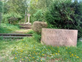
Turn left, then head right onto a track and left onto the path leading to the Roche du Coucou.
(13) Keep to the right at the junction on the site and continue to the first path leading downhill.
Red Ring markings
Take this path towards the Guebwiller Quarries, turn right at the first junction towards the quarries and reach them fairly quickly.
(14) This section is also quite winding. Take in the remaining ruins of the old quarry operations. At a picnic table, the signpost indicates to turn right, but the path has been abandoned. Head straight ahead along a clearer track to rejoin the signposted path further down the slope . You’ll cross a track.
(15) Follow it to the right until you reach the hairpin bend.
(16) Turn left, then left again towards the Buhl Quarries.
(17) Take in the views of the quarries before beginning the descent via the hairpin bends. Turn right at the track to reach a junction.
(18) Take the path on the left. When you reach the next track, keep to the right. Continue along the road for a few metres until you come to the start of a narrow path on the left.
Unmarked
(19) Follow this path. Be careful: the grass (nettles) is tall, so wear long trousers. (Otherwise, continue along the road and turn left.)
Green Ring signposting
At the end of the path, turn right and continue to the end of the road.
Red Triangle signpost
Keep left twice. Then turn right onto the first path and cross the main road.
Blue Ring signpost
Take the road opposite, cross the River Lauch, then take the first path on the right. Keep left at the town hall.
No signposting
Take the first road on the left. Pass the “Carrefour Market”. After a straight stretch, take a right-hand bend to reach a Fork in the road at Buhl.
(20) Turn left twice towards Murbach. Please note: there is no pedestrian crossing on this busy road. Continue to the first track.
Signposting: White Rectangle.
Follow this track uphill. At the first right-hand bend, stay on the track until you reach the first path on the left.
Signpost: Yellow Disc
(21) Take this path. Cross two tracks to reach the pass, then continue along the descending path until you reach the next track.
(22) Follow it to the right. Continue along the same track at the next junction until you reach another junction.
(23) Take the path starting almost directly opposite. Cross another track and follow it to the right towards the Luspelkopf.
(24) Keep to the right towards the Bildstockle. Continue along the track that lies straight ahead at each junction until you reach the pass.
Signpost: White Rectangle crossed out
(25) There is a bench where you can take a break. Facing the wayside shrine, take the path starting to the right of it. Ignore two junctions. After a short climb, begin a gentle descent. Ignore a crossroads of tracks and, further on, you’ll come across an inconspicuous path.
(26) Follow it to the right. Take care on some very steep sections of the descent. Join a track and first turn right then left. Keep left at the end of the track to reach the end of this track, amongst the vineyards.
(27) Keep to the left. Continue straight on until you reach the first houses, then carry on along the street that extends from the path, keeping to the right all the way to Rimbach.
(28) Turn left onto the main road. Cross the river at the bridge, then first turn right then left to reach the town hall square, followed by the church square (S/E).

 Visorando Member
 Easy

 Difficult
 Tourist office