


 Country:

 City:
City:


Starting point: From the sign opposite the town hall, on Place de l’Église. Follow the blue markings with the church-shaped symbol.
(S/E) Walk past the town hall, then follow Ruelle des Prés to the right. Cross the Goutelle bridge and continue along the path between the stream and the factory. On Rue de l’Abattoir, head towards the cemetery on the right. After the cemetery, cross the D22 county road and continue straight on. Once at Saint-Lieu, turn left after the chapel and join a forest track.
(1) Follow it to the right, then turn onto the path on the right towards Les Trois Croix. At Les Trois Croix, continue straight on through the fir forest for about 150 m until you reach the engraved stone, then turn left onto the forest track.
(2) At the wooden marker with the signpost, cross the embankment on the right to follow the path.
(1) At the end of the path, facing the chapel, turn right onto the forest track and head down to the D22 departmental road. Cross it, then follow Rue de l’Abattoir to the end. When you reach Rue de la Gare, turn right and follow the D979 departmental road to the community hall.
(3) Cross the departmental road at the pedestrian crossing on the left and head towards the old railway station. Continue towards the sports hall, go round it on the left, then walk alongside the football pitch, continuing straight on. At the end of the pitch, turn right and walk alongside the Ruisseau de la Goutelle. Cross the stream via the wooden footbridge and continue straight on.
(4) At the junction with the Chemin des Longs Champs, carry on straight ahead to complete the full route.
(5) At the Sept Charmes crossroads, follow the forest track to the left and carry on until you reach the houses in the hamlet of La Scierie.
(6) At La Scierie, take the path on the right. Carry on straight ahead, take the small path that climbs alongside the pastures, then turn left and carry on straight ahead.
(7) At the end of the path, turn left towards the D9799 county road. Cross it carefully to reach the pavement, then follow it to the left, passing through the hamlet of Rogissart alongside this road.
(8) At the end of the hamlet, take the path on the right. At the top of the hill, turn left and follow the path straight on; this leads onto Chemin Bouteny. (Note: the alternative route joins the main route here).
(9) Carry on straight ahead along Chemin des Épinettes, then continue along the pavement running alongside the D979 departmental road. At the chemist’s, turn right onto Rue des Épinettes. Halfway down this street, turn right onto Ruelle des Chenevières.
(10) Follow the first path on the left, which leads onto Rue des Waquignons, near the wash house. Cross this street straight ahead to reach Rue Haute, which turns left and becomes Rue des Laquans.
(11) Turn right onto Rue de l’Auche, walk past the recycling centre and continue along the path that climbs uphill. At the junction at the top of the path, turn left and follow the footpath.
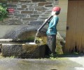
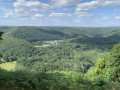
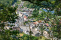
(12) Before the wayside cross and the gate, take the path leading uphill to the right. Reach the viewpoint overlooking the village, then continue straight on until you reach a clearing. Turn left onto the path leading back down, then turn right towards the village. Walk down Rue de la Belle Vue towards the village centre. Walk past the Malbrough (a fountain-statue of a young figure with water flowing through his flute), then continue straight on until you reach the Place de l’Église (S/E).
 Local authority
 Moderate
 Visorando Member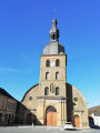
 Difficult
