Suc du Mounier from Saint-Jeures

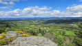
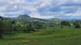
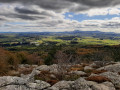
Starting from the pretty village of Saint-Jeures, this short, easy circular route will take you to the summit of the Suc du Mounier. Although less famous than its larger neighbour, the Lizieux, it nevertheless offers superb panoramic views.

Details

52050247
Creation:
Last update:
Last review:
  • Walking
    Activity: Walking
  • ↔
    Distance: 4.38 mi
  • ◔
    Average duration: 2h 40 
  • ▲
    Difficulty: Easy

  • ⚐
    Back to start: Yes
  • ↗
    Ascent: + 732 ft
  • ↘
    Descent: - 741 ft

  • ▲
    Highest point: 3,953 ft
  • ▼
    Lowest point: 3,271 ft

Photos

Description of the walk

You can park in the large car park at Place du Fougal, in the heart of the village of Saint-Jeures.

(S/E) Leave the car park and take the Route du Lizieux (D7) on the left for 200 m.

(1) Take the street leading down to the left, then, after 50 m, follow Rue du Fort, which veers slightly to the right. Then leave the road as it bends to the left and continue along the dirt track in front of you, which takes you back to the D7. Turn left and follow the road for about 100 m to reach the junction at the industrial estate.

(2) Take the road running alongside it on the right. Follow this road for just over 500 m to reach a crossroads just past a beautiful stone barn.

(3) Follow the stony path on the right and, shortly afterwards, take the path on the left which heads uphill into the forest. After a sharp bend to the left, turn right and continue to the next junction.

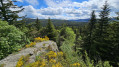
(4) Turn left onto the path leading up to the summit of the Knoll du Mounier (signposted). Follow this narrow track as it winds its way up to the summit.

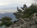
(5) Feel free to climb onto the boulders (though the passage may be tricky for some) to enjoy the view. Head back down the same path to the previous junction.

(4) Head left and follow the path for about 400 m until you reach a major forest track.

(6) Turn right, join a small tarmac road, cross it and take the path opposite. Stay on this path, ignoring the signposted paths branching off to the left and right.

(7) As you emerge from the forest, follow the path to the left, which will soon take you to a lovely farm. Go round it by turning right onto theGR®65, then head downhill to the D18, which you should cross carefully, and continue for about a hundred metres.

(8) Turn right just before the Rochette farm, staying on the GR®. Winding through pretty meadows, the path climbs gently towards the hamlet of La Croix de Pierre, where it rejoins the D18.

(9). Take the road to the left until you reach the original junction.

(1) Turn left onto the Route du Lizieux, which takes you back to the Place du Fougal (S/E).

Waypoints

  1. S/E : mi 0 - alt. 3,432 ft - Place du Fougal
  2. 1 : mi 0.17 - alt. 3,419 ft - Junction of the circular loop
  3. 2 : mi 0.63 - alt. 3,376 ft - Crossroads at the industrial estate
  4. 3 : mi 1.03 - alt. 3,484 ft - Crossroads, turn right
  5. 4 : mi 1.39 - alt. 3,724 ft - Suc du Mounier junction
  6. 5 : mi 1.61 - alt. 3,953 ft - Suc du Mounier
  7. 6 : mi 2.09 - alt. 3,747 ft - Forest track, on the right
  8. 7 : mi 3.1 - alt. 3,458 ft - Lisière, on the left
  9. 8 : mi 3.37 - alt. 3,392 ft - Turn right at the junction
  10. 9 : mi 4.15 - alt. 3,412 ft - Croix de Pierre, D18
  11. S/E : mi 4.38 - alt. 3,432 ft - Place du Fougal

Always be cautious and plan ahead when you're outdoors. Visorando and the author of this route cannot be held responsible for any accidents occurring on this route.

The GR® and PR® markings are the intellectual property of the Fédération Française de Randonnée Pédestre.

Reviews and comments

4.2 / 5
Based on 4 reviews

Reliability of the description
4.3 / 5
Ease of following the route
4 / 5
Route interest
4.3 / 5
User 25303232

Overall rating : 4.3 / 5

Date of your route : Apr 25, 2026
Reliability of the description : ★★★★★ Very good
Ease of following the route : ★★★★☆ Good
Route interest : ★★★★☆ Good
Very busy route : No

A lovely, fairly easy walk, completed in 2 hours including a 15-minute stop at the summit, mainly through woodland. The route is clearly marked and was made easier by the trail markings. Note that at point 5, it is possible to return to the forest track via a second path that leads back near point 6
Beautiful views from the summit after a few rocky sections requiring a bit of agility

Machine-translated

mjc43
mjc43

Overall rating : 2.7 / 5

Date of your route : Nov 04, 2024
Reliability of the description : ★★☆☆☆ Disappointing
Ease of following the route : ★★☆☆☆ Disappointing
Route interest : ★★★★☆ Good
Very busy route : No

Signposting is very poor, if not non-existent, in the wooded section leading to the top of the knoll; a GPS is essential to follow the route. Otherwise, the view from the top is superb on a clear day.

Machine-translated

LFau
LFau

Overall rating : 5 / 5

Date of your route : Jul 26, 2024
Reliability of the description : ★★★★★ Very good
Ease of following the route : ★★★★★ Very good
Route interest : ★★★★★ Very good
Very busy route : No

A very pleasant walk suitable for everyone.
At the start, we follow some narrow roads, which might make you think it’s a rather uninteresting walk, but as soon as you enter the forest, it’s a real pleasure.
On the way up, we preferred to follow a narrow track that appeared to have been carved out for mountain bikers rather than the wider path (which is steeper but more rugged).
Even once out of the forest, the return journey through the meadows amongst the farmlands is very pleasant, even if it’s much sunnier.

Machine-translated

Marie BRENIER-LIOGIER

Overall rating : 4.7 / 5

Date of your route : Jul 22, 2024
Reliability of the description : ★★★★★ Very good
Ease of following the route : ★★★★★ Very good
Route interest : ★★★★☆ Good
Very busy route : No

A short, peaceful stroll through some lovely woodland

Machine-translated

Other walks in the area

For more walks, use our search engine .

The GPS track and description are the property of this route's author. Please do not copy them without permission.