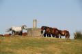
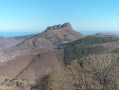
The summit of Bianditz as seen from Eskas

A beautiful hike, starting in the heart of the forest and heading towards one of the region’s most iconic peaks, taking in cromlech sites along the way and offering fantastic views of the region’s other peaks, such as Jaizkibel and the Three Crowns.

Details

23052636
Creation:
Last update:
Last review:
  • Walking
    Activity: Walking
  • ↔
    Distance: 4.03 mi
  • ◔
    Average duration: 2h 30 
  • ▲
    Difficulty: Moderate

  • ⚐
    Back to start: Yes
  • ↗
    Ascent: + 696 ft
  • ↘
    Descent: - 712 ft

  • ▲
    Highest point: 2,713 ft
  • ▼
    Lowest point: 2,093 ft

Photos

Description of the walk

The start of this walk is in the Aiako Harria Nature Reserve at a place called Askas, where one of the park rangers’ huts is located. To get there, see the ‘Practical Information’ section below.

(S/E) Head towards the rangers’ hut and walk past it through a small wooden gate. The path to follow, which is very clearly marked, is almost flat and runs through the middle of the forest. Follow the yellow and white markings.

(1) Leave the wide track and take the small path on the left.

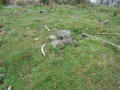
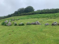
(2) You’ll reach thePR®-NA-11-San Anton-Domiko path, which isn’t actually marked out, but there’s a wide area of short grass. Head left, climbing the slope which becomes quite steep. Follow the hunters’ posts and, as you pass, take note of the Gatzarrieta Hego cromlechs.

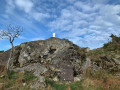
(3) You’ll reach the summit of Galtzarrieta (813 m), recognisable by a metal sculpture in the shape of a prism. From the summit, head very slightly to the left to rejoin the path and continue on your way. Follow the markers on the ground and arrive at Bianditz (840 m), having passed other prehistoric remains along the way.

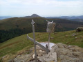
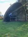
(4) The triangulation point is marked by a cube topped with a cylinder. Also note the cross and the metal drum a few metres further on. Continue along the path, passing further prehistoric burial sites (Arritxulangaña). You will then reach the road.

(5) Cross the road, heading left towards the end of an embankment, and approach a 50 km/h speed limit sign. On the other side of the road, look for a tiny, overgrown, zigzagging path amongst the ferns; the descent is quite steep but short (take great care). You’ll arrive above a large hole (protected by a wire fence) and continue down to reach the base of this large hole. This is actually the exit of a railway tunnel. You will then emerge onto a very wide path (PR®-GI 1007 Artikutzako trenbide zaharra) and follow it all the way. Leave the path to head up to the left towards Eskas and thus return to the car park where you started (S/E).


Waypoints

  1. S/E : mi 0 - alt. 2,123 ft - Eskas, the wardens’ hut
  2. 1 : mi 1.29 - alt. 2,425 ft - Junction
  3. 2 : mi 1.34 - alt. 2,382 ft - Change of direction
  4. 3 : mi 1.67 - alt. 2,654 ft - Galtzarieta summit
  5. 4 : mi 1.99 - alt. 2,703 ft - Bianditz summit
  6. 5 : mi 3.18 - alt. 2,310 ft - Crossing the GI-3631 road
  7. S/E : mi 4.03 - alt. 2,123 ft - Return to the car park

Notes

Access by car.
Cross the border at Béhobie and take the GI-636 towards San Sebastián, staying on this road until you see Leroy Merlin on your left and City Wok on your right.
At this point, move into the right-hand lane to take the Errenteria-Oiartzun GI-2132 exit (at the Repsol petrol station).
At the roundabout, take the GI-2132 Oiartzun exit (3 km) and go under a bridge.
At the roundabout, continue to follow the GI-2132 towards Oiartzun for 3 km to the left: take the3rd exit.
At the roundabout, follow signs for AP8-Donostia and GI-2132 Astigarraga for 8 km (straight ahead).
At the roundabout, continue on the GI-2132 towards Astigarraga for 8 km and the Aiako Harria Nature Reserve.
Then, please note: at the next roundabout, turn left onto the GI-3631 towards Artikutza and the Aiako Harria Nature Reserve. Drive for 16 km along a narrow, winding road which ends at a place called Eskas, where you’ll find the Aiako Harria park rangers’ house (Casa del Guarda). Park in the car park there.

For your information, the journey by car took around 40 km in 45 minutes.

Return journey:
Drive back down the 16 km along the GI-3631. Pass through Altzibar and then Ugaldetxo. Continue along the GI-3631 until you reach the roundabouts: then follow the signs for Irun on the GI-2132.
Pass through the three roundabouts, following the GI-2132 towards Errenteria and/or the GI-636 towards IRUN
Continue to the border.

Worth a visit

Once you reach the tunnel entrance, it can be fun to make a round trip to the other side, as the tunnel isn’t very long. As the entrance is protected by barriers, no livestock can get through, so the ground is clean. It’s safer to have a head torch.

Always be cautious and plan ahead when you're outdoors. Visorando and the author of this route cannot be held responsible for any accidents occurring on this route.

The GR® and PR® markings are the intellectual property of the Fédération Française de Randonnée Pédestre.

Reviews and comments

4.2 / 5
Based on 3 reviews

Reliability of the description
4.3 / 5
Ease of following the route
3.5 / 5
Route interest
4.7 / 5
User 28268163

Overall rating : 4.7 / 5

Date of your route : Jun 22, 2026
Reliability of the description : ★★★★★ Very good
Ease of following the route : ★★★★☆ Good
Route interest : ★★★★★ Very good
Very busy route : No

The first section is very shady, but the rest of the route follows the ridge and is therefore very sunny. This is a walk best done in the morning. Furthermore, the final section, where you rejoin the road, is not directly accessible due to the brambles. You can reach the dirt track below by following the road for 300 metres and turning right onto a small path that leads down and joins the trail.

Machine-translated

Yvan40
Yvan40

Overall rating : 4 / 5

Date of your route : Sep 30, 2024
Reliability of the description : ★★★★☆ Good
Ease of following the route : ★★★☆☆ Average
Route interest : ★★★★★ Very good
Very busy route : No

I’d tried to reach the summit of Bianditz and the prehistoric remains via the Aritxulegi side during the wood pigeon hunting season, but given the number of hunters and the frequency of gunfire, I gave up. This is just to say that you should avoid this period.
So, I completed the walk at the end of September, starting from Eskas. A very pleasant walk, the first part of which is very shaded along a well-maintained and very comfortable path up to ‘point 1’. The signposting is relatively sparse, so a GPS may be useful. Due to heavy rain in the preceding days, the path between points 1 and 2 is impassable (this is an occasional occurrence); do not hesitate to take the track on the left through the ferns (less than 100 metres).
After the summit of Bianditz, follow the ridge, initially through an enclosure, and walk alongside the wire fence (distance not measured); continue along the ridge, following the red and white markings on the GR121 until you reach the road at point 5. At this point, given the vegetation, I didn’t dare carry on to join the track below, so we followed the road for 500 metres before finding the track a little further on to the right, and thus returning to the starting point.
Highlights: Beautiful views from the ridges and numerous prehistoric remains.

Machine-translated

pat ogaz
pat ogaz

Overall rating : 4 / 5

Date of your route : Jul 18, 2024
Reliability of the description : ★★★★☆ Good
Ease of following the route : Not used / Not applicable
Route interest : ★★★★☆ Good
Very busy route : No

I’m used to going to Bianditz from the road, but via Eskas. I wanted to do the Bianditz–Eskas route. I know the way up to Bianditz. The view is as beautiful as ever, but I was bothered by loads of insects that followed me the whole way (drawn by the sheep and horse droppings, or by my smell or sweat…). Not everyone is a Tour de France cyclist without breaking a sweat after four mountain passes. When I reached Bianditz, with no signposting for the way ahead and no mobile signal, I followed my instincts and turned right, but after a steep path, I hesitated, and as I was on my own, I decided to retrace my steps, accompanied by my little friends.
Once back on the road, I headed to Eskas to have a look. Can anyone tell me if the path leading to Uzo is the right one, or if I need to go further down the road?
In any case, I’ve really taken a shine to this place.

Machine-translated

Other walks in the area

For more walks, use our search engine .

The GPS track and description are the property of this route's author. Please do not copy them without permission.