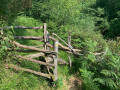
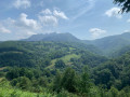
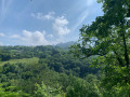
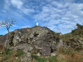
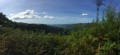
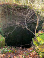
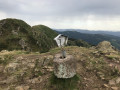
Source of the River Tornola

This route is known as thePR®-GI 1008 ‘Tornola errekako iturburua’, which means ‘the source of the River Tornola’ in Basque.

Details

n°3169911
Creation:
Last update:
Last review:
  • Walking
    Activity: Walking
  • ↔
    Distance: 5.47 mi
  • ◔
    Average duration: 3h 45 
  • ▲
    Difficulty: Moderate

  • ⚐
    Back to start: Yes
  • ↗
    Ascent: + 1,385 ft
  • ↘
    Descent: - 1,391 ft

  • ▲
    Highest point: 1,578 ft
  • ▼
    Lowest point: 518 ft

Photos

Description of the walk

Cross the border at Behobie and head for Oiartzun via the GI-2134. On entering Oiartzun, turn left towards Lesaka on the GI-3420. The start is 500 m before the tunnel that descends to Lake Endara, near the Arritxulo Aterpetxea Inn.

(S/E) The path starts at the far end of the car park, heading south. It follows a circular route westwards, then turns east-southeast to reach a three-way junction.

(1) Take a sharp right-hand bend onto the path, which later turns northwards and reaches a T-junction.

(2) Turn left for 100 metres, then turn right onto the path which descends towards the river and crosses it via some pretty wooden bridges.

(3) After climbing about sixty metres, take the path on the right which follows the edge of a canal along the contour line, then climbs until it reaches the edge of a tarmac road.

(4) Do not follow the road but take the path immediately on the right, which winds its way down towards some buildings.

(5) Before the bend, turn right and walk alongside a factory, following the river. After 100 metres, a small path branches off to the left. This path then winds twice and rejoins a small concrete road.

(6) Continue to the right towards the north-east to rejoin the GI-2134 after a left-hand bend.

(7) Cross the GI-2134 to take the path opposite, then, 600 metres further on, cross this road again.

(8) To the left of the main track, take a very narrow path which climbs quite steeply, then runs alongside the road until you return to the car park (S/E).

Waypoints

  1. S/E : mi 0 - alt. 1,365 ft - Albergue Arritxulo Aterpetxea car park
  2. 1 : mi 0.97 - alt. 1,342 ft - Three-way junction
  3. 2 : mi 1.53 - alt. 856 ft - T-junction
  4. 3 : mi 1.8 - alt. 778 ft - Horizontal path
  5. 4 : mi 3.04 - alt. 925 ft - Access road
  6. 5 : mi 3.67 - alt. 518 ft - Buildings
  7. 6 : mi 4.02 - alt. 725 ft - Small road
  8. 7 : mi 4.28 - alt. 860 ft - GI-2134
  9. 8 : mi 4.86 - alt. 1,099 ft - Path on the left
  10. S/E : mi 5.48 - alt. 1,362 ft - Albergue Arritxulo Aterpetxea car park

Notes

No water sources along the route.

Always be cautious and plan ahead when you're outdoors. Visorando and the author of this route cannot be held responsible for any accidents occurring on this route.

The GR® and PR® markings are the intellectual property of the Fédération Française de Randonnée Pédestre.

Reviews and comments

4 / 5
Based on 2 reviews

Reliability of the description
4.5 / 5
Ease of following the route
3.5 / 5
Route interest
4 / 5
Izura
Izura

Overall rating : 4 / 5

Date of your route : Oct 10, 2023
Reliability of the description : ★★★★☆ Good
Ease of following the route : ★★★★☆ Good
Route interest : ★★★★☆ Good
Very busy route : No

Nothing to report

Machine-translated

Martine et Patrick
Martine et Patrick

Overall rating : 4 / 5

Date of your route : Nov 14, 2022
Reliability of the description : ★★★★★ Very good
Ease of following the route : ★★★☆☆ Average
Route interest : ★★★★☆ Good
Very busy route : No

You have to walk several kilometres past Oiartzun before reaching the starting point of the walk. The sign for ‘Oiartzungo Mendi Aterpea’ is just before the Aritxulegi tunnel. The walk is marked with yellow and white signs. It follows a series of canals; at times you have to walk a few steps along a rather narrow canal bank, so it’s best to do this walk without children and in dry weather.
Just before reaching point 7, you have to leave the track and climb a slope; this point is hard to spot – we walked past it twice before managing to find it thanks to the app.
The route is shaded; you descend into a small valley and climb back up on the return journey. The canal system is interesting to look at.

Machine-translated

Other walks in the area

For more walks, use our search engine .

The GPS track and description are the property of this route's author. Please do not copy them without permission.