Le Col de la Vache depuis le parking du Muret

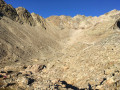
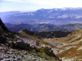
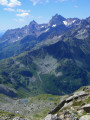
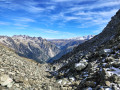
A pleasant hike in the magnificent Belledonne massif. The path begins by climbing towards the charming Habert d’Aiguebelle refuge. Once near it, it ascends the Pas de la Coche, passes above the pretty lake of the same name, then crosses a field of blueberry bushes. It passes the flank of the Roches Jaunes, joins theGR®®738and crosses mountain pastures. As you walk along the cliffs of the Crête des Îlettes, the pass comes into view against a rocky backdrop and can be reached after a steep scree slope, with a magnificent view of Lac du Cos and the peaks of the Allervard massif as a reward.

Details

44406516
Creation:
Last update:
Last review:
  • Walking
    Activity: Walking
  • ↔
    Distance: 9.48 mi
  • ◔
    Average duration: 8h 05 
  • ▲
    Difficulty: Difficult

  • ⚐
    Back to start: Yes
  • ↗
    Ascent: + 4,278 ft
  • ↘
    Descent: - 4,275 ft

  • ▲
    Highest point: 8,373 ft
  • ▼
    Lowest point: 4,409 ft

Description of the walk

By car: from the motorway, take the Brignoud exit. In the town centre, at the junction with the D523, take the D528 opposite, towards Laval. Drive past Laval-en-Belledonne; once you reach Prabert, turn right towards La Betta via the Route du Pré de L’Arc. From the Pont de la Betta car park, continue for 500 m to park at the Muret car park, situated 13 km from Brignoud.

(S/E) Head towards the hairpin bend. At the sign for Le Muret (alt. 1,343 m), head up to the left towards the Cime de la Jasse and the Pas de la Coche (east) along a sunken, damp and stony path marked in yellow. You’ll reach a crossroads (alt. 1,410 m) opposite a concrete cistern.

(1) Leave the track on your right. Turn left, then immediately right onto a dirt track leading to the Habert d’Aiguebelle refuge. At around 1,430 m, take the shortcut across the field to the right to rejoin the track after 150 m. Follow it to the left and reach a fork (alt. 1,730 m)

(2) Ignore the track to the left, towards the Habert d’Aiguebelle, and take theGR®®738andGR®® de Pays path to the right, heading towards the Pas de la Coche and the high-voltage power lines. Cross a small stream and, after a winding climb, reach the Pas de la Coche junction (elevation 1990).

(3) Ignore the two paths leading down to the right: theGR®®738towards the Refuge Jean Collet and the one towards the pretty little Lac de La Coche just below. Stay at the pass, to the left of the lake, on the yellow-marked path. After about a hundred metres, you’ll come to another junction (alt. 2000 m).

(4) Leave theGR®® de Pays to your right, which descends towards the lake and then the village of Rivier d’Allemont. Continue towards a gully leading up to a small pass (alt. 2020 m).

(5) Once over the pass, descend about fifty metres through the blueberry bushes. Climb up a scree slope and, after a narrow section crossing a steep slope beneath the Pic du Pin, reach a junction (alt. 2000 m).

(6) Leave the path on the right, which descends towards theGR®® de Pays. Continue straight ahead, cross two scree gullies and join theGR®®738(alt. 2060 m).

(7) Ignore the left-hand branch (north), heading towards the Col de L’Aigleton. Follow the right-hand branch, which crosses a stream, then turns north and, after 200 m, reaches a junction (alt. 2100 m).

(8) Ignore the first path on the left (north-west) leading to the Col de L’Aigleton and the second one towards the Col de la Belle Étoile (north). Continue along theGR®®738, turning right (south-east) and climbing diagonally up the grassy slope.

(9) At the 2157-metre mark, climb a steeper slope to the north-east through the mountain pastures.

(10) At the marshy plateau (elevation 2322), head gently eastwards towards the scree couloir of the Col de la Vache, skirting the foot of the Crête des Îlettes on the left. Start the ascent of the gully from the left, keeping a close eye on the cairns and the yellow and white/red markings, as the track is rarely visible amongst the boulders. Gradually head to the right and go round a marshy hollow at around 2400 m. The boulders give way to scree and the track becomes visible again. Climb the switchbacks of the final slope to reach the Col de la Vache (elevation 2556).

(11) From the Col de la Vache, the return journey follows the same route in the opposite direction, back to the car park (S/E).


Waypoints

  1. S/E : mi 0 - alt. 4,409 ft - Muret car park
  2. 1 : mi 0.17 - alt. 4,583 ft - Crossroads, concrete cistern
  3. 2 : mi 1.43 - alt. 5,659 ft - Junction at the refuge at - Habert d'Aiguebelle
  4. 3 : mi 2.28 - alt. 6,526 ft - Pas de la Coche junction above the - Lac de la Coche
  5. 4 : mi 2.32 - alt. 6,529 ft - Junction, leave the GR® de Pays trail
  6. 5 : mi 2.44 - alt. 6,588 ft - Pas de la Coche (2020m)
  7. 6 : mi 2.98 - alt. 6,545 ft - Junction
  8. 7 : mi 3.3 - alt. 6,749 ft - Junction with the GR738
  9. 8 : mi 3.39 - alt. 6,837 ft - Junction
  10. 9 : mi 3.72 - alt. 7,083 ft - Elevation 2157
  11. 10 : mi 4.18 - alt. 7,615 ft - Marshy hollow
  12. 11 : mi 4.74 - alt. 8,373 ft - Col de la Vache
  13. S/E : mi 9.48 - alt. 4,409 ft - Muret car park

Notes

Route details:
From (S/E) to (2) Standard yellow markings.
From (2) to (4) Standard white/red markings.
From (4) to (7): No markings, but the path is clearly defined.
From (7) to (11) Conventional white/red markings.

The route is neither high up nor exposed, but remains a mountain trail.

Worth a visit

For information about the Habert d’Aiguebelle mountain hut:
https://refugedaiguebelle.fr/
https://www.refuges.info/point/5576/refu...

The lovely little Lac de la Coche is the perfect spot for a break.

At the Col de La Vache, heading left (north) up the Crêtes des Îlettes over a climb of around 50 m, you’ll be treated to a superb view of the lakes and the peaks surrounding them.

Always be cautious and plan ahead when you're outdoors. Visorando and the author of this route cannot be held responsible for any accidents occurring on this route.

The GR® and PR® markings are the intellectual property of the Fédération Française de Randonnée Pédestre.

Reviews and comments

4.6 / 5
Based on 5 reviews

Reliability of the description
4.3 / 5
Ease of following the route
4.3 / 5
Route interest
5 / 5
Robzi2004
Robzi2004

Overall rating : 5 / 5

Date of your route : Aug 27, 2025
Reliability of the description : ★★★★★ Very good
Ease of following the route : ★★★★★ Very good
Route interest : ★★★★★ Very good
Very busy route : Yes

We followed this trail to reach the Habert d'Aiguebelle mountain refuge during the Echappée Belle.
The walk was splendid and we were not disappointed with the refuge.

Machine-translated

JODIDO
JODIDO

Hello,

Since you mentioned that you were walking at a good pace, why didn't you go down to the Lacs des 7 Laux?
Personally, I think that to really appreciate the beauty of this hike, you have to go down the other side of the Col de La Vache, see the first two lakes, then climb back up to the pass via a really difficult scree slope...
Last year, I went as far as the 7 Laux refuge and then retraced my steps all the way back to the Pont de la Betta car park.
In the end, it was 26 km and over 1,800 metres of elevation gain!
One of my favourite hikes in Belledonne!
Today, I climbed the Grands Moulins, a beautiful hike that I'll post a review of on the website in the next few days...

Machine-translated

unBlqzed
unBlqzed

Overall rating : 5 / 5

Date of your route : Aug 10, 2025
Reliability of the description : ★★★★★ Very good
Ease of following the route : ★★★★★ Very good
Route interest : ★★★★★ Very good
Very busy route : No

Hike completed on a very hot day (37°C in the valley). There was little shade, but the altitude meant that we were spared from the excessive heat.
The car park was packed, but it was fine on the trail.
the last 200 metres of elevation gain are on a really unpleasant and steep scree slope (clearly no fun at all).
Fortunately, the view from the Col de la Vache is well worth the effort!

The hike took 5 hours and 20 minutes at a good pace (including the break at the summit). A great physical effort

Machine-translated

JODIDO
JODIDO
• Edited:

Overall rating : 5 / 5

Date of your route : Aug 22, 2024
Reliability of the description : Not used / Not applicable
Ease of following the route : Not used / Not applicable
Route interest : ★★★★★ Very good
Very busy route : No

I had done this hike in August 2020, including the descent to Lac de Cos, and I’d promised myself I’d do it again as I’d really enjoyed this somewhat challenging route!
I set off on the hike at 7 am from the Pont de la Betta car park (1,300 m).
It took an hour to reach Aiguebelle (1,720 m), then 40 minutes to reach Le Pas de la Coche (2,000 m).
Beautiful views of the Chartreuse Massif, including Chamechaude (2,082 m) and La Dent de Crolles (2,062 m).
After the last sheepfold, the path becomes steep before reaching a flat section where the Col de la Vache is clearly visible.
Crossing the scree slope proved easy this time, given how much I’d struggled in 2020, as, following the famous “L’Échappée Belle” Ultra Trail scheduled for the next day, there were small orange flags serving as markers. The scree crossing took 40 minutes. At the Col de la Vache (2,556 m) at 10.45 am. A 3½-hour walk and a 15-minute break. I spent a good half-hour at the pass and struck up a conversation with a few fellow hikers. Descent to Lac de Cos in 40 minutes and a break at the Col des 7 Laux (2,184 m) for lunch.
As it was only 12.30 pm and I was feeling fit, I pushed on to the Refuge des 7 Laux (2,135 m), which I reached after an hour’s walk. The refuge was packed!
I set off again at 2 pm and the sun was beating down! Back at Lac de Cos and up to the Col de la Vache. The sign said 1 hour 5 minutes, and it took me 55 minutes. Once at the pass, I realised I still had a 3-hour descent ahead of me! Crossed the scree slope again in 35 minutes, and just after that I came across two mountain dogs who bared their teeth at me! The herd was on the path, and I had to climb up onto the ridges a bit to continue my descent.
I really felt the fatigue when I reached the Pas de la Coche! The last section seemed to go on forever! I reached my car at 7.30 pm, completely exhausted, 12 and a half hours after setting off that morning...
At least 10 hours’ walking, 26 km and over 1,800 metres of elevation gain in a single day!
A magnificent but very demanding hike, but the beauty of the scenery more than makes up for the physical effort expended during the day...!

Machine-translated

ncm38
ncm38

Overall rating : 3.7 / 5

Date of your route : Aug 17, 2024
Reliability of the description : ★★★☆☆ Average
Ease of following the route : ★★★☆☆ Average
Route interest : ★★★★★ Very good
Very busy route : No

Hike to the Pas de la Coche (point 5): the aim of the hike that day was to find blueberries
I couldn’t find the concrete cistern. I followed the trail until I lost my bearings, then let myself be guided by the directions in the PDF file and the signposts.

I almost turned back because of the weather (foggy) before reaching the Pas de la Coche and the rain (I got caught in three downpours).

Both the ascent and the descent are stony, and for once I didn’t regret having nicked my husband’s walking poles. They served me well on the way down and cushioned the impact on my knees.

Machine-translated

JODIDO
JODIDO
• Edited:

Overall rating : 5 / 5

Date of your route : Aug 25, 2020
Reliability of the description : Not used / Not applicable
Ease of following the route : Not used / Not applicable
Route interest : ★★★★★ Very good
Very busy route : No

I took out my 2020 diary to see what I’d written down about that hike.
I set off from the Pont de la Betta at 1,300 metres.
I then had to follow the same route as described in the guide.
I’d started the hike at 7 am and reached the Col de la Vache at 10.50 am.
Crossing the scree slope had been a bit tricky, as I hadn’t followed the yellow markings (which I did on the way back!).
I was in great shape that day, so I descended to Lac de Cos/Col des 7 Laux. And had a snack break by the lake.
I then climbed the 350-metre ascent in 45 minutes to get back to the Col de la Vache, and crossing the scree slope had taken me half an hour. Back at my car at 4.10 pm.
In total, 19 km and nearly 1,700 metres of elevation gain over 9 hours and 10 minutes.
I have wonderful memories of this hike, one of the most beautiful I’ve done in the Belledonne Massif, and I hope to do it again!

Machine-translated

Other walks in the area

For more walks, use our search engine .

The GPS track and description are the property of this route's author. Please do not copy them without permission.